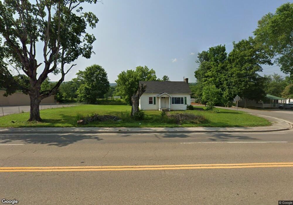
7817 Highway 11w Rutledge, TN 37861
Estimated Value: $112,274 - $215,000
Studio
--
Bath
1,110
Sq Ft
$131/Sq Ft
Est. Value
About This Home
This home is located at 7817 Highway 11w, Rutledge, TN 37861 and is currently estimated at $145,319, approximately $130 per square foot. 7817 Highway 11w is a home with nearby schools including Rutledge Primary School, Rutledge Elementary School, and Rutledge Middle School.
Ownership History
Date
Name
Owned For
Owner Type
Purchase Details
Closed on
Jul 19, 2022
Sold by
Carter Ralph D
Bought by
Tn Investments Llc
Current Estimated Value
Home Financials for this Owner
Home Financials are based on the most recent Mortgage that was taken out on this home.
Original Mortgage
$70,000
Outstanding Balance
$62,967
Interest Rate
5.23%
Mortgage Type
Credit Line Revolving
Estimated Equity
$82,352
Purchase Details
Closed on
Apr 22, 2016
Sold by
Jarnagin Imogene
Bought by
Jarnagin Imogene and Carter Ralph
Create a Home Valuation Report for This Property
The Home Valuation Report is an in-depth analysis detailing your home's value as well as a comparison with similar homes in the area
Purchase History
| Date | Buyer | Sale Price | Title Company |
|---|---|---|---|
| Tn Investments Llc | $87,500 | None Listed On Document | |
| Jarnagin Imogene | $80,000 | -- |
Source: Public Records
Mortgage History
| Date | Status | Borrower | Loan Amount |
|---|---|---|---|
| Open | Tn Investments Llc | $70,000 |
Source: Public Records
Tax History
| Year | Tax Paid | Tax Assessment Tax Assessment Total Assessment is a certain percentage of the fair market value that is determined by local assessors to be the total taxable value of land and additions on the property. | Land | Improvement |
|---|---|---|---|---|
| 2025 | -- | $18,075 | $4,175 | $13,900 |
| 2024 | -- | $18,075 | $4,175 | $13,900 |
| 2023 | $425 | $18,075 | $4,175 | $13,900 |
| 2022 | $415 | $18,075 | $4,175 | $13,900 |
| 2021 | $415 | $18,075 | $4,175 | $13,900 |
| 2020 | $432 | $18,075 | $4,175 | $13,900 |
| 2019 | $432 | $15,425 | $4,175 | $11,250 |
| 2018 | $373 | $15,425 | $4,175 | $11,250 |
| 2017 | $373 | $15,425 | $4,175 | $11,250 |
| 2016 | $373 | $15,425 | $4,175 | $11,250 |
| 2015 | $434 | $15,425 | $4,175 | $11,250 |
| 2014 | $434 | $17,358 | $0 | $0 |
Source: Public Records
Map
Nearby Homes
- 238 Overlook Ln
- 0 Silent Ln Unit 1299563
- 131 Southside Ave
- 3500 Poor Valley Rd
- 1655 Lester Whitt Rd
- 172 W Hills Rd
- 979 Tennessee 92
- 979 Highway 92
- 180 Farrow Rd
- 5960 Poor Valley Rd
- 0 Cherry St
- 621 Carrol Greenlee Rd
- 1901 Highway 92
- 345 Charlie Greenlee Rd
- 0 Jarnagin Unit 1328423
- 132 Cedarock Ln
- Lot 136 Tumbleweed Trail
- Lot 77 Shiloh Springs Rd
- Lot 11 Pocahontas Ln
- Lot 8 Waterway Dr
- 7825 Rutledge Pike
- 7812 Rutledge Pike
- 7824 Rutledge Pike
- 7796 Rutledge Pike
- 7786 Rutledge Pike
- 145 Cedar Ave
- 118 Water St
- 7863 Rutledge Pike
- 7768 Rutledge Pike
- 167 Cedar Ave
- 7760 Rutledge Pike
- 173 Cedar Ave
- 132 Water St
- 145 High St
- 143 Dailey St
- 195 Cedar Ave
- 0 High St Unit RTC2983296
- 0 High St Unit 794531
- 0 High St Unit 864550
- 0 High St Unit 888002
Your Personal Tour Guide
Ask me questions while you tour the home.