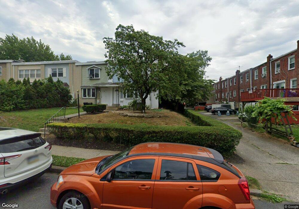
782 Mohawk St Allentown, PA 18103
Southside NeighborhoodEstimated Value: $234,000 - $252,397
3
Beds
2
Baths
1,402
Sq Ft
$171/Sq Ft
Est. Value
About This Home
This home is located at 782 Mohawk St, Allentown, PA 18103 and is currently estimated at $239,099, approximately $170 per square foot. 782 Mohawk St is a home located in Lehigh County with nearby schools including Hiram W Dodd Elementary School, South Mountain Middle School, and William Allen High School.
Ownership History
Date
Name
Owned For
Owner Type
Purchase Details
Closed on
Jul 13, 2020
Sold by
Kent Erlinda
Bought by
Kent Erlinda and Kent Andrew
Current Estimated Value
Purchase Details
Closed on
May 21, 2010
Sold by
Kent Andrew A
Bought by
Kent Jack
Home Financials for this Owner
Home Financials are based on the most recent Mortgage that was taken out on this home.
Original Mortgage
$95,314
Outstanding Balance
$64,135
Interest Rate
5.13%
Mortgage Type
New Conventional
Estimated Equity
$174,964
Purchase Details
Closed on
Sep 30, 1996
Sold by
Baker Jr Raymond M and Baker Trudy R
Bought by
Kent Andrew A
Create a Home Valuation Report for This Property
The Home Valuation Report is an in-depth analysis detailing your home's value as well as a comparison with similar homes in the area
Home Values in the Area
Average Home Value in this Area
Purchase History
| Date | Buyer | Sale Price | Title Company |
|---|---|---|---|
| Kent Erlinda | -- | None Available | |
| Kent Jack | $85,501 | -- | |
| Kent Andrew A | $71,000 | -- |
Source: Public Records
Mortgage History
| Date | Status | Borrower | Loan Amount |
|---|---|---|---|
| Open | Kent Jack | $95,314 |
Source: Public Records
Tax History Compared to Growth
Tax History
| Year | Tax Paid | Tax Assessment Tax Assessment Total Assessment is a certain percentage of the fair market value that is determined by local assessors to be the total taxable value of land and additions on the property. | Land | Improvement |
|---|---|---|---|---|
| 2025 | $3,367 | $100,400 | $14,000 | $86,400 |
| 2024 | $3,367 | $100,400 | $14,000 | $86,400 |
| 2023 | $3,367 | $100,400 | $14,000 | $86,400 |
| 2022 | $3,253 | $100,400 | $86,400 | $14,000 |
| 2021 | $3,190 | $100,400 | $14,000 | $86,400 |
| 2020 | $3,109 | $100,400 | $14,000 | $86,400 |
| 2019 | $3,061 | $100,400 | $14,000 | $86,400 |
| 2018 | $2,842 | $100,400 | $14,000 | $86,400 |
| 2017 | $2,772 | $100,400 | $14,000 | $86,400 |
| 2016 | -- | $100,400 | $14,000 | $86,400 |
| 2015 | -- | $100,400 | $14,000 | $86,400 |
| 2014 | -- | $100,400 | $14,000 | $86,400 |
Source: Public Records
Map
Nearby Homes
- 1931 S Hall St Unit 1933
- 1990 S Delaware St
- 1831 S Church St
- 725 Trout Creek Ln
- 566 W Emaus Ave
- 566 588 W Emaus Ave
- 1066 Devonshire Rd Unit 1068
- 1076 W Tioga St
- 2157 S Poplar St
- 2430 S Law St
- 2212 S Melrose St
- 1882 S 2nd St
- 2531 S Carbon St
- 1126 Lehigh St
- 2487 S 6th St
- 2333 S 4th St
- 1113 S Howard St
- 1243 W Tioga St
- 135 W Wabash St
- 750 W Cumberland St
- 780 Mohawk St
- 778 Mohawk St
- 776 Mohawk St
- 774 Mohawk St
- 1903 S Delaware St
- 1905 S Delaware St
- 1901 S Delaware St
- 1907 S Delaware St
- 1909 S Delaware St
- 772 Mohawk St
- 1911 S Delaware St
- 1913 S Delaware St
- 1915 S Delaware St
- 1916 S Hall St
- 1923 S Delaware St
- 1918 S Hall St
- 777 Mohawk St
- 781 Mohawk St
- 1920 S Hall St
- 779 Mohawk St