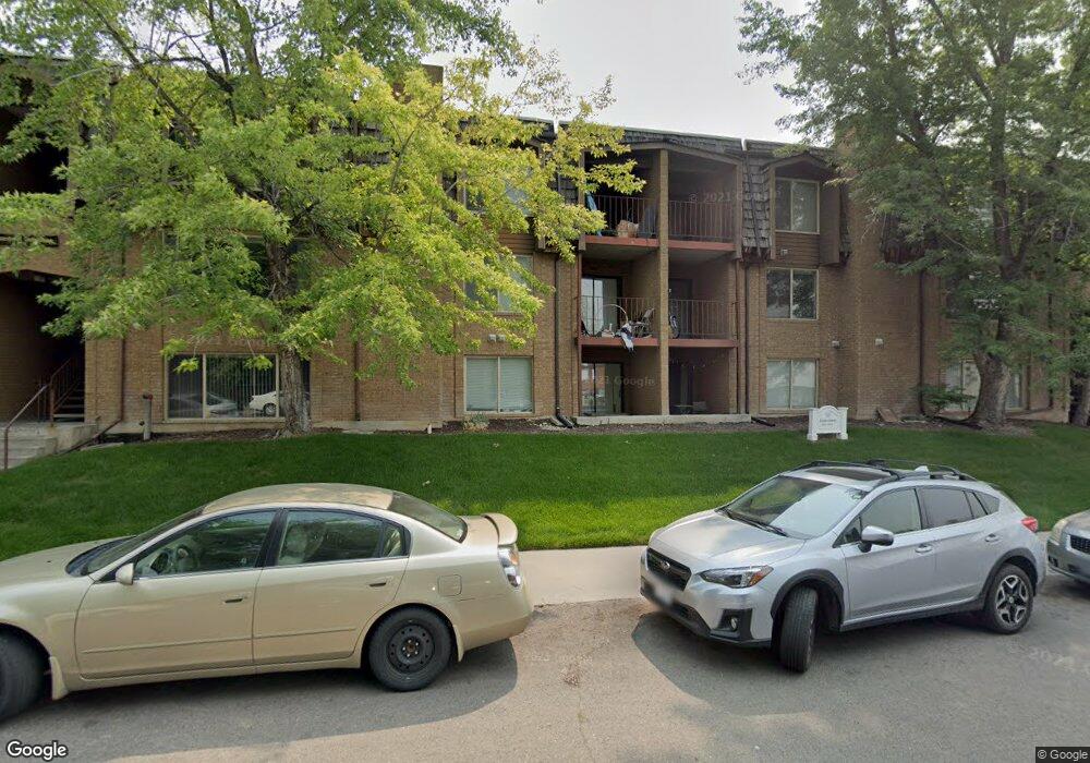
782 N 800 E Provo, UT 84606
Joaquin NeighborhoodEstimated Value: $382,000 - $461,000
2
Beds
2
Baths
1,212
Sq Ft
$343/Sq Ft
Est. Value
About This Home
This home is located at 782 N 800 E, Provo, UT 84606 and is currently estimated at $415,716, approximately $343 per square foot. 782 N 800 E is a home located in Utah County with nearby schools including Provo Peaks School, Centennial Middle School, and Timpview High School.
Ownership History
Date
Name
Owned For
Owner Type
Purchase Details
Closed on
Dec 30, 2021
Sold by
Michael Jamison Properties Llc
Bought by
Michael Jamison Properties Iii Llc
Current Estimated Value
Purchase Details
Closed on
Jan 3, 2017
Sold by
Gebhard Family Llc
Bought by
Michael Jamison Properties Llc
Purchase Details
Closed on
May 13, 2004
Sold by
Felsted H W and Felsted Carol L
Bought by
Gebhard James S and Gebhard Helen H
Home Financials for this Owner
Home Financials are based on the most recent Mortgage that was taken out on this home.
Original Mortgage
$132,800
Interest Rate
5.5%
Mortgage Type
Balloon
Purchase Details
Closed on
Jul 11, 2003
Sold by
Ricks Norman R and Ricks Sharon T
Bought by
Felsted H W and Felsted Carol L
Purchase Details
Closed on
Dec 11, 1997
Sold by
Warner Sean A
Bought by
Ricks Norman R and Ricks Sharon T
Create a Home Valuation Report for This Property
The Home Valuation Report is an in-depth analysis detailing your home's value as well as a comparison with similar homes in the area
Home Values in the Area
Average Home Value in this Area
Purchase History
| Date | Buyer | Sale Price | Title Company |
|---|---|---|---|
| Michael Jamison Properties Iii Llc | -- | None Listed On Document | |
| Michael Jamison Properties Llc | -- | First American Title Ins Co | |
| Gebhard James S | -- | Old Republic Title Company | |
| Felsted H W | -- | Old Republic Title Company | |
| Ricks Norman R | -- | Old Republic Title Co Of Uta |
Source: Public Records
Mortgage History
| Date | Status | Borrower | Loan Amount |
|---|---|---|---|
| Previous Owner | Gebhard James S | $132,800 |
Source: Public Records
Tax History
| Year | Tax Paid | Tax Assessment Tax Assessment Total Assessment is a certain percentage of the fair market value that is determined by local assessors to be the total taxable value of land and additions on the property. | Land | Improvement |
|---|---|---|---|---|
| 2025 | $1,988 | $202,565 | -- | -- |
| 2024 | $1,950 | $195,690 | $0 | $0 |
| 2023 | $1,950 | $189,255 | $0 | $0 |
| 2022 | $2,116 | $207,020 | $0 | $0 |
| 2021 | $1,779 | $303,600 | $36,400 | $267,200 |
| 2020 | $1,755 | $280,700 | $33,700 | $247,000 |
| 2019 | $1,527 | $254,000 | $29,000 | $225,000 |
| 2018 | $1,394 | $235,200 | $29,000 | $206,200 |
| 2017 | $1,268 | $117,590 | $0 | $0 |
| 2016 | $1,260 | $108,900 | $0 | $0 |
| 2015 | $1,152 | $100,650 | $0 | $0 |
| 2014 | $997 | $90,805 | $0 | $0 |
Source: Public Records
Map
Nearby Homes
- 737 E 750 N Unit 1
- 907 E 820 N Unit 11
- 735 E 620 N
- 785 E 560 N Unit 405
- 513 E 700 N
- 541 E 500 N Unit 12
- 362 N 800 E
- 386 N 500 E
- 990 Cedar Ave
- 364 N 500 E
- 1051 E 300 N
- 245 N 800 E
- 864 E 200 N
- 240 N 500 East St
- 394 N 300 E
- 433 N 300 E
- 635 N Ridge Dr Unit 25
- 1205 N Old Willow Ln
- 466 N 200 E
- 261 N 400 E Unit 301
Your Personal Tour Guide
Ask me questions while you tour the home.