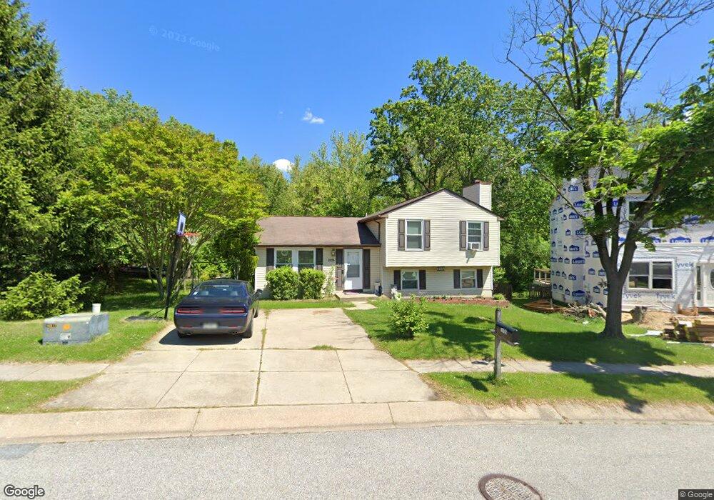
7826 Grassy Garth Unit C-3 Elkridge, MD 21075
Estimated Value: $412,000 - $532,000
--
Bed
3
Baths
1,560
Sq Ft
$312/Sq Ft
Est. Value
About This Home
This home is located at 7826 Grassy Garth Unit C-3, Elkridge, MD 21075 and is currently estimated at $486,729, approximately $312 per square foot. 7826 Grassy Garth Unit C-3 is a home located in Howard County with nearby schools including Deep Run Elementary School, Mayfield Woods Middle School, and Long Reach High School.
Ownership History
Date
Name
Owned For
Owner Type
Purchase Details
Closed on
May 24, 1999
Sold by
Lavelle William J
Bought by
Conley Bryan D
Current Estimated Value
Purchase Details
Closed on
Jun 13, 1994
Sold by
Olson B T
Bought by
Lavelle William J
Home Financials for this Owner
Home Financials are based on the most recent Mortgage that was taken out on this home.
Original Mortgage
$120,000
Interest Rate
8.29%
Purchase Details
Closed on
Feb 2, 1990
Sold by
Olson Bradley T
Bought by
Olson Bradley T
Home Financials for this Owner
Home Financials are based on the most recent Mortgage that was taken out on this home.
Original Mortgage
$136,000
Interest Rate
10.17%
Create a Home Valuation Report for This Property
The Home Valuation Report is an in-depth analysis detailing your home's value as well as a comparison with similar homes in the area
Home Values in the Area
Average Home Value in this Area
Purchase History
| Date | Buyer | Sale Price | Title Company |
|---|---|---|---|
| Conley Bryan D | $146,900 | -- | |
| Lavelle William J | $150,000 | -- | |
| Olson Bradley T | $136,000 | -- |
Source: Public Records
Mortgage History
| Date | Status | Borrower | Loan Amount |
|---|---|---|---|
| Previous Owner | Lavelle William J | $120,000 | |
| Previous Owner | Olson Bradley T | $136,000 | |
| Closed | Conley Bryan D | -- |
Source: Public Records
Tax History Compared to Growth
Tax History
| Year | Tax Paid | Tax Assessment Tax Assessment Total Assessment is a certain percentage of the fair market value that is determined by local assessors to be the total taxable value of land and additions on the property. | Land | Improvement |
|---|---|---|---|---|
| 2025 | $5,673 | $390,167 | $0 | $0 |
| 2024 | $5,673 | $359,633 | $0 | $0 |
| 2023 | $5,139 | $329,100 | $175,100 | $154,000 |
| 2022 | $4,982 | $320,967 | $0 | $0 |
| 2021 | $4,865 | $312,833 | $0 | $0 |
| 2020 | $4,748 | $304,700 | $133,300 | $171,400 |
| 2019 | $4,748 | $304,700 | $133,300 | $171,400 |
| 2018 | $4,481 | $304,700 | $133,300 | $171,400 |
| 2017 | $4,511 | $308,000 | $0 | $0 |
| 2016 | -- | $301,633 | $0 | $0 |
| 2015 | -- | $295,267 | $0 | $0 |
| 2014 | -- | $288,900 | $0 | $0 |
Source: Public Records
Map
Nearby Homes
- 7922 Red Barn Way
- 7954 Millstream Ct
- 7870 Marioak Dr
- 7638 Oldfield Ln
- 6322 Wimbledon Ct
- 6204 Briar Ct
- 8087 Keeton Rd
- 6519 Tufts Dr
- 0 Mullinix Rd Unit MDHW2057498
- 8102 Forever Green Ct
- 7812 Whistling Pines Ct
- 8030 Keeton Rd
- 8020 Glasgow Ave
- 7807 Whistling Pines Ct
- 6477 Woodland Forest Dr
- 6485 Woodland Forest Dr
- 6210 Hunters Hollow Rd
- 6560 Meadowfield Ct
- 6710 Tranquil Way
- 8205 Tall Trees Ct
- 7826 Grassy Garth
- 7822 Grassy Garth
- 7840 Milkshed Place
- 7844 Milkshed Place
- 7818 Grassy Garth
- 7813 Grassy Garth
- 7817 Grassy Garth
- 7809 Grassy Garth
- 7848 Milkshed Place
- 7814 Grassy Garth
- 7821 Grassy Garth
- 7843 Milkshed Place
- 7805 Grassy Garth
- 7825 Grassy Garth
- 7852 Milkshed Place
- 7810 Grassy Garth
- 7847 Milkshed Place
- 7846 Mayfield Ave
- 7850 Mayfield Ave
- 7842 Mayfield Ave