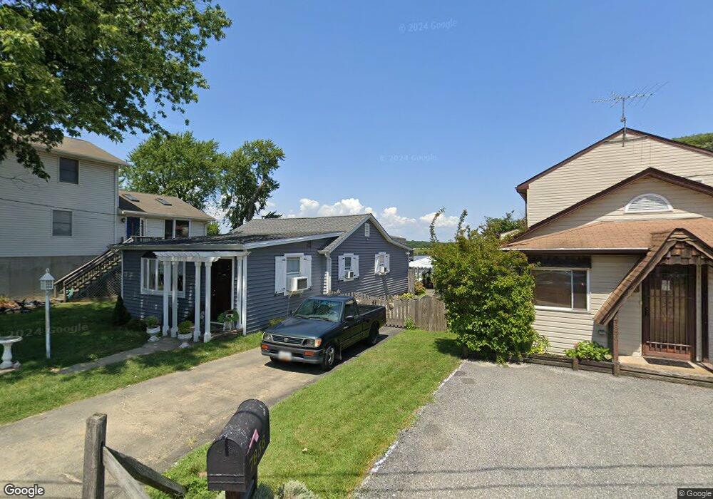
7834 Denton Ave Sparrows Point, MD 21219
Estimated Value: $338,000 - $418,000
--
Bed
1
Bath
1,032
Sq Ft
$359/Sq Ft
Est. Value
About This Home
This home is located at 7834 Denton Ave, Sparrows Point, MD 21219 and is currently estimated at $370,038, approximately $358 per square foot. 7834 Denton Ave is a home located in Baltimore County with nearby schools including Chesapeake Terrace Elementary School, Sparrows Point Middle School, and Sparrows Point High School.
Ownership History
Date
Name
Owned For
Owner Type
Purchase Details
Closed on
May 17, 2013
Sold by
Butschky Sherri C and Gernhart James R
Bought by
Frank Joseph F and Frank Karen M
Current Estimated Value
Home Financials for this Owner
Home Financials are based on the most recent Mortgage that was taken out on this home.
Original Mortgage
$160,000
Outstanding Balance
$113,224
Interest Rate
3.45%
Mortgage Type
Purchase Money Mortgage
Estimated Equity
$256,814
Purchase Details
Closed on
Sep 13, 1972
Sold by
Love Robert W
Bought by
Gernhart Carole Marie
Create a Home Valuation Report for This Property
The Home Valuation Report is an in-depth analysis detailing your home's value as well as a comparison with similar homes in the area
Home Values in the Area
Average Home Value in this Area
Purchase History
| Date | Buyer | Sale Price | Title Company |
|---|---|---|---|
| Frank Joseph F | $215,000 | North American Title Company | |
| Gernhart Carole Marie | $9,000 | -- |
Source: Public Records
Mortgage History
| Date | Status | Borrower | Loan Amount |
|---|---|---|---|
| Open | Frank Joseph F | $160,000 |
Source: Public Records
Tax History Compared to Growth
Tax History
| Year | Tax Paid | Tax Assessment Tax Assessment Total Assessment is a certain percentage of the fair market value that is determined by local assessors to be the total taxable value of land and additions on the property. | Land | Improvement |
|---|---|---|---|---|
| 2025 | $3,963 | $315,767 | -- | -- |
| 2024 | $3,963 | $277,833 | $0 | $0 |
| 2023 | $1,841 | $239,900 | $159,500 | $80,400 |
| 2022 | $3,321 | $225,833 | $0 | $0 |
| 2021 | $2,985 | $211,767 | $0 | $0 |
| 2020 | $2,985 | $197,700 | $127,600 | $70,100 |
| 2019 | $2,772 | $197,433 | $0 | $0 |
| 2018 | $2,918 | $197,167 | $0 | $0 |
| 2017 | $2,700 | $196,900 | $0 | $0 |
| 2016 | $1,874 | $195,300 | $0 | $0 |
| 2015 | $1,874 | $193,700 | $0 | $0 |
| 2014 | $1,874 | $192,100 | $0 | $0 |
Source: Public Records
Map
Nearby Homes
- 8610 Oak Rd
- 2122 Lodge Forest Dr
- 7428 Bay Front Rd
- 7708 S Cove Rd
- 2217 Lodge Farm Rd
- 2322 Lodge Forest Dr
- 2409 Woodridge Rd
- 7349 Hughes Ave
- 2408 Lodge Farm Rd
- 0 Lodge Farm Rd
- 7316A Hughes Ave
- 2400 Lincoln Ave Unit 2
- 2400 Lincoln Ave Unit 15
- 2924 Waterfront Way
- 2918 Waterfront Way
- 7226 Waldman Ave
- 2636 Haddaway Rd
- 2703 Sparrows Point Rd
- 2542 Sycamore Ave
- 2904 Shaws Rd
- 7832 Denton Ave
- 7836 Denton Ave
- 7830 Denton Ave
- 7838 Denton Ave
- 7828 Denton Ave
- 7840 Denton Ave
- 7837 Denton Ave
- 7842 Denton Ave
- 7824 Denton Ave
- 7835 Denton Ave
- 7844 Denton Ave
- 7833 Denton Ave
- 7841 Denton Ave
- 7831 Denton Ave
- 7822 Denton Ave
- 7843 Denton Ave
- 7846 Denton Ave
- 7829 Denton Ave
- 7820 Denton Ave
- 7825 Denton Ave