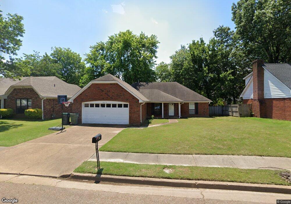
7837 Redfearn Ln Memphis, TN 38133
Estimated Value: $223,000 - $241,861
3
Beds
2
Baths
1,520
Sq Ft
$153/Sq Ft
Est. Value
About This Home
This home is located at 7837 Redfearn Ln, Memphis, TN 38133 and is currently estimated at $232,215, approximately $152 per square foot. 7837 Redfearn Ln is a home located in Shelby County with nearby schools including Kate Bond Elementary School, Kate Bond Middle School, and Cordova High School.
Ownership History
Date
Name
Owned For
Owner Type
Purchase Details
Closed on
Jun 29, 1998
Sold by
Flack William M and Flack Leisha S
Bought by
Pruiett Reo D
Current Estimated Value
Home Financials for this Owner
Home Financials are based on the most recent Mortgage that was taken out on this home.
Original Mortgage
$101,600
Outstanding Balance
$20,054
Interest Rate
6.59%
Estimated Equity
$212,161
Create a Home Valuation Report for This Property
The Home Valuation Report is an in-depth analysis detailing your home's value as well as a comparison with similar homes in the area
Home Values in the Area
Average Home Value in this Area
Purchase History
| Date | Buyer | Sale Price | Title Company |
|---|---|---|---|
| Pruiett Reo D | $107,000 | Transcontinental Title Compa |
Source: Public Records
Mortgage History
| Date | Status | Borrower | Loan Amount |
|---|---|---|---|
| Open | Pruiett Reo D | $101,600 |
Source: Public Records
Tax History Compared to Growth
Tax History
| Year | Tax Paid | Tax Assessment Tax Assessment Total Assessment is a certain percentage of the fair market value that is determined by local assessors to be the total taxable value of land and additions on the property. | Land | Improvement |
|---|---|---|---|---|
| 2025 | $1,353 | $58,375 | $8,750 | $49,625 |
| 2024 | $1,353 | $39,900 | $6,875 | $33,025 |
| 2023 | $2,431 | $39,900 | $6,875 | $33,025 |
| 2022 | $2,431 | $39,900 | $6,875 | $33,025 |
| 2021 | $2,459 | $39,900 | $6,875 | $33,025 |
| 2020 | $1,906 | $26,300 | $6,875 | $19,425 |
| 2019 | $1,906 | $26,300 | $6,875 | $19,425 |
| 2018 | $1,906 | $26,300 | $6,875 | $19,425 |
| 2017 | $1,081 | $26,300 | $6,875 | $19,425 |
| 2016 | $1,085 | $24,825 | $0 | $0 |
| 2014 | $1,085 | $24,825 | $0 | $0 |
Source: Public Records
Map
Nearby Homes
- 7828 Deerfield Trace
- 2718 Kate Bond Rd
- 7723 Reese Rd
- 7685 Crystal Brook Cove
- 2412 Kate Bond Rd
- 7725 Deerfield Trace
- 0 Cr 177
- 7551 Meadowland Dr
- 2554 Appling Glen Dr
- 2376 Pate Rd
- 2566 Austin Green Bay
- 7374 U S Highway 64
- 2789 Arbor Lane Dr
- 2739 Lakeside Dr
- 6898 Talcott Ln
- 6878 Johnstown Ln
- 3116 Mannington Ln
- BERRYHILL Rd
- 2065 Steeplebrook Dr
- 2029 Woodchase Cove
- 7829 Redfearn Ln
- 7845 Redfearn Ln
- 2592 Kilgore Cove
- 7823 Redfearn Ln
- 2588 Kilgore Cove
- 7853 Redfearn Ln
- 2596 Kilgore Cove
- 7838 Redfearn Ln
- 7830 Redfearn Ln
- 7859 Redfearn Ln
- 7822 Redfearn Ln
- 2600 Kilgore Cove
- 2596 Kate Bond Rd
- 2621 Coulter Ln
- 2580 Kilgore Cove
- 2612 Coulter Ln
- 2591 Kilgore Cove
- 7818 Redfearn Ln
- 2575 Kilgore Cove
- 7865 Redfearn Ln