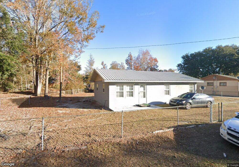
784 Dix St Allendale, SC 29810
Estimated Value: $19,000 - $68,000
3
Beds
1
Bath
960
Sq Ft
$54/Sq Ft
Est. Value
About This Home
This home is located at 784 Dix St, Allendale, SC 29810 and is currently estimated at $51,844, approximately $54 per square foot. 784 Dix St is a home located in Allendale County with nearby schools including Allendale Fairfax High School.
Ownership History
Date
Name
Owned For
Owner Type
Purchase Details
Closed on
Mar 5, 2025
Sold by
Barnes Joshua O
Bought by
Rogers Jimmy R
Current Estimated Value
Purchase Details
Closed on
Apr 30, 2024
Sold by
Loadholt Marc D
Bought by
Barnes Joshua O
Purchase Details
Closed on
Feb 13, 2009
Sold by
Hsbc Bank Usa
Bought by
Barnes Joshua O and Loadholt Marc D
Home Financials for this Owner
Home Financials are based on the most recent Mortgage that was taken out on this home.
Original Mortgage
$15,000
Interest Rate
5.03%
Mortgage Type
Purchase Money Mortgage
Purchase Details
Closed on
Nov 25, 2008
Sold by
Davis Willie Lee and Badger Pauline Carolyn
Bought by
Hsbc Bank Usa and Citigroup Mortgage Loan Trust Inc
Create a Home Valuation Report for This Property
The Home Valuation Report is an in-depth analysis detailing your home's value as well as a comparison with similar homes in the area
Home Values in the Area
Average Home Value in this Area
Purchase History
| Date | Buyer | Sale Price | Title Company |
|---|---|---|---|
| Rogers Jimmy R | $20,000 | None Listed On Document | |
| Rogers Jimmy R | $20,000 | None Listed On Document | |
| Barnes Joshua O | -- | None Listed On Document | |
| Barnes Joshua O | $10,200 | -- | |
| Hsbc Bank Usa | -- | -- |
Source: Public Records
Mortgage History
| Date | Status | Borrower | Loan Amount |
|---|---|---|---|
| Previous Owner | Barnes Joshua O | $15,000 |
Source: Public Records
Tax History
| Year | Tax Paid | Tax Assessment Tax Assessment Total Assessment is a certain percentage of the fair market value that is determined by local assessors to be the total taxable value of land and additions on the property. | Land | Improvement |
|---|---|---|---|---|
| 2025 | $665 | $1,300 | $210 | $1,090 |
| 2024 | $656 | $1,300 | $210 | $1,090 |
| 2023 | $607 | $21,300 | $0 | $0 |
| 2022 | $613 | $21,300 | $3,200 | $18,100 |
| 2021 | $607 | $1,280 | $190 | $1,090 |
| 2020 | $621 | $1,280 | $190 | $1,090 |
| 2019 | $631 | $1,280 | $190 | $1,090 |
| 2018 | $621 | $1,270 | $180 | $1,090 |
| 2017 | $622 | $1,270 | $180 | $1,090 |
| 2016 | $625 | $1,270 | $180 | $1,090 |
| 2015 | -- | $1,270 | $180 | $1,090 |
| 2014 | -- | $1,270 | $180 | $1,090 |
| 2013 | -- | $1,270 | $180 | $1,090 |
Source: Public Records
Map
Nearby Homes
- 793 Robin St
- 372 Gum St E
- 1237 Railroad Ave E
- 4169 Bluff Rd
- 4058 Bluff Rd
- 4015 Allendale-Fairfax Hwy
- 242 Short St
- 169 Lawton Dr
- 1495 Augusta Hwy
- 820 Parkwood Terrace
- 299 Warren St
- 388 Warren St
- 582 Parkwood Terrace
- 4887 Burtons Ferry Hwy
- 187 Rambo Rd
- Pocotaligo Rd
- 1792 Appleton Rd
- Tbd Revolutionary Trail
- Tbd Moultry Loop
- 894 7th St W
Your Personal Tour Guide
Ask me questions while you tour the home.