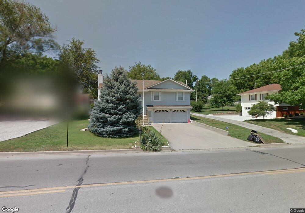
784 Limit St Leavenworth, KS 66048
Estimated Value: $279,000 - $316,592
4
Beds
3
Baths
1,463
Sq Ft
$204/Sq Ft
Est. Value
About This Home
This home is located at 784 Limit St, Leavenworth, KS 66048 and is currently estimated at $297,898, approximately $203 per square foot. 784 Limit St is a home located in Leavenworth County with nearby schools including Henry Leavenworth, Richard Warren Middle School, and Leavenworth Senior High School.
Ownership History
Date
Name
Owned For
Owner Type
Purchase Details
Closed on
Apr 9, 2008
Sold by
Aames Mtg Trust 2005 & 1
Bought by
Anderson Andrew Severt
Current Estimated Value
Home Financials for this Owner
Home Financials are based on the most recent Mortgage that was taken out on this home.
Original Mortgage
$106,417
Outstanding Balance
$67,901
Interest Rate
6.11%
Mortgage Type
New Conventional
Estimated Equity
$229,997
Create a Home Valuation Report for This Property
The Home Valuation Report is an in-depth analysis detailing your home's value as well as a comparison with similar homes in the area
Home Values in the Area
Average Home Value in this Area
Purchase History
| Date | Buyer | Sale Price | Title Company |
|---|---|---|---|
| Anderson Andrew Severt | $133,021 | Mokan Title Svcs Llc |
Source: Public Records
Mortgage History
| Date | Status | Borrower | Loan Amount |
|---|---|---|---|
| Open | Anderson Andrew Severt | $106,417 |
Source: Public Records
Tax History Compared to Growth
Tax History
| Year | Tax Paid | Tax Assessment Tax Assessment Total Assessment is a certain percentage of the fair market value that is determined by local assessors to be the total taxable value of land and additions on the property. | Land | Improvement |
|---|---|---|---|---|
| 2025 | $3,553 | $31,753 | $3,166 | $28,587 |
| 2024 | $3,525 | $30,240 | $3,166 | $27,074 |
| 2023 | $3,525 | $29,360 | $3,166 | $26,194 |
| 2022 | $3,084 | $25,530 | $2,757 | $22,773 |
| 2021 | $2,916 | $22,713 | $2,757 | $19,956 |
| 2020 | $2,705 | $20,904 | $2,757 | $18,147 |
| 2019 | $2,637 | $20,197 | $2,757 | $17,440 |
| 2018 | $2,553 | $19,392 | $2,757 | $16,635 |
| 2017 | $2,397 | $18,294 | $2,757 | $15,537 |
| 2016 | $2,310 | $17,614 | $2,757 | $14,857 |
| 2015 | $2,297 | $17,614 | $2,757 | $14,857 |
| 2014 | $2,218 | $17,101 | $2,757 | $14,344 |
Source: Public Records
Map
Nearby Homes
- 00000 Limit St
- 2104 Limit St
- 840 Limit St
- 901 Limit St
- 2704 Garland St
- 911 Limit St
- 2017 Vilas St
- 2021 Vilas St
- 1036 Vilas St
- 108 Woodmoor Ct Unit Lot 100
- 1204 Wildwood St
- 2307 Maple Ave
- 1932 S Broadway St
- 708 Thornton St
- 3804 Garland Ave
- 3705 Shrine Park Rd
- 1316 Vilas St
- 1913 Cleveland Terrace
- 702 Deerfield St
- 507 Santa fe St
- 788 Limit St
- 778 Limit St
- 2809 Spring Garden St
- 41 Limit St
- 2100 A Limit St
- 2100 B Limit St
- 2900 Garland St
- 774 Limit St
- 2810 Garland St
- 2814 Garland St
- 2812 Garland St
- 2805 Spring Garden St
- 2901 Spring Garden St
- 2804 Garland St
- 2906 Garland St
- 804 Limit St
- 2901 Garland St
- 2905 Spring Garden St
- 2801 Spring Garden St
- 2808 Spring Garden St