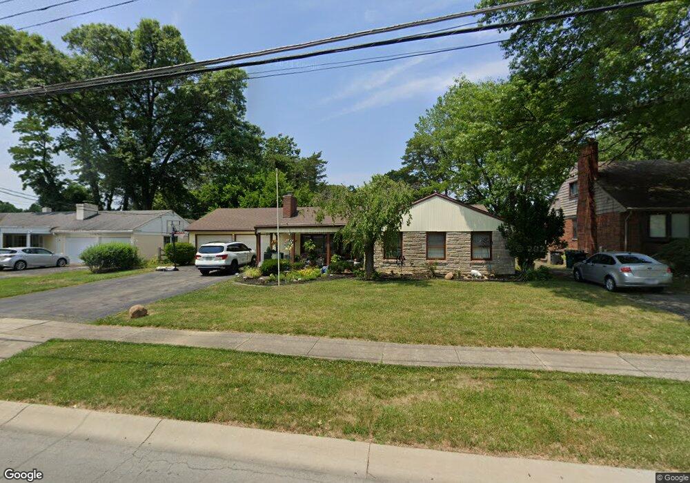
7845 Bobolink Dr Cincinnati, OH 45224
College Hill NeighborhoodEstimated Value: $237,010 - $263,000
3
Beds
2
Baths
1,672
Sq Ft
$151/Sq Ft
Est. Value
About This Home
This home is located at 7845 Bobolink Dr, Cincinnati, OH 45224 and is currently estimated at $251,753, approximately $150 per square foot. 7845 Bobolink Dr is a home located in Hamilton County with nearby schools including Pleasant Hill Elementary School, Robert A. Taft Information Technology High School, and Western Hills High School.
Ownership History
Date
Name
Owned For
Owner Type
Purchase Details
Closed on
Jun 5, 2025
Sold by
Weaver Linda A
Bought by
Linda Ann Weaver Family Revocable Living Trus and Weaver
Current Estimated Value
Purchase Details
Closed on
Jun 18, 2013
Sold by
Weaver Linda A
Bought by
Weaver Linda A
Home Financials for this Owner
Home Financials are based on the most recent Mortgage that was taken out on this home.
Original Mortgage
$113,000
Interest Rate
4.49%
Mortgage Type
New Conventional
Purchase Details
Closed on
Sep 26, 2007
Sold by
Mcmahan Ted Lewis and Mcmahan Alma May
Bought by
Weaver Linda A
Home Financials for this Owner
Home Financials are based on the most recent Mortgage that was taken out on this home.
Original Mortgage
$127,000
Interest Rate
6.49%
Mortgage Type
Unknown
Create a Home Valuation Report for This Property
The Home Valuation Report is an in-depth analysis detailing your home's value as well as a comparison with similar homes in the area
Home Values in the Area
Average Home Value in this Area
Purchase History
| Date | Buyer | Sale Price | Title Company |
|---|---|---|---|
| Linda Ann Weaver Family Revocable Living Trus | -- | None Listed On Document | |
| Linda Ann Weaver Family Revocable Living Trus | -- | None Listed On Document | |
| Weaver Linda A | -- | Servicelink | |
| Weaver Linda A | $127,000 | Advanced Land Title Agency |
Source: Public Records
Mortgage History
| Date | Status | Borrower | Loan Amount |
|---|---|---|---|
| Previous Owner | Weaver Linda A | $113,000 | |
| Previous Owner | Weaver Linda A | $127,000 |
Source: Public Records
Tax History Compared to Growth
Tax History
| Year | Tax Paid | Tax Assessment Tax Assessment Total Assessment is a certain percentage of the fair market value that is determined by local assessors to be the total taxable value of land and additions on the property. | Land | Improvement |
|---|---|---|---|---|
| 2024 | $3,334 | $55,542 | $13,447 | $42,095 |
| 2023 | $3,409 | $55,542 | $13,447 | $42,095 |
| 2022 | $2,286 | $33,264 | $10,948 | $22,316 |
| 2021 | $2,194 | $33,264 | $10,948 | $22,316 |
| 2020 | $2,258 | $33,264 | $10,948 | $22,316 |
| 2019 | $2,165 | $29,180 | $9,604 | $19,576 |
| 2018 | $2,168 | $29,180 | $9,604 | $19,576 |
| 2017 | $2,059 | $29,180 | $9,604 | $19,576 |
| 2016 | $2,482 | $34,721 | $10,245 | $24,476 |
| 2015 | $2,238 | $34,721 | $10,245 | $24,476 |
| 2014 | $2,254 | $34,721 | $10,245 | $24,476 |
| 2013 | $2,363 | $35,795 | $10,563 | $25,232 |
Source: Public Records
Map
Nearby Homes
- 1280 Brushwood Ave
- 7923 Bobolink Dr
- 6596 S Oak Knoll Dr
- 7929 Cherrywood Ct
- 6586 S Oak Knoll Dr
- 6538 S Oak Knoll Dr
- 6765 Richard Ave
- 1148 Hollywood Ave
- 1140 Hollywood Ave
- 6785 Marvin Ave
- 6642 Plantation Way
- 6832 Tarawa Dr
- 1346 Wittekind Terrace
- 1533 Corcoran Place
- 1406 Wittekind Terrace
- 1063 Roxie Ln
- 1544 W Galbraith Rd
- 1562 Oak Knoll Dr
- 6629 Charann Ln
- 6531 Hamilton Ave
- 7841 Bobolink Dr
- 7849 Bobolink Dr
- 7840 Bankwood Ln
- 7838 Bankwood Ln
- 7855 Bobolink Dr
- 1300 Oak Knoll Dr
- 1310 Oak Knoll Dr
- 7844 Bankwood Ln
- 7842 Bobolink Dr
- 7846 Bobolink Dr
- 7859 Bobolink Dr
- 7820 Bobolink Dr
- 7848 Bankwood Ln
- 7854 Bobolink Dr
- 1320 Oak Knoll Dr
- 7839 Bankwood Ln
- 7852 Bankwood Ln
- 1292 Oak Knoll Dr
- 7863 Bobolink Dr
- 7858 Bobolink Dr