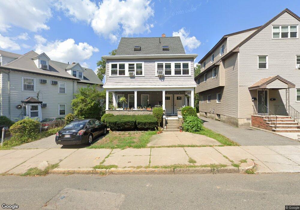
785 Broadway Somerville, MA 02144
Ball Square NeighborhoodEstimated Value: $1,314,000 - $1,790,645
7
Beds
4
Baths
2,634
Sq Ft
$554/Sq Ft
Est. Value
About This Home
This home is located at 785 Broadway, Somerville, MA 02144 and is currently estimated at $1,459,661, approximately $554 per square foot. 785 Broadway is a home located in Middlesex County with nearby schools including Somerville High School and St. Clement Elementary School.
Ownership History
Date
Name
Owned For
Owner Type
Purchase Details
Closed on
Nov 20, 2013
Sold by
Rfh Broadway T and Hill Robert F
Bought by
Hill Robert F
Current Estimated Value
Purchase Details
Closed on
Oct 30, 1997
Sold by
Marker Rt and Rigazio Michael A
Bought by
Hill Robert F and Hill Robert F
Home Financials for this Owner
Home Financials are based on the most recent Mortgage that was taken out on this home.
Original Mortgage
$212,000
Interest Rate
7.31%
Mortgage Type
Purchase Money Mortgage
Purchase Details
Closed on
Jan 10, 1989
Sold by
Vining Charles W
Bought by
Marker Rt
Create a Home Valuation Report for This Property
The Home Valuation Report is an in-depth analysis detailing your home's value as well as a comparison with similar homes in the area
Home Values in the Area
Average Home Value in this Area
Purchase History
| Date | Buyer | Sale Price | Title Company |
|---|---|---|---|
| Hill Robert F | -- | -- | |
| Hill Robert F | $265,000 | -- | |
| Marker Rt | $215,000 | -- |
Source: Public Records
Mortgage History
| Date | Status | Borrower | Loan Amount |
|---|---|---|---|
| Previous Owner | Marker Rt | $205,000 | |
| Previous Owner | Marker Rt | $215,000 | |
| Previous Owner | Marker Rt | $212,000 | |
| Previous Owner | Marker Rt | $222,000 |
Source: Public Records
Tax History Compared to Growth
Tax History
| Year | Tax Paid | Tax Assessment Tax Assessment Total Assessment is a certain percentage of the fair market value that is determined by local assessors to be the total taxable value of land and additions on the property. | Land | Improvement |
|---|---|---|---|---|
| 2025 | $14,930 | $1,368,500 | $696,900 | $671,600 |
| 2024 | $13,992 | $1,330,000 | $696,900 | $633,100 |
| 2023 | $13,638 | $1,319,000 | $696,900 | $622,100 |
| 2022 | $12,752 | $1,252,700 | $663,700 | $589,000 |
| 2021 | $3,918 | $1,203,900 | $658,900 | $545,000 |
| 2020 | $11,846 | $1,174,000 | $659,300 | $514,700 |
| 2019 | $3,644 | $1,073,600 | $600,200 | $473,400 |
| 2018 | $3,297 | $946,500 | $545,700 | $400,800 |
| 2017 | $3,292 | $882,700 | $514,800 | $367,900 |
| 2016 | $10,197 | $813,800 | $459,700 | $354,100 |
| 2015 | $9,745 | $772,800 | $424,600 | $348,200 |
Source: Public Records
Map
Nearby Homes
- 25 Warner St
- 26 Warner St
- 54 Lowden Ave Unit 2
- 111 Pearson Rd
- 9 Kidder Ave Unit 2
- 15 Colby St
- 51 Foskett St Unit 2
- 74 Josephine Ave Unit B
- 39 Rogers Ave
- 81 Princeton St
- 60 Pearson Ave Unit 60
- 20 Electric Ave Unit 2
- 31 Wareham St
- 22 Ossipee Rd Unit 2
- 595 Broadway Unit 202
- 595 Broadway Unit 302
- 595 Broadway Unit 101
- 53 Paulina St
- 23 Highland Rd
- 67 Boston Ave Unit 67
- 783 Broadway Unit 1
- 783 Broadway
- 787 Broadway
- 9 Warner St
- 779 Broadway
- 15 Warner St
- 19 Warner St
- 19 Warner St Unit 2
- 19 Warner St Unit 1
- 139 College Ave
- 4 Warner St
- 139 College Ave Unit 139
- 139-1 College Ave Unit 139
- 139 College Ave
- 4 Warner St Unit 2
- 4 Warner St
- 4 Warner St Unit 1
- 139 College Ave Unit 1
- 6 Warner St
- 6 Warner St Unit 2