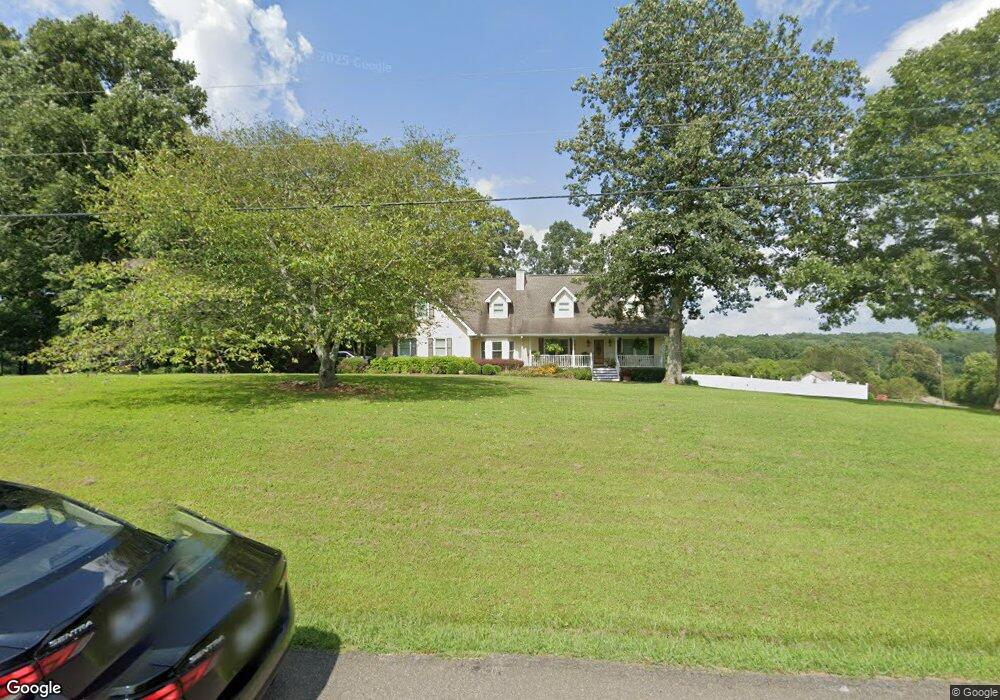
785 Bryant Rd Ranger, GA 30734
Estimated Value: $474,388 - $981,000
Studio
4
Baths
2,164
Sq Ft
$298/Sq Ft
Est. Value
About This Home
This home is located at 785 Bryant Rd, Ranger, GA 30734 and is currently estimated at $645,463, approximately $298 per square foot. 785 Bryant Rd is a home located in Pickens County with nearby schools including Hill City Elementary School, Pickens County Middle School, and Pickens County High School.
Ownership History
Date
Name
Owned For
Owner Type
Purchase Details
Closed on
Feb 12, 2008
Sold by
Holmes Donald
Bought by
Holmes Donald C and Holmes Susan A
Current Estimated Value
Purchase Details
Closed on
May 24, 2002
Sold by
Highfield Jacky F
Bought by
Holmes Donald C
Purchase Details
Closed on
May 15, 2000
Bought by
Highfield Jacky F
Purchase Details
Closed on
Feb 23, 2000
Bought by
Dean Douglas Terry and Nancy Ledford
Create a Home Valuation Report for This Property
The Home Valuation Report is an in-depth analysis detailing your home's value as well as a comparison with similar homes in the area
Home Values in the Area
Average Home Value in this Area
Purchase History
| Date | Buyer | Sale Price | Title Company |
|---|---|---|---|
| Holmes Donald C | -- | -- | |
| Holmes Donald C | $247,000 | -- | |
| Highfield Jacky F | $210,000 | -- | |
| Dean Douglas Terry | -- | -- |
Source: Public Records
Tax History
| Year | Tax Paid | Tax Assessment Tax Assessment Total Assessment is a certain percentage of the fair market value that is determined by local assessors to be the total taxable value of land and additions on the property. | Land | Improvement |
|---|---|---|---|---|
| 2025 | $1,971 | $194,523 | $29,837 | $164,686 |
| 2024 | $2,316 | $122,051 | $25,217 | $96,834 |
| 2023 | $2,381 | $122,051 | $25,217 | $96,834 |
| 2022 | $2,381 | $122,051 | $25,217 | $96,834 |
| 2021 | $2,550 | $122,051 | $25,217 | $96,834 |
| 2020 | $2,627 | $122,051 | $25,217 | $96,834 |
| 2019 | $2,687 | $122,051 | $25,217 | $96,834 |
| 2018 | $2,713 | $122,051 | $25,217 | $96,834 |
| 2017 | $2,757 | $122,051 | $25,217 | $96,834 |
| 2016 | $2,778 | $121,082 | $24,247 | $96,834 |
| 2015 | $2,713 | $121,082 | $24,247 | $96,834 |
| 2014 | $2,719 | $121,082 | $24,247 | $96,834 |
| 2013 | -- | $121,081 | $24,247 | $96,834 |
Source: Public Records
Map
Nearby Homes
- 0 Bryant Rd Unit 7713526
- 0 Bryant Rd Unit 10684467
- 10746 Highway 53 W
- 0 Pin Hook Rd Unit 7616347
- 000 Black Knob Church Rd
- Lot 1 Thompson Ln
- 369 Thompson Ln
- 373 Thompson Ln
- 0 Black Knob Church Rd - Tract 3
- 0 Black Knob Church Rd Unit TRACT 3
- 0 Carver Mill Rd Unit 7670227
- 0 Carver Mill Rd Unit 7670211
- 2081 Jerusalem Church Rd
- 2075 Jerusalem Church Rd
- 0 Young Loop Unit 7206
- 13396 Highway 53
- 2 Young Loop
- 1 Young Loop
- 11953 Henderson Mountain Rd
- 110 Jerusalem Farms Dr
Your Personal Tour Guide
Ask me questions while you tour the home.