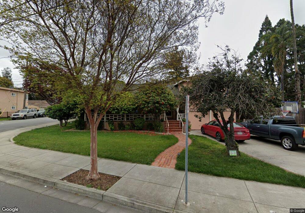
785 Hampton Rd Hayward, CA 94541
Estimated Value: $810,000 - $1,057,000
4
Beds
3
Baths
2,644
Sq Ft
$353/Sq Ft
Est. Value
About This Home
This home is located at 785 Hampton Rd, Hayward, CA 94541 and is currently estimated at $933,038, approximately $352 per square foot. 785 Hampton Rd is a home located in Alameda County with nearby schools including Colonial Acres Elementary School, Edendale Middle, and San Lorenzo High School.
Ownership History
Date
Name
Owned For
Owner Type
Purchase Details
Closed on
Oct 13, 2003
Sold by
Chaisson John
Bought by
Long Frederick
Current Estimated Value
Home Financials for this Owner
Home Financials are based on the most recent Mortgage that was taken out on this home.
Original Mortgage
$360,000
Interest Rate
4.75%
Mortgage Type
New Conventional
Purchase Details
Closed on
Jun 17, 1998
Sold by
Sofios Anna Intervivos Trust and Anna
Bought by
Chaisson John
Home Financials for this Owner
Home Financials are based on the most recent Mortgage that was taken out on this home.
Original Mortgage
$228,000
Interest Rate
8.99%
Create a Home Valuation Report for This Property
The Home Valuation Report is an in-depth analysis detailing your home's value as well as a comparison with similar homes in the area
Home Values in the Area
Average Home Value in this Area
Purchase History
| Date | Buyer | Sale Price | Title Company |
|---|---|---|---|
| Long Frederick | $450,000 | First American Title Company | |
| Chaisson John | $285,000 | Commonwealth Land Title Co | |
| Sofios Ann | -- | Commonwealth Land Title Co |
Source: Public Records
Mortgage History
| Date | Status | Borrower | Loan Amount |
|---|---|---|---|
| Previous Owner | Long Frederick | $360,000 | |
| Previous Owner | Chaisson John | $228,000 | |
| Closed | Chaisson John | $42,750 | |
| Closed | Long Frederick | $45,000 |
Source: Public Records
Tax History
| Year | Tax Paid | Tax Assessment Tax Assessment Total Assessment is a certain percentage of the fair market value that is determined by local assessors to be the total taxable value of land and additions on the property. | Land | Improvement |
|---|---|---|---|---|
| 2025 | $6,835 | $519,032 | $184,822 | $341,210 |
| 2024 | $6,835 | $508,720 | $181,199 | $334,521 |
| 2023 | $6,802 | $505,608 | $177,646 | $327,962 |
| 2022 | $6,700 | $488,695 | $174,163 | $321,532 |
| 2021 | $6,516 | $478,979 | $170,749 | $315,230 |
| 2020 | $6,375 | $481,000 | $169,000 | $312,000 |
| 2019 | $6,382 | $471,568 | $165,686 | $305,882 |
| 2018 | $6,029 | $462,321 | $162,437 | $299,884 |
| 2017 | $5,754 | $453,256 | $159,252 | $294,004 |
| 2016 | $5,489 | $444,370 | $156,130 | $288,240 |
| 2015 | $5,369 | $437,694 | $153,784 | $283,910 |
| 2014 | $5,289 | $429,121 | $150,772 | $278,349 |
Source: Public Records
Map
Nearby Homes
- 263 Medford Ave
- 20923 Haviland Ave
- 823 Blossom Way
- 595 Blossom Way Unit 10
- 17028 Santa fe St
- 688 Grove Way
- 21492 Montgomery Ave
- 16826 Bar Ave
- 127 Hampton Rd
- 21447 Ocean View Dr
- 19884 Meekland Ave
- 592 Willow Ave
- 19539 Meekland Ave
- 10 Leighty Ct Unit 5
- 21117 Gary Dr Unit 116
- 21117 Gary Dr Unit 119
- 21117 Gary Dr Unit 106
- 21117 Gary Dr Unit 217
- 18407 Rainier Ave
- 2135 173rd Ave
- 779 Hampton Rd
- 20225 Concord Ave
- 771 Hampton Rd
- 805 Hampton Rd
- 20226 Concord Ave
- 20253 Concord Ave
- 759 Hampton Rd
- 794 Hampton Rd
- 782 Hampton Rd
- 20252 Concord Ave
- 745 Hampton Rd
- 825 Hampton Rd
- 741 Hampton Rd
- 770 Hampton Rd
- 20276 Concord Ave
- 826 Hampton Rd
- 810 Hampton Rd
- 20257 Concord Ave
- 20255 Concord Ave Unit 6
- 20255 Concord Ave Unit 5
Your Personal Tour Guide
Ask me questions while you tour the home.