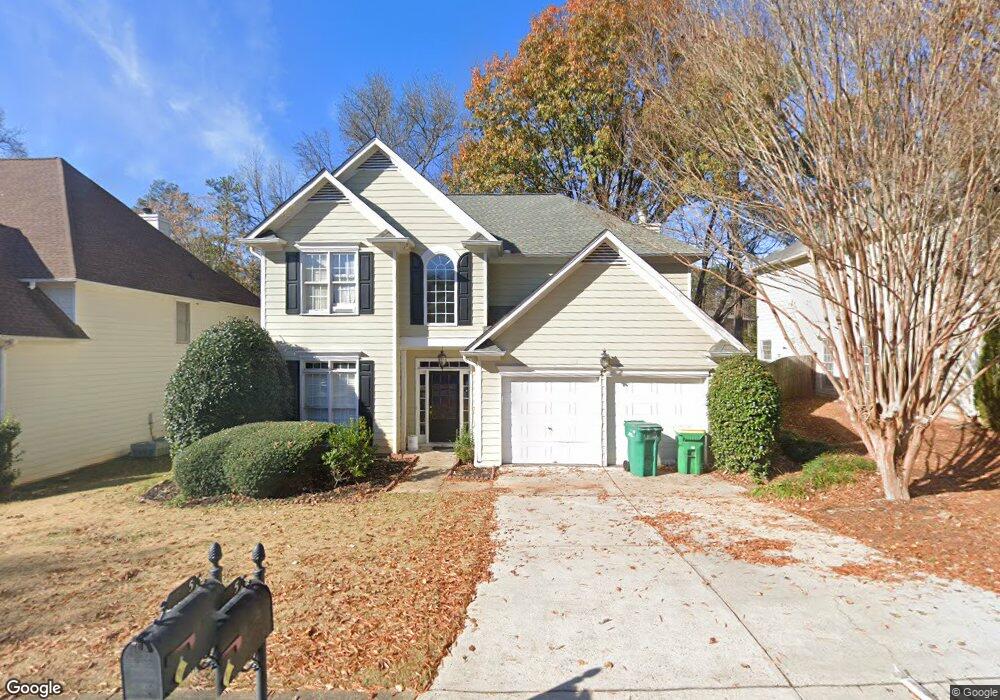
785 Kimball Parc Ct Alpharetta, GA 30022
Estimated Value: $327,000 - $573,000
4
Beds
3
Baths
2,255
Sq Ft
$222/Sq Ft
Est. Value
About This Home
This home is located at 785 Kimball Parc Ct, Alpharetta, GA 30022 and is currently estimated at $501,060, approximately $222 per square foot. 785 Kimball Parc Ct is a home located in Fulton County with nearby schools including Ocee Elementary School, Taylor Road Middle School, and Chattahoochee High School.
Ownership History
Date
Name
Owned For
Owner Type
Purchase Details
Closed on
Jun 14, 2007
Sold by
Durkin Joseph
Bought by
Joshi Hemant and Joshi Supriya H
Current Estimated Value
Home Financials for this Owner
Home Financials are based on the most recent Mortgage that was taken out on this home.
Original Mortgage
$214,400
Outstanding Balance
$130,550
Interest Rate
6.1%
Mortgage Type
New Conventional
Estimated Equity
$370,510
Purchase Details
Closed on
Oct 8, 1999
Sold by
Watson Liana
Bought by
Watson Liana
Home Financials for this Owner
Home Financials are based on the most recent Mortgage that was taken out on this home.
Original Mortgage
$183,400
Interest Rate
7.89%
Mortgage Type
New Conventional
Create a Home Valuation Report for This Property
The Home Valuation Report is an in-depth analysis detailing your home's value as well as a comparison with similar homes in the area
Home Values in the Area
Average Home Value in this Area
Purchase History
| Date | Buyer | Sale Price | Title Company |
|---|---|---|---|
| Joshi Hemant | $268,000 | -- | |
| Watson Liana | -- | -- | |
| Watson Liana | $183,500 | -- |
Source: Public Records
Mortgage History
| Date | Status | Borrower | Loan Amount |
|---|---|---|---|
| Open | Joshi Hemant | $214,400 | |
| Previous Owner | Watson Liana | $183,400 |
Source: Public Records
Tax History Compared to Growth
Tax History
| Year | Tax Paid | Tax Assessment Tax Assessment Total Assessment is a certain percentage of the fair market value that is determined by local assessors to be the total taxable value of land and additions on the property. | Land | Improvement |
|---|---|---|---|---|
| 2025 | $3,283 | $109,000 | $31,720 | $77,280 |
| 2023 | $3,087 | $109,360 | $31,720 | $77,640 |
| 2022 | $3,356 | $109,360 | $31,720 | $77,640 |
| 2021 | $3,346 | $106,200 | $30,800 | $75,400 |
| 2020 | $3,377 | $104,920 | $30,440 | $74,480 |
| 2019 | $406 | $103,040 | $29,880 | $73,160 |
| 2018 | $3,279 | $100,680 | $29,200 | $71,480 |
| 2017 | $3,198 | $93,960 | $26,960 | $67,000 |
| 2016 | $3,152 | $93,960 | $26,960 | $67,000 |
| 2015 | $3,187 | $93,960 | $26,960 | $67,000 |
| 2014 | $2,551 | $85,360 | $24,480 | $60,880 |
Source: Public Records
Map
Nearby Homes
- 680 Kimball Parc Way
- 690 Kimball Parc Way
- 485 Portrait Cir
- 4905 Weathervane Dr
- 11390 Ridge Hill Dr
- 4790 Roswell Mill Dr
- 130 Douglas Fir Ct Unit 1
- 11686 Davenport Ln
- 310 Creekside Dr
- 11619 Davenport Ln
- 1620 Silverleaf Way
- 410 Fox Chase Cir
- 4965 N Bridges Dr
- 1140 Park Glenn Dr
- 4740 Carversham Way
- 5160 Abbotts Bridge Rd
- 2800 Lakewind Ct
- 4440 Webb Bridge Rd
- 5060 Cinnabar Dr
- 4965 Cinnabar Dr
- 795 Kimball Parc Ct
- 775 Kimball Parc Ct
- 775 Kimball Parc Ct Unit 775
- 805 Kimball Parc Ct
- 805 Kimball Parc Ct Unit 805
- 765 Kimball Parc Ct
- 750 Kimball Parc Ct
- 740 Kimball Parc Ct
- 760 Kimball Parc Ct
- 4795 Kimball Bridge Rd
- 755 Kimball Parc Ct
- 730 Kimball Parc Ct
- 720 Kimball Parc Ct
- 770 Kimball Parc Ct
- 745 Kimball Parc Ct
- 655 Kimball Parc Way
- 780 Kimball Parc Ct
- 685 Kimball Parc Way
- 710 Kimball Parc Ct
- 695 Kimball Parc Way