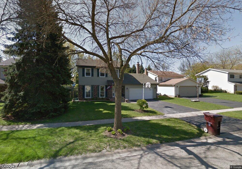
785 Merrill Ln Grayslake, IL 60030
Estimated Value: $338,000 - $418,000
3
Beds
3
Baths
1,800
Sq Ft
$214/Sq Ft
Est. Value
About This Home
This home is located at 785 Merrill Ln, Grayslake, IL 60030 and is currently estimated at $384,430, approximately $213 per square foot. 785 Merrill Ln is a home located in Lake County with nearby schools including Frederick School, Woodview School, and Grayslake Middle School.
Ownership History
Date
Name
Owned For
Owner Type
Purchase Details
Closed on
Apr 10, 1998
Sold by
King Everett W and King Linda F
Bought by
Hayes David A and Hayes Shannon Q
Current Estimated Value
Home Financials for this Owner
Home Financials are based on the most recent Mortgage that was taken out on this home.
Original Mortgage
$146,900
Outstanding Balance
$28,301
Interest Rate
7.27%
Estimated Equity
$356,129
Create a Home Valuation Report for This Property
The Home Valuation Report is an in-depth analysis detailing your home's value as well as a comparison with similar homes in the area
Home Values in the Area
Average Home Value in this Area
Purchase History
| Date | Buyer | Sale Price | Title Company |
|---|---|---|---|
| Hayes David A | $158,000 | -- |
Source: Public Records
Mortgage History
| Date | Status | Borrower | Loan Amount |
|---|---|---|---|
| Open | Hayes David A | $146,900 |
Source: Public Records
Tax History Compared to Growth
Tax History
| Year | Tax Paid | Tax Assessment Tax Assessment Total Assessment is a certain percentage of the fair market value that is determined by local assessors to be the total taxable value of land and additions on the property. | Land | Improvement |
|---|---|---|---|---|
| 2024 | $10,144 | $97,564 | $19,394 | $78,170 |
| 2023 | $9,320 | $94,254 | $18,736 | $75,518 |
| 2022 | $9,320 | $83,715 | $14,019 | $69,696 |
| 2021 | $9,208 | $80,465 | $13,475 | $66,990 |
| 2020 | $9,201 | $76,560 | $12,821 | $63,739 |
| 2019 | $8,881 | $73,453 | $12,301 | $61,152 |
| 2018 | $8,770 | $73,116 | $15,883 | $57,233 |
| 2017 | $8,718 | $68,776 | $14,940 | $53,836 |
| 2016 | $8,356 | $63,487 | $13,791 | $49,696 |
| 2015 | $8,129 | $58,000 | $12,599 | $45,401 |
| 2014 | $7,083 | $51,041 | $10,288 | $40,753 |
| 2012 | $6,990 | $53,307 | $10,745 | $42,562 |
Source: Public Records
Map
Nearby Homes
- 399 Banbury Ln
- 633 Dove Ct Unit 4
- 745 Dillon Ct
- 355 Buckingham Dr
- 707 Crossland Dr
- 827 Easton Ct
- 820 Amelia Ct
- 618 Barron Blvd
- 873 Essex Cir
- 418 Flanders Ln
- 20295 W Washington St
- 1045 Manchester Cir
- 23 Bobolink Dr
- 268 Normandy Ln
- 146 Westerfield Place
- 1191 Hummingbird Ln
- 872 Tylerton Cir
- 121 Park Ave
- 11 S Lake St
- 230 Burton St Unit 2