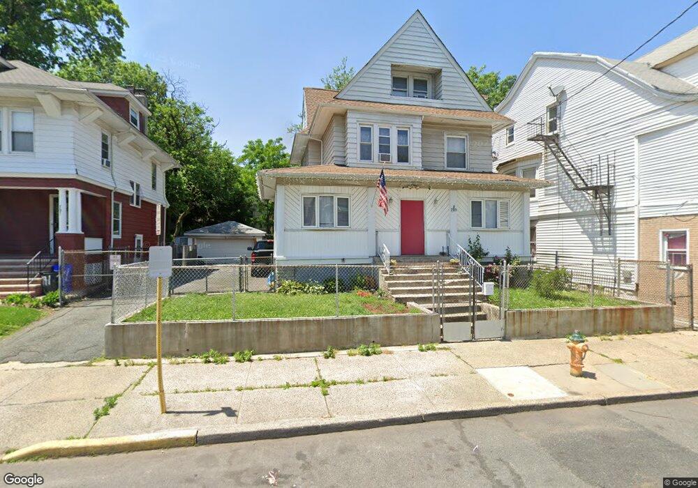
785 S 11th St Unit 787 Newark, NJ 07108
Clinton Hill NeighborhoodEstimated Value: $395,000 - $525,000
--
Bed
--
Bath
1,961
Sq Ft
$245/Sq Ft
Est. Value
About This Home
This home is located at 785 S 11th St Unit 787, Newark, NJ 07108 and is currently estimated at $481,215, approximately $245 per square foot. 785 S 11th St Unit 787 is a home located in Essex County with nearby schools including Hawthorne Avenue Elementary School, Belmont Runyon School, and Louise A. Spencer School.
Ownership History
Date
Name
Owned For
Owner Type
Purchase Details
Closed on
Aug 30, 2005
Sold by
Scott Catherine
Bought by
Baptista Ernest and Baptista Ana
Current Estimated Value
Home Financials for this Owner
Home Financials are based on the most recent Mortgage that was taken out on this home.
Original Mortgage
$44,332
Outstanding Balance
$23,703
Interest Rate
5.84%
Mortgage Type
Stand Alone Second
Estimated Equity
$457,512
Purchase Details
Closed on
Nov 15, 1999
Sold by
D & B Development
Bought by
Scott Catherine
Home Financials for this Owner
Home Financials are based on the most recent Mortgage that was taken out on this home.
Original Mortgage
$106,400
Interest Rate
7.86%
Purchase Details
Closed on
Sep 22, 1998
Sold by
Wilshire Credit
Bought by
D E Development
Create a Home Valuation Report for This Property
The Home Valuation Report is an in-depth analysis detailing your home's value as well as a comparison with similar homes in the area
Home Values in the Area
Average Home Value in this Area
Purchase History
| Date | Buyer | Sale Price | Title Company |
|---|---|---|---|
| Baptista Ernest | $221,660 | -- | |
| -- | $221,700 | -- | |
| Scott Catherine | $112,000 | -- | |
| D E Development | $22,000 | -- |
Source: Public Records
Mortgage History
| Date | Status | Borrower | Loan Amount |
|---|---|---|---|
| Open | -- | $44,332 | |
| Open | -- | $177,328 | |
| Previous Owner | Scott Catherine | $106,400 |
Source: Public Records
Tax History Compared to Growth
Tax History
| Year | Tax Paid | Tax Assessment Tax Assessment Total Assessment is a certain percentage of the fair market value that is determined by local assessors to be the total taxable value of land and additions on the property. | Land | Improvement |
|---|---|---|---|---|
| 2025 | $5,443 | $146,000 | $17,100 | $128,900 |
| 2024 | $5,443 | $146,000 | $17,100 | $128,900 |
| 2022 | $5,455 | $146,000 | $17,100 | $128,900 |
| 2021 | $5,452 | $146,000 | $17,100 | $128,900 |
| 2020 | $5,548 | $146,000 | $17,100 | $128,900 |
| 2019 | $5,491 | $146,000 | $17,100 | $128,900 |
| 2018 | $5,392 | $146,000 | $17,100 | $128,900 |
| 2017 | $5,198 | $146,000 | $17,100 | $128,900 |
| 2016 | $5,022 | $146,000 | $17,100 | $128,900 |
| 2015 | $4,831 | $146,000 | $17,100 | $128,900 |
| 2014 | $4,527 | $146,000 | $17,100 | $128,900 |
Source: Public Records
Map
Nearby Homes
- 742-744 S 10th St
- 742 S 10th St Unit 744
- 754-756 S 11th St
- 754 St Unit 4
- 742 S 12th St
- 122 Rose Terrace
- 827 S 11th St Unit 829
- 725 S 11th St
- 783 S 13th St
- 783 S 13th St Unit 2
- 723 S 11th St
- 721 S 11th St
- 824-826 S 13th St
- 811 S 13th St
- 719 S 11th St
- 2 Baldwin Ave
- 10 Baldwin Ave
- 418 Avon Ave
- 788 S 15th St
- 57-59 Treacy Ave
- 783 S 11th St
- 783 S 11th St Unit 3
- 789 S 11th St Unit 791
- 793 S 11th St
- 776 S 12th St
- 778-780 S 12th St
- 778 S 12th St Unit 780
- 782 S 12th St
- 782 S 12th St Unit 2
- 774 S 12th St
- 786 S 12th St
- 795 S 11th St Unit 797
- 770 S 12th St Unit 772
- 788 S 12th St Unit 790
- 768 S 12th St
- 799 S 11th St
- 786 S 11th St Unit 788
- 784 S 11th St
- 780 S 11th St Unit 782
- 778-778 S 11th St Unit 778 S