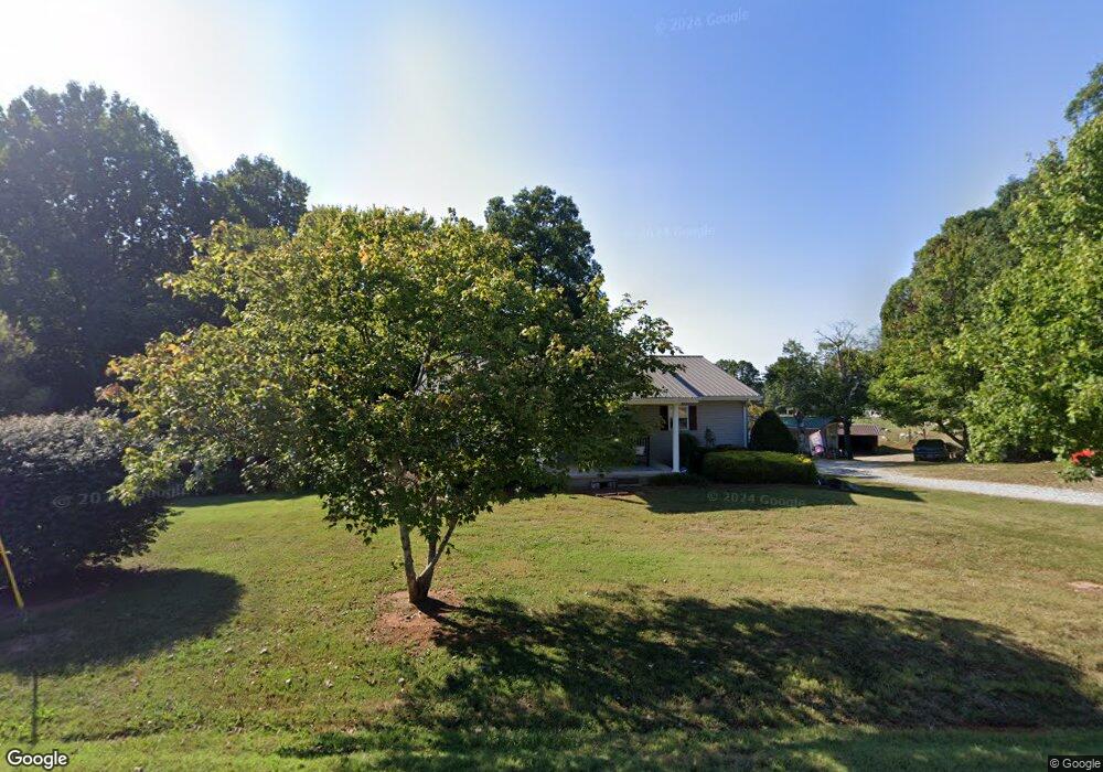
785 Simpson Rd Unit 795 Sparta, TN 38583
Estimated Value: $257,715 - $352,000
Studio
2
Baths
1,280
Sq Ft
$243/Sq Ft
Est. Value
About This Home
This home is located at 785 Simpson Rd Unit 795, Sparta, TN 38583 and is currently estimated at $311,429, approximately $243 per square foot. 785 Simpson Rd Unit 795 is a home located in White County with nearby schools including Cassville Elementary School, White County Middle School, and White County High School.
Ownership History
Date
Name
Owned For
Owner Type
Purchase Details
Closed on
Jul 2, 2025
Sold by
Allen Billy Gene and Allen Annette Lynn
Bought by
Billy And Annette Allen Joint Revocable Livin and Allen
Current Estimated Value
Purchase Details
Closed on
Oct 4, 1994
Purchase Details
Closed on
Jan 21, 1986
Bought by
Allen Billy
Purchase Details
Closed on
Jan 2, 1900
Create a Home Valuation Report for This Property
The Home Valuation Report is an in-depth analysis detailing your home's value as well as a comparison with similar homes in the area
Purchase History
| Date | Buyer | Sale Price | Title Company |
|---|---|---|---|
| Billy And Annette Allen Joint Revocable Livin | -- | Capstone Title & Escrow | |
| Billy And Annette Allen Joint Revocable Livin | -- | Capstone Title & Escrow | |
| -- | $2,000 | -- | |
| Allen Billy | -- | -- | |
| -- | -- | -- |
Source: Public Records
Tax History
| Year | Tax Paid | Tax Assessment Tax Assessment Total Assessment is a certain percentage of the fair market value that is determined by local assessors to be the total taxable value of land and additions on the property. | Land | Improvement |
|---|---|---|---|---|
| 2025 | $1,061 | $75,275 | $21,775 | $53,500 |
| 2024 | $837 | $40,825 | $12,550 | $28,275 |
| 2023 | $837 | $40,825 | $12,550 | $28,275 |
| 2022 | $837 | $40,825 | $12,550 | $28,275 |
| 2021 | $837 | $40,825 | $12,550 | $28,275 |
| 2020 | $837 | $40,825 | $12,550 | $28,275 |
| 2019 | $744 | $36,300 | $11,450 | $24,850 |
| 2018 | $744 | $36,300 | $11,450 | $24,850 |
| 2017 | $744 | $36,300 | $11,450 | $24,850 |
| 2016 | $744 | $36,300 | $11,450 | $24,850 |
| 2015 | $672 | $36,300 | $11,450 | $24,850 |
| 2014 | -- | $36,300 | $11,450 | $24,850 |
| 2013 | -- | $35,200 | $11,450 | $23,750 |
Source: Public Records
Map
Nearby Homes
- 6760 Smithville Hwy
- 304 Lucille St
- 6444 Old Smithville Hwy S
- 8444 Old Kentucky Rd
- 6311 Old Smithville Hwy S
- 121 Hutchings College Rd
- 0 Liberty Rd
- 409 Westwood Dr
- 288 Westwood Dr
- lot 16 Old Kentucky Rd
- Lot 17 Old Kentucky Rd
- 0 Jenkins Rd
- 268 Fairview Cir
- 365 Fairview Cir
- 478 Frank Anderson Rd
- 459 Frank Anderson Rd
- 1092 Frank Anderson Rd
- 1072 Frank Anderson Rd
- 1054 Frank Anderson Rd
- 912 Frank Anderson Rd
- 744 Simpson Rd
- 745 Simpson Rd
- 799 Simpson Rd
- 704 Simpson Rd
- 676 Simpson Rd
- 895 Simpson Rd
- 0 Simpson Rd Unit 126154
- 0 Simpson Rd Unit 213206
- 796 Simpson Rd
- Par10.04 Simpson Rd
- LOT 1 B Simpson Rd
- LOT 1C Simpson Rd
- 2.68 ACR Simpson Rd
- 00 Simpson Rd
- 423 Simpson Rd
- 602 Simpson Rd
- 107 Darkey Springs Rd
- 1367 Hutchings College Rd
- 1010 Simpson Rd
Your Personal Tour Guide
Ask me questions while you tour the home.