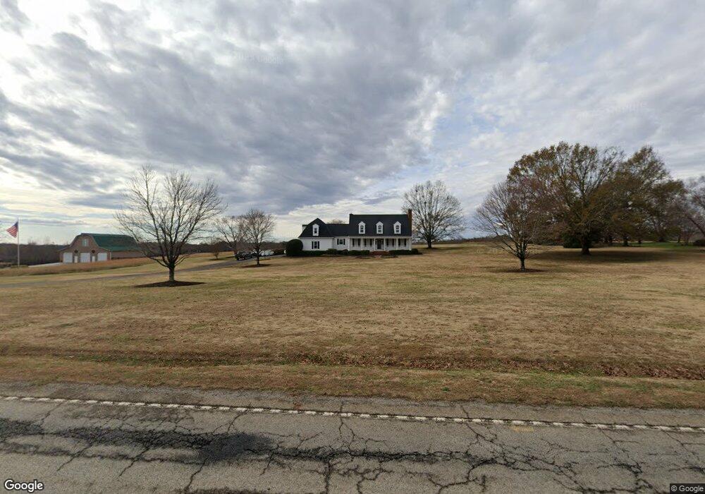
7855 Parris Bridge Rd Chesnee, SC 29323
Estimated Value: $576,000 - $997,225
4
Beds
4
Baths
3,443
Sq Ft
$213/Sq Ft
Est. Value
About This Home
This home is located at 7855 Parris Bridge Rd, Chesnee, SC 29323 and is currently estimated at $732,408, approximately $212 per square foot. 7855 Parris Bridge Rd is a home located in Spartanburg County with nearby schools including Chesnee Middle School and Chesnee High School.
Ownership History
Date
Name
Owned For
Owner Type
Purchase Details
Closed on
Aug 10, 2022
Sold by
Edwin Painter Mark
Bought by
Painter James W and Painter Kathy F
Current Estimated Value
Purchase Details
Closed on
Mar 29, 2016
Sold by
Painter Mark Edwin
Bought by
Painter Mark Edwin and Painter Kenda M
Home Financials for this Owner
Home Financials are based on the most recent Mortgage that was taken out on this home.
Original Mortgage
$194,350
Interest Rate
3.59%
Mortgage Type
New Conventional
Create a Home Valuation Report for This Property
The Home Valuation Report is an in-depth analysis detailing your home's value as well as a comparison with similar homes in the area
Home Values in the Area
Average Home Value in this Area
Purchase History
| Date | Buyer | Sale Price | Title Company |
|---|---|---|---|
| Painter James W | -- | None Listed On Document | |
| Painter James W | -- | None Listed On Document | |
| Painter Mark Edwin | -- | None Available |
Source: Public Records
Mortgage History
| Date | Status | Borrower | Loan Amount |
|---|---|---|---|
| Previous Owner | Painter Mark Edwin | $194,350 |
Source: Public Records
Tax History Compared to Growth
Tax History
| Year | Tax Paid | Tax Assessment Tax Assessment Total Assessment is a certain percentage of the fair market value that is determined by local assessors to be the total taxable value of land and additions on the property. | Land | Improvement |
|---|---|---|---|---|
| 2025 | $2,015 | $12,582 | $340 | $12,242 |
| 2024 | $2,015 | $12,582 | $340 | $12,242 |
| 2023 | $2,015 | $12,582 | $340 | $12,242 |
| 2022 | $4,007 | $14,835 | $7,884 | $6,951 |
| 2021 | $1,931 | $11,692 | $1,056 | $10,636 |
| 2020 | $1,901 | $11,692 | $1,056 | $10,636 |
| 2019 | $1,901 | $11,692 | $1,056 | $10,636 |
| 2018 | $1,854 | $11,692 | $1,056 | $10,636 |
| 2017 | $5,708 | $15,984 | $1,320 | $14,664 |
| 2016 | $1,715 | $10,656 | $880 | $9,776 |
| 2015 | $1,710 | $10,656 | $880 | $9,776 |
| 2014 | $1,705 | $10,656 | $880 | $9,776 |
Source: Public Records
Map
Nearby Homes
- 0 Cantrell Dr
- 351 Smith Wall Rd
- 202 Arrowood Branch Rd
- 107 Brooklyn Church Rd
- 216 Sweetgrass Dr
- 291 Robbins Rd
- 140 Manor House Ln
- 1543 Highway 11 W
- 523 State Road S-42-1879
- 537 State Road S-42-1879
- 545 State Road S-42-1879
- 561 State Road S-42-1879
- 565 State Road S-42-1879
- 569 State Road S-42-1879
- 0 State Road S-42-1879
- 190 Clement Rd
- 268 Margate Cir
- 229 Holly Rd
- 550 Harris Rd
- 402 Dodger Ave
- 7885 Parris Bridge Rd
- 7807 Parris Bridge Rd
- 7889 Parris Bridge Rd
- 7780 Parris Bridge Rd
- 7893 Parris Bridge Rd
- 7771 Parris Bridge Rd
- 7901 Parris Bridge Rd
- 7764 Parris Bridge Rd
- 7760 Parris Bridge Rd
- 7743 Parris Bridge Rd
- 7740 Parris Bridge Rd
- 368 Ivey Rd
- 375 Ivey Rd
- 356 Ivey Rd
- 7720 Parris Bridge Rd
- 342 Ivey Rd
- 359 Ivey Rd
- 7775 Parris Bridge Rd
- 2161 Highway 11 W
- 2130 Highway 11 W