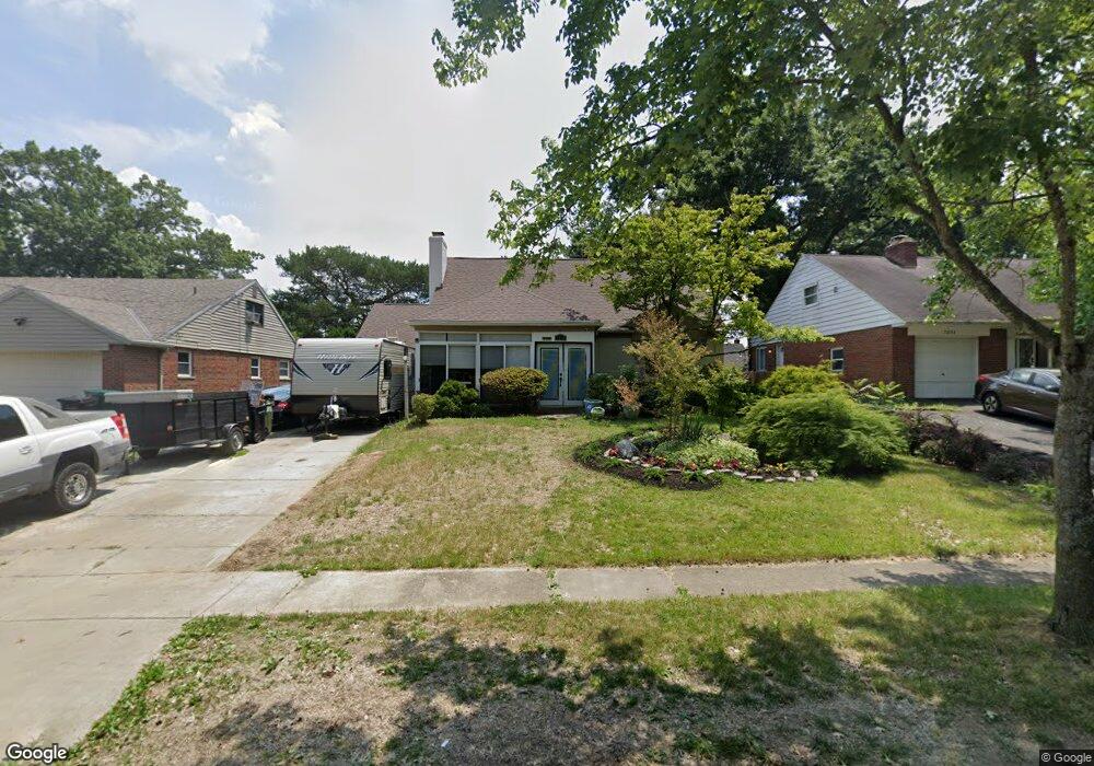
7858 Bobolink Dr Cincinnati, OH 45224
College Hill NeighborhoodEstimated Value: $249,602 - $268,000
4
Beds
2
Baths
1,598
Sq Ft
$162/Sq Ft
Est. Value
About This Home
This home is located at 7858 Bobolink Dr, Cincinnati, OH 45224 and is currently estimated at $258,401, approximately $161 per square foot. 7858 Bobolink Dr is a home located in Hamilton County with nearby schools including Pleasant Hill Elementary School, Robert A. Taft Information Technology High School, and Western Hills High School.
Ownership History
Date
Name
Owned For
Owner Type
Purchase Details
Closed on
Jul 30, 2003
Sold by
Medley Marilyn K
Bought by
Washington William
Current Estimated Value
Home Financials for this Owner
Home Financials are based on the most recent Mortgage that was taken out on this home.
Original Mortgage
$129,000
Outstanding Balance
$60,426
Interest Rate
6.99%
Mortgage Type
Unknown
Estimated Equity
$197,975
Create a Home Valuation Report for This Property
The Home Valuation Report is an in-depth analysis detailing your home's value as well as a comparison with similar homes in the area
Home Values in the Area
Average Home Value in this Area
Purchase History
| Date | Buyer | Sale Price | Title Company |
|---|---|---|---|
| Washington William | $129,000 | Royal Land Title Agency Ltd |
Source: Public Records
Mortgage History
| Date | Status | Borrower | Loan Amount |
|---|---|---|---|
| Open | Washington William | $129,000 |
Source: Public Records
Tax History
| Year | Tax Paid | Tax Assessment Tax Assessment Total Assessment is a certain percentage of the fair market value that is determined by local assessors to be the total taxable value of land and additions on the property. | Land | Improvement |
|---|---|---|---|---|
| 2025 | $4,035 | $65,335 | $12,005 | $53,330 |
| 2023 | $4,001 | $65,335 | $12,005 | $53,330 |
| 2022 | $2,444 | $35,690 | $9,776 | $25,914 |
| 2021 | $2,348 | $35,690 | $9,776 | $25,914 |
| 2020 | $2,417 | $35,690 | $9,776 | $25,914 |
| 2019 | $2,318 | $31,308 | $8,575 | $22,733 |
| 2018 | $2,322 | $31,308 | $8,575 | $22,733 |
| 2017 | $2,205 | $31,308 | $8,575 | $22,733 |
| 2016 | $2,681 | $37,573 | $9,149 | $28,424 |
| 2015 | $2,418 | $37,573 | $9,149 | $28,424 |
| 2014 | $2,435 | $37,573 | $9,149 | $28,424 |
| 2013 | $2,553 | $38,735 | $9,433 | $29,302 |
Source: Public Records
Map
Nearby Homes
- 7873 Bobolink Dr
- 7923 Bobolink Dr
- 1280 Brushwood Ave
- 7929 Cherrywood Ct
- 1291 W Galbraith Rd
- 6669 Kirkland Dr
- 1165 W Galbraith Rd
- 6538 S Oak Knoll Dr
- 1148 Hollywood Ave
- 6785 Marvin Ave
- 6917 Kleindale Ave
- 1472 Larrywood Ln
- 1088 Pinehollow Ln
- 1387 Teakwood Ave
- 6629 Charann Ln
- 8491 Fernwell Dr
- 6531 Hamilton Ave
- 1491 Reid Ave
- 1006 Hearthstone Dr
- 1568 Wittekind Terrace
- 7864 Bobolink Dr
- 7854 Bobolink Dr
- 7868 Bobolink Dr
- 7719 Knollwood Ln
- 7695 Knollwood Ln
- 7743 Knollwood Ln
- 7846 Bobolink Dr
- 7874 Bobolink Dr
- 7671 Knollwood Ln
- 7859 Bobolink Dr
- 7863 Bobolink Dr
- 7767 Knollwood Ln
- 7855 Bobolink Dr
- 7867 Bobolink Dr
- 7647 Knollwood Ln
- 7880 Bobolink Dr
- 7849 Bobolink Dr
- 7791 Knollwood Ln
- 7842 Bobolink Dr
- 7879 Bobolink Dr
Your Personal Tour Guide
Ask me questions while you tour the home.