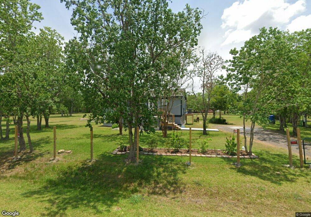
7858 County Road 116 Pearland, TX 77584
Estimated Value: $211,000 - $376,000
--
Bed
5
Baths
1,050
Sq Ft
$277/Sq Ft
Est. Value
About This Home
This home is located at 7858 County Road 116, Pearland, TX 77584 and is currently estimated at $291,350, approximately $277 per square foot. 7858 County Road 116 is a home with nearby schools including Mark Twain Elementary School, G.W. Harby Junior High School, and Manvel High School.
Ownership History
Date
Name
Owned For
Owner Type
Purchase Details
Closed on
May 10, 2023
Sold by
Delcid Llc
Bought by
Delcid Victor
Current Estimated Value
Purchase Details
Closed on
Jun 23, 2021
Sold by
Cardona Amando
Bought by
Decid Llc
Home Financials for this Owner
Home Financials are based on the most recent Mortgage that was taken out on this home.
Original Mortgage
$120,000
Interest Rate
2.9%
Mortgage Type
Purchase Money Mortgage
Purchase Details
Closed on
Feb 5, 2010
Sold by
Cardona Felipe J
Bought by
Cardona Armando
Create a Home Valuation Report for This Property
The Home Valuation Report is an in-depth analysis detailing your home's value as well as a comparison with similar homes in the area
Home Values in the Area
Average Home Value in this Area
Purchase History
| Date | Buyer | Sale Price | Title Company |
|---|---|---|---|
| Delcid Victor | -- | None Listed On Document | |
| Decid Llc | -- | Stewart Title | |
| Cardona Armando | -- | None Available |
Source: Public Records
Mortgage History
| Date | Status | Borrower | Loan Amount |
|---|---|---|---|
| Previous Owner | Decid Llc | $120,000 |
Source: Public Records
Tax History Compared to Growth
Tax History
| Year | Tax Paid | Tax Assessment Tax Assessment Total Assessment is a certain percentage of the fair market value that is determined by local assessors to be the total taxable value of land and additions on the property. | Land | Improvement |
|---|---|---|---|---|
| 2025 | $2,772 | $275,000 | $187,310 | $87,690 |
| 2023 | $2,772 | $332,650 | $230,880 | $101,770 |
| 2022 | $3,810 | $179,620 | $90,300 | $89,320 |
| 2021 | $3,192 | $148,930 | $82,560 | $66,370 |
| 2020 | $2,805 | $130,760 | $61,920 | $68,840 |
| 2019 | $2,667 | $128,130 | $61,920 | $66,210 |
| 2018 | $2,430 | $109,610 | $44,850 | $64,760 |
| 2017 | $2,461 | $109,610 | $44,850 | $64,760 |
| 2016 | $2,377 | $105,890 | $44,850 | $61,040 |
| 2015 | $1,681 | $104,730 | $43,130 | $61,600 |
| 2014 | $1,681 | $88,400 | $43,130 | $45,270 |
Source: Public Records
Map
Nearby Homes
- 17501 County Road 116
- 7829 James St Unit CR117
- COUNTRY RD 143 County Road 112
- 3415 Herbert Dr
- 18111 Roy Long Rd
- 18502 Wells Ct
- 7225 Libby Ln
- 4016 Atago Tree Ln
- 3411 Woodrose Orchard Dr
- 4013 Green Anjou Ln
- 3421 Comice Ln
- 7223 Libby Ln
- 3410 Comice Ln
- 4004 Green Anjou Ln
- 3424 Daily Harvest Dr
- 3425 Daily Harvest Dr
- 3412 Daily Harvest Dr
- 3405 Daily Harvest Dr
- 3308 Comice Ln
- 3344 Daily Harvest Dr
- 7844 Lester St
- 7842 Lester St
- 7842 Lester St
- 7900 Debbie Dr
- 7843 Lester St
- 7839 Lester St
- 7801 Moore Rd
- 7809 Moore Rd
- 8005 Moore Rd
- 8005 Moore Rd Unit B
- 17501 Debbie Dr
- 0 Moore Rd
- 7905 Moore Rd
- 7822 Lester St
- 8007 Moore Rd
- 7946 Moore Rd
- 7946 Moore Rd
- 8003 Moore Rd
- 7914 County Road 162
- 7819 Lester St