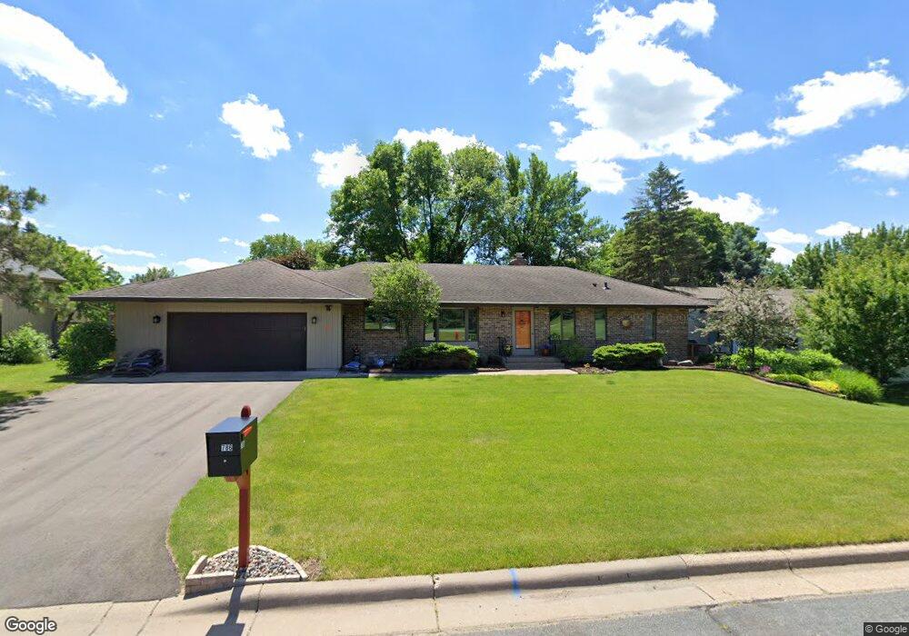
786 Bachelor Ave Saint Paul, MN 55118
Estimated Value: $637,000 - $725,000
About This Home
This home is located at 786 Bachelor Ave, Saint Paul, MN 55118 and is currently estimated at $674,272, approximately $207 per square foot. 786 Bachelor Ave is a home located in Dakota County with nearby schools including Somerset Elementary School, Heritage E-STEM Magnet School, and Two Rivers High School.
Ownership History
We collect this data history from publicly available records. To have your information removed, we recommend requesting removal directly through your county’s website.
Purchase Details
Purchase Details
Home Financials for this Owner
Home Financials are based on the most recent Mortgage that was taken out on this home.Purchase Details
Home Financials for this Owner
Home Financials are based on the most recent Mortgage that was taken out on this home.Home Values in the Area
Average Home Value in this Area
Purchase History
We collect this data history from publicly available records. To have your information removed, we recommend requesting removal directly through your county’s website.
| Date | Buyer | Sale Price | Title Company |
|---|---|---|---|
| -- | None Available | ||
| $565,000 | Burnet Title | ||
| $435,000 | Results Title | ||
| $565,000 | -- |
Mortgage History
We collect this data history from publicly available records. To have your information removed, we recommend requesting removal directly through your county’s website.
| Date | Status | Borrower | Loan Amount |
|---|---|---|---|
| Open | $367,250 | ||
| Previous Owner | $348,000 | ||
| Closed | $565,000 |
Tax History
We collect this data history from publicly available records. To have your information removed, we recommend requesting removal directly through your county’s website.
| Year | Tax Paid | Tax Assessment Tax Assessment Total Assessment is a certain percentage of the fair market value that is determined by local assessors to be the total taxable value of land and additions on the property. | Land | Improvement |
|---|---|---|---|---|
| 2025 | $6,772 | $653,200 | $187,700 | $465,500 |
| 2024 | $5,960 | $650,400 | $180,900 | $469,500 |
| 2023 | $5,960 | $617,100 | $176,800 | $440,300 |
| 2022 | $4,698 | $585,400 | $176,400 | $409,000 |
| 2021 | $4,698 | $470,000 | $146,100 | $323,900 |
| 2020 | $4,872 | $463,600 | $139,100 | $324,500 |
| 2019 | $4,477 | $463,300 | $139,100 | $324,200 |
| 2018 | $4,352 | $404,900 | $123,800 | $281,100 |
| 2017 | $4,237 | $396,900 | $117,900 | $279,000 |
| 2016 | $4,223 | $372,400 | $112,200 | $260,200 |
| 2015 | $4,196 | $373,800 | $112,200 | $261,600 |
| 2014 | -- | $357,200 | $106,000 | $251,200 |
| 2013 | -- | $320,800 | $102,800 | $218,000 |
Map
- 782 Evergreen Knolls
- 717 Marie Ave W
- 888 Nina Ct
- 700 Hidden Creek Trail
- TBD Barbara Ct
- 688 Wentworth Ave W
- 784 Hilltop Ct
- 685 Hidden Creek Trail
- 768 Lower Colonial Dr
- 715 Linden St Unit 204
- 1948 Crown Point Dr
- 614 Hidden Creek Trail
- 1359 Cherry Hill Rd
- 1421 Clement St
- 609 Callahan Place
- 599 Callahan Place
- 620 Callahan Place
- 1900 Victoria Rd S Unit C
- 1918 South Ln
- 1320 Riverside Ln Unit 200
- 776 Bachelor Ave
- 796 Bachelor Ave
- 1722 Sutton Ln
- 1722 1722 Sutton Ln
- 1718 Sutton Ln
- 758 Bachelor Ave
- 800 Bachelor Ave
- 1716 Trail Rd
- 1726 Sutton Ln
- 1728 Trail Rd
- 1723 Sutton Ln
- 1717 Sutton Ln
- 1741 Sutton Ln
- 748 Bachelor Ave
- 1732 Sutton Ln
- 1746 Trail Rd
- 1735 Trail Rd
- 1729 Trail Rd
- 1729 1729 Trail-Road-
- 1738 Sutton Ln
Ask me questions while you tour the home.