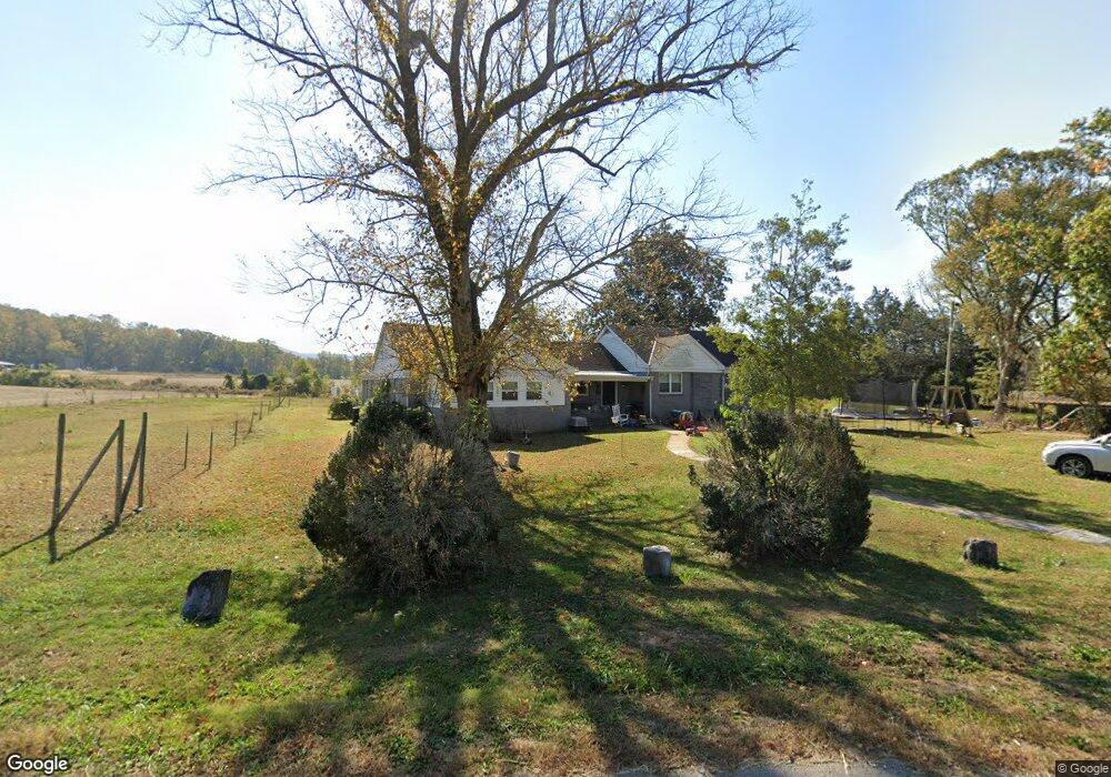
786 E Roarks Cove Rd Decherd, TN 37324
Estimated Value: $236,797 - $439,000
Studio
2
Baths
2,026
Sq Ft
$155/Sq Ft
Est. Value
About This Home
This home is located at 786 E Roarks Cove Rd, Decherd, TN 37324 and is currently estimated at $313,449, approximately $154 per square foot. 786 E Roarks Cove Rd is a home located in Franklin County with nearby schools including North Middle School and Franklin County High School.
Ownership History
Date
Name
Owned For
Owner Type
Purchase Details
Closed on
Sep 17, 2018
Sold by
Binkley E Dean and Binkley Andrea
Bought by
George Austin M and Binkley Andrea
Current Estimated Value
Home Financials for this Owner
Home Financials are based on the most recent Mortgage that was taken out on this home.
Original Mortgage
$199,530
Interest Rate
4.5%
Mortgage Type
Construction
Purchase Details
Closed on
Jul 25, 2017
Sold by
Raulston Hugh S and Raulston Katherine Dale
Bought by
Duncan Farms Family Limited Partnership
Home Financials for this Owner
Home Financials are based on the most recent Mortgage that was taken out on this home.
Original Mortgage
$100,000
Interest Rate
3.91%
Mortgage Type
Commercial
Create a Home Valuation Report for This Property
The Home Valuation Report is an in-depth analysis detailing your home's value as well as a comparison with similar homes in the area
Purchase History
| Date | Buyer | Sale Price | Title Company |
|---|---|---|---|
| George Austin M | $207,246 | Southern Tennessee Title | |
| Duncan Farms Family Limited Partnership | $271,689 | None Available | |
| Raulston Hugh S | -- | None Available |
Source: Public Records
Mortgage History
| Date | Status | Borrower | Loan Amount |
|---|---|---|---|
| Closed | George Austin M | $199,530 | |
| Previous Owner | Duncan Farms Family Limited Partnership | $100,000 |
Source: Public Records
Tax History
| Year | Tax Paid | Tax Assessment Tax Assessment Total Assessment is a certain percentage of the fair market value that is determined by local assessors to be the total taxable value of land and additions on the property. | Land | Improvement |
|---|---|---|---|---|
| 2025 | $883 | $44,275 | $10,425 | $33,850 |
| 2024 | $883 | $44,275 | $10,425 | $33,850 |
| 2023 | $883 | $44,275 | $10,425 | $33,850 |
| 2022 | $830 | $44,275 | $10,425 | $33,850 |
| 2021 | $864 | $44,275 | $10,425 | $33,850 |
| 2020 | $864 | $30,025 | $6,050 | $23,975 |
| 2019 | $864 | $30,025 | $6,050 | $23,975 |
| 2018 | $803 | $30,025 | $6,050 | $23,975 |
| 2017 | $1,402 | $52,450 | $28,475 | $23,975 |
| 2016 | $1,286 | $48,100 | $24,550 | $23,550 |
| 2015 | $1,286 | $48,100 | $24,550 | $23,550 |
| 2014 | $1,286 | $48,097 | $0 | $0 |
Source: Public Records
Map
Nearby Homes
- 640 Dotson Cemetery Rd
- 0 Dotson Cemetery Rd
- 0 Providence Rd
- 72 Lady Slipper Ln
- 0 Laxton Rd Unit RTC2957818
- 774 Sherrell Rd
- 1431 Roarks Cove Rd
- 0 U S Highway 64
- 0 Deep Woods Rd
- 431 Rose Dr
- 0 Old Alto Hwy Unit RTC3039048
- 8084 Old Alto Hwy
- 836 Spur Rd
- 1863 Lake Louisa Loop
- 191 Tiffany Ln
- 276 Wilder Rd
- 2095 Lake Louisa Loop
- 0 Roarks Cove Rd
- 0 Cooleys Rift Blvd Unit 14
- 1651 Lake Louisa Loop
- 679 E Roarks Cove Rd
- 1122 E Roarks Cove Rd
- 565 E Roarks Cove Rd
- 939 E Roarks Cove Rd
- 1282 E Roarks Cove Rd
- 3 Serenity Trace
- 538 Dotson Cemetery Rd
- 538 Dotson Cemetery Rd
- 1506 E Roarks Cove Rd
- 434 Ikard Ln
- 255 E Roarks Cove Rd
- 391 Dotson Cemetery Rd
- 1641 E Roarks Cove Rd
- 250 Ikard Ln
- 341 Serenity Ln
- 490 Sanders Rd
- 0 Roarks Cove Rd Off Unit 1504340
- 12330 David Crockett Pkwy E
- 12690 David Crockett Pkwy E
- 378 Sanders Rd
Your Personal Tour Guide
Ask me questions while you tour the home.