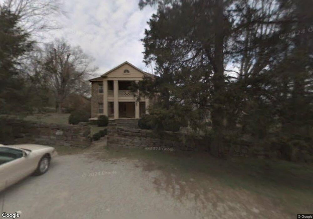
786 Lonnie Carr Rd Sparta, TN 38583
Estimated Value: $629,000 - $2,072,913
--
Bed
2
Baths
3,200
Sq Ft
$422/Sq Ft
Est. Value
About This Home
This home is located at 786 Lonnie Carr Rd, Sparta, TN 38583 and is currently estimated at $1,350,957, approximately $422 per square foot. 786 Lonnie Carr Rd is a home located in White County with nearby schools including Woodland Park Elementary School, White County Middle School, and White County High School.
Ownership History
Date
Name
Owned For
Owner Type
Purchase Details
Closed on
Dec 20, 2012
Bought by
Carr Farms Partnership Lp
Current Estimated Value
Purchase Details
Closed on
Nov 28, 2005
Sold by
Dewhite Public Utility Dis
Bought by
Hanson Carr
Purchase Details
Closed on
Aug 1, 2005
Create a Home Valuation Report for This Property
The Home Valuation Report is an in-depth analysis detailing your home's value as well as a comparison with similar homes in the area
Home Values in the Area
Average Home Value in this Area
Purchase History
| Date | Buyer | Sale Price | Title Company |
|---|---|---|---|
| Carr Farms Partnership Lp | -- | -- | |
| Hanson Carr | -- | -- | |
| -- | -- | -- |
Source: Public Records
Tax History Compared to Growth
Tax History
| Year | Tax Paid | Tax Assessment Tax Assessment Total Assessment is a certain percentage of the fair market value that is determined by local assessors to be the total taxable value of land and additions on the property. | Land | Improvement |
|---|---|---|---|---|
| 2025 | $7,932 | $660,875 | $0 | $0 |
| 2024 | $7,932 | $386,925 | $341,900 | $45,025 |
| 2023 | $7,932 | $386,925 | $341,900 | $45,025 |
| 2022 | $7,932 | $386,925 | $341,900 | $45,025 |
| 2021 | $7,932 | $386,925 | $341,900 | $45,025 |
| 2020 | $7,932 | $386,925 | $341,900 | $45,025 |
| 2019 | $6,237 | $304,225 | $275,750 | $28,475 |
| 2018 | $6,237 | $304,225 | $275,750 | $28,475 |
| 2017 | $6,237 | $304,225 | $275,750 | $28,475 |
| 2016 | $6,237 | $304,225 | $275,750 | $28,475 |
| 2015 | $5,628 | $304,225 | $275,750 | $28,475 |
| 2014 | -- | $304,225 | $275,750 | $28,475 |
| 2013 | -- | $86,750 | $60,575 | $26,175 |
Source: Public Records
Map
Nearby Homes
- 180 Frank Anderson Rd
- 8.5 Acres Frank Anderson Rd
- 536 Frank Anderson Rd
- 8.5 Acre Frank Anderson Rd
- 0 Frank Anderson Rd
- 217 Oaklawn Cemetery Rd
- 912 Frank Anderson Rd
- 154 Jersey Pike
- 1054 Frank Anderson Rd
- 268 Fairview Cir
- lot 16 Old Kentucky Rd
- Lot 17 Old Kentucky Rd
- 8565 Old Kentucky Rd
- 0 Old Kentucky Rd
- LOT 3 Old Kentucky Rd
- 8444 Old Kentucky Rd
- 999 Gum Springs Mountain Rd
- 226 Blackberry Ln
- 419 Adams St
- 288 Westwood Dr
- 672 Rock Cut Rd
- 98 AC Lonnie Carr Rd
- 0 Lonnie Carr Rd
- 211 Lonnie Carr Rd
- 9.74 Lonnie Carr Rd
- 000 Lonnie Carr Rd
- 3480 Smithville Hwy
- 280 Lonnie Carr Rd
- 286 Rock Cut Rd
- 80AC Darlene Dr
- 205 Lonnie Carr Rd
- 3675 Old Smithville Hwy N
- 3365 Old Smithville Hwy N
- 3271 Old Smithville Hwy N
- 3024 Old Smithville Hwy N
- 3521 Old Smithville Hwy N
- 2960 Old Smithville Hwy N
- 2854 Old Smithville Hwy N
- 2898 Old Smithville Hwy N
- 3467 Old Smithville Hwy N