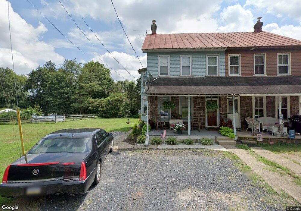
786 S Keim St Pottstown, PA 19465
North Coventry NeighborhoodEstimated Value: $163,000 - $290,662
3
Beds
2
Baths
1,460
Sq Ft
$163/Sq Ft
Est. Value
About This Home
This home is located at 786 S Keim St, Pottstown, PA 19465 and is currently estimated at $237,666, approximately $162 per square foot. 786 S Keim St is a home located in Chester County with nearby schools including North Coventry Elementary School, Owen J Roberts Middle School, and Owen J Roberts High School.
Ownership History
Date
Name
Owned For
Owner Type
Purchase Details
Closed on
Mar 9, 2002
Sold by
Burtt Dorothy V
Bought by
Smith Julie M
Current Estimated Value
Home Financials for this Owner
Home Financials are based on the most recent Mortgage that was taken out on this home.
Original Mortgage
$52,250
Outstanding Balance
$21,550
Interest Rate
6.88%
Estimated Equity
$216,116
Create a Home Valuation Report for This Property
The Home Valuation Report is an in-depth analysis detailing your home's value as well as a comparison with similar homes in the area
Home Values in the Area
Average Home Value in this Area
Purchase History
| Date | Buyer | Sale Price | Title Company |
|---|---|---|---|
| Smith Julie M | $55,000 | -- |
Source: Public Records
Mortgage History
| Date | Status | Borrower | Loan Amount |
|---|---|---|---|
| Open | Smith Julie M | $52,250 |
Source: Public Records
Tax History Compared to Growth
Tax History
| Year | Tax Paid | Tax Assessment Tax Assessment Total Assessment is a certain percentage of the fair market value that is determined by local assessors to be the total taxable value of land and additions on the property. | Land | Improvement |
|---|---|---|---|---|
| 2025 | $3,658 | $86,360 | $20,100 | $66,260 |
| 2024 | $3,658 | $86,360 | $20,100 | $66,260 |
| 2023 | $3,606 | $86,360 | $20,100 | $66,260 |
| 2022 | $3,532 | $86,360 | $20,100 | $66,260 |
| 2021 | $3,471 | $86,360 | $20,100 | $66,260 |
| 2020 | $3,383 | $86,360 | $20,100 | $66,260 |
| 2019 | $3,321 | $86,360 | $20,100 | $66,260 |
| 2018 | $3,232 | $86,360 | $20,100 | $66,260 |
| 2017 | $3,148 | $86,360 | $20,100 | $66,260 |
| 2016 | $2,501 | $86,360 | $20,100 | $66,260 |
| 2015 | $2,501 | $86,360 | $20,100 | $66,260 |
| 2014 | $2,501 | $86,360 | $20,100 | $66,260 |
Source: Public Records
Map
Nearby Homes
- 1027 Riverside Dr
- 1079 Riverside Dr
- 1111 Riverside Dr
- 1025 Darby Ct
- 1060 S Keim St
- 780 E Cedarville Rd
- 847 South St Unit 93
- 764 Queen St
- 851 Queen St
- 1132 Wendler Cir
- 866 E High St
- 428 South St
- 1057 South St
- 110 S Franklin St
- 1107 South St
- 639 E High St
- 28 Wil-Be Dr
- 1116 Queen St
- 1150 Queen St
- 277 Industrial Hwy