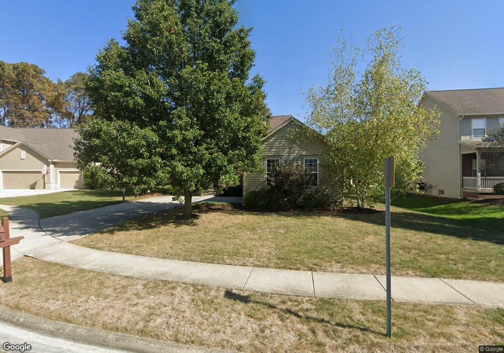
7863 Charline Ct Lewis Center, OH 43035
Orange NeighborhoodEstimated Value: $553,000 - $646,000
4
Beds
4
Baths
2,590
Sq Ft
$227/Sq Ft
Est. Value
About This Home
This home is located at 7863 Charline Ct, Lewis Center, OH 43035 and is currently estimated at $588,682, approximately $227 per square foot. 7863 Charline Ct is a home located in Delaware County with nearby schools including Freedom Trail Elementary School, Olentangy Orange Middle School, and Orange High School.
Ownership History
Date
Name
Owned For
Owner Type
Purchase Details
Closed on
Sep 9, 2002
Sold by
Joshua Investment Co
Bought by
Greenwald Mitchell M and Greenwald Julie A
Current Estimated Value
Home Financials for this Owner
Home Financials are based on the most recent Mortgage that was taken out on this home.
Original Mortgage
$262,526
Outstanding Balance
$111,026
Interest Rate
6.41%
Mortgage Type
New Conventional
Estimated Equity
$477,656
Create a Home Valuation Report for This Property
The Home Valuation Report is an in-depth analysis detailing your home's value as well as a comparison with similar homes in the area
Home Values in the Area
Average Home Value in this Area
Purchase History
| Date | Buyer | Sale Price | Title Company |
|---|---|---|---|
| Greenwald Mitchell M | $328,158 | -- |
Source: Public Records
Mortgage History
| Date | Status | Borrower | Loan Amount |
|---|---|---|---|
| Open | Greenwald Mitchell M | $262,526 |
Source: Public Records
Tax History Compared to Growth
Tax History
| Year | Tax Paid | Tax Assessment Tax Assessment Total Assessment is a certain percentage of the fair market value that is determined by local assessors to be the total taxable value of land and additions on the property. | Land | Improvement |
|---|---|---|---|---|
| 2024 | $9,828 | $177,670 | $36,020 | $141,650 |
| 2023 | $9,864 | $177,670 | $36,020 | $141,650 |
| 2022 | $9,217 | $135,000 | $25,380 | $109,620 |
| 2021 | $9,269 | $135,000 | $25,380 | $109,620 |
| 2020 | $9,313 | $135,000 | $25,380 | $109,620 |
| 2019 | $7,982 | $119,910 | $22,050 | $97,860 |
| 2018 | $8,018 | $119,910 | $22,050 | $97,860 |
| 2017 | $7,541 | $110,080 | $16,940 | $93,140 |
| 2016 | $7,836 | $110,080 | $16,940 | $93,140 |
| 2015 | $7,152 | $110,080 | $16,940 | $93,140 |
| 2014 | $7,253 | $110,080 | $16,940 | $93,140 |
| 2013 | $7,181 | $106,510 | $16,000 | $90,510 |
Source: Public Records
Map
Nearby Homes
- 7631 Pleasant Colony Ct
- 2216 Reeves Ave
- 2165 Ben Brush Place
- 2383 Bold Venture Dr
- 2715 Tucker Trail
- 8322 Aurora Ct
- 1923 Myrtle St
- 1746 E Powell Rd
- 1955 Royal Oak Dr
- 1627 Bristol Commons Place
- 975 Adara Dr Unit 6975
- 7633 Storrington Place
- 0 E Orange Rd Unit lot 1
- 0 E Orange Rd
- 1520 Aniko Ave
- 1143 Little Bear Place
- 3313 Glen Oaks Ct
- 3138 E Powell Rd
- 3144 Abbey Knoll Dr
- 1245 Little Bear Loop
- 7879 Charline Ct
- 7851 Charline Ct
- 7723 Lydia Dr
- 7893 Charline Ct
- 7860 Charline Ct
- 7715 Lydia Dr
- 7840 Charline Ct
- 7876 Charline Ct
- 7733 Lydia Dr
- 7848 Charline Ct
- 7890 Charline Ct
- 7907 Charline Ct
- 7705 Lydia Dr
- 2492 Pleasant Colony Dr
- 2498 Pleasant Colony Dr
- 7741 Lydia Dr
- 2486 Pleasant Colony Dr
- 2508 Pleasant Colony Dr
- 7904 Charline Ct
- 2467 Reeves Ave