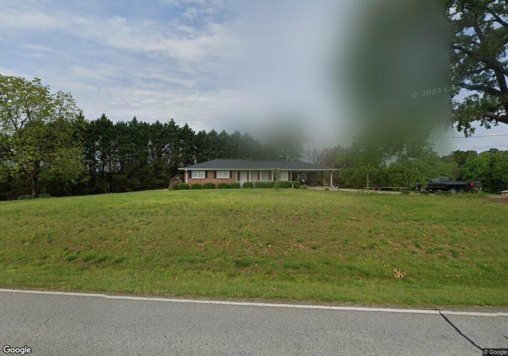
7865 Highway 320 Carnesville, GA 30521
Estimated Value: $349,000 - $423,000
3
Beds
2
Baths
1,444
Sq Ft
$265/Sq Ft
Est. Value
About This Home
This home is located at 7865 Highway 320, Carnesville, GA 30521 and is currently estimated at $382,209, approximately $264 per square foot. 7865 Highway 320 is a home located in Franklin County with nearby schools including Franklin County High School.
Ownership History
Date
Name
Owned For
Owner Type
Purchase Details
Closed on
Mar 23, 2021
Sold by
Ayers William Mark
Bought by
Ayers Christopher Mark and Ayers William Jacob
Current Estimated Value
Purchase Details
Closed on
Oct 10, 2016
Sold by
Judy A
Bought by
Ayers William Mark and Ayers Sherrie H
Purchase Details
Closed on
Apr 23, 2014
Sold by
Ayers Samuel Charlton
Bought by
Ayers Judy and Spencer Linda A
Purchase Details
Closed on
Aug 31, 1989
Bought by
Ayers Samuel Charlto
Create a Home Valuation Report for This Property
The Home Valuation Report is an in-depth analysis detailing your home's value as well as a comparison with similar homes in the area
Home Values in the Area
Average Home Value in this Area
Purchase History
| Date | Buyer | Sale Price | Title Company |
|---|---|---|---|
| Ayers Christopher Mark | -- | -- | |
| Ayers William Mark | -- | -- | |
| Ayers Judy | -- | -- | |
| Ayers Samuel Charlto | -- | -- |
Source: Public Records
Tax History Compared to Growth
Tax History
| Year | Tax Paid | Tax Assessment Tax Assessment Total Assessment is a certain percentage of the fair market value that is determined by local assessors to be the total taxable value of land and additions on the property. | Land | Improvement |
|---|---|---|---|---|
| 2024 | $1,804 | $106,324 | $39,552 | $66,772 |
| 2023 | $1,794 | $96,867 | $35,958 | $60,909 |
| 2022 | $1,638 | $83,482 | $27,900 | $55,582 |
| 2021 | $1,508 | $76,997 | $27,900 | $49,097 |
| 2020 | $1,280 | $64,103 | $23,342 | $40,761 |
| 2019 | $1,232 | $64,103 | $23,342 | $40,761 |
| 2018 | $1,002 | $61,761 | $29,162 | $32,599 |
| 2017 | $1,031 | $63,514 | $30,915 | $32,599 |
| 2016 | $979 | $58,358 | $30,915 | $27,443 |
| 2015 | -- | $58,357 | $30,915 | $27,443 |
| 2014 | -- | $58,646 | $30,915 | $27,731 |
| 2013 | -- | $59,141 | $30,914 | $28,226 |
Source: Public Records
Map
Nearby Homes
- 83 Henry Williams Rd
- 2845 Hunters Creek Rd
- 701 Sunshine Rd
- LOT 10 Bent Tree Rd
- 380 Stephens Rd
- 6060 Highway 320
- 1035 McFarlin Bridge Rd
- 964 Gooseneck Rd
- 964 Gooseneck Rd
- 123 Gennings Dr
- 0 Red Hill Rd Unit 10564928
- 6126 Mize Rd
- 2630 Prospect Rd
- 125 Lewis Crump Rd
- 2526 Prospect Rd
- 5831 Mize Rd
- 0 Banks Academy Rd Unit 10636762
- 1578 New Hope Rd
- 5620 Mize Rd
- 193 Tabitha Page Ln
- 8020 Highway 320
- 8016 Highway 320
- 8040 Highway 320
- 8115 Highway 320
- 8140 Highway 320
- 8211 Highway 320
- 8309 Highway 320
- 7866 Highway 320
- 7888 Highway 320
- 8330 Highway 320
- 8309 Georgia 320
- 7778 Highway 320
- 425 Arlin Williams Rd
- 8430 Highway 320
- 7681 Georgia 320
- 7681 Highway 320
- 0 Arlin Willams Rd Unit 8129018
- 8443 Highway 320
- 8443 Highway 320
- 7585 Highway 320