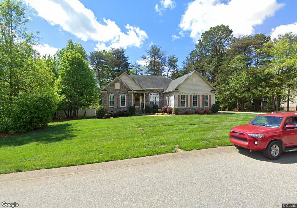
7866 Harbor Master Ct Unit 24 Denver, NC 28037
Estimated Value: $610,000 - $733,000
3
Beds
3
Baths
2,894
Sq Ft
$232/Sq Ft
Est. Value
About This Home
This home is located at 7866 Harbor Master Ct Unit 24, Denver, NC 28037 and is currently estimated at $671,860, approximately $232 per square foot. 7866 Harbor Master Ct Unit 24 is a home located in Lincoln County with nearby schools including Catawba Springs Elementary School, East Lincoln Middle School, and East Lincoln High School.
Ownership History
Date
Name
Owned For
Owner Type
Purchase Details
Closed on
Oct 17, 2014
Sold by
Friese Andrea P and Ramsey Dennie Willis
Bought by
Malagese Anthony J and Malagese Sandra R
Current Estimated Value
Home Financials for this Owner
Home Financials are based on the most recent Mortgage that was taken out on this home.
Original Mortgage
$310,650
Outstanding Balance
$238,770
Interest Rate
4.17%
Mortgage Type
New Conventional
Estimated Equity
$433,090
Purchase Details
Closed on
Mar 19, 2008
Sold by
Nvr Inc
Bought by
Friese Andrea P
Purchase Details
Closed on
Dec 10, 2007
Sold by
Rnh Inc
Bought by
Nvr Inc
Create a Home Valuation Report for This Property
The Home Valuation Report is an in-depth analysis detailing your home's value as well as a comparison with similar homes in the area
Home Values in the Area
Average Home Value in this Area
Purchase History
| Date | Buyer | Sale Price | Title Company |
|---|---|---|---|
| Malagese Anthony J | $327,000 | None Available | |
| Friese Andrea P | $343,000 | None Available | |
| Nvr Inc | $110,000 | None Available |
Source: Public Records
Mortgage History
| Date | Status | Borrower | Loan Amount |
|---|---|---|---|
| Open | Malagese Anthony J | $310,650 |
Source: Public Records
Tax History Compared to Growth
Tax History
| Year | Tax Paid | Tax Assessment Tax Assessment Total Assessment is a certain percentage of the fair market value that is determined by local assessors to be the total taxable value of land and additions on the property. | Land | Improvement |
|---|---|---|---|---|
| 2025 | $3,317 | $526,042 | $80,000 | $446,042 |
| 2024 | $3,284 | $526,042 | $80,000 | $446,042 |
| 2023 | $3,279 | $526,042 | $80,000 | $446,042 |
| 2022 | $2,781 | $360,718 | $65,000 | $295,718 |
| 2021 | $2,799 | $360,718 | $65,000 | $295,718 |
| 2020 | $2,514 | $360,718 | $65,000 | $295,718 |
| 2019 | $2,514 | $360,718 | $65,000 | $295,718 |
| 2018 | $2,286 | $312,092 | $63,500 | $248,592 |
| 2017 | $2,185 | $312,092 | $63,500 | $248,592 |
| 2016 | $2,175 | $312,092 | $63,500 | $248,592 |
| 2015 | $2,314 | $312,092 | $63,500 | $248,592 |
| 2014 | $2,272 | $319,175 | $64,000 | $255,175 |
Source: Public Records
Map
Nearby Homes
- 8150 Malibu Pointe Ln
- 1925 Cameron Heights Cir
- 6242 Ashton Park Dr
- 6273 Ashton Park Dr
- 1959 Rock Springs Cir
- 1751 Knights Dr
- 4178 Millstream Rd
- St. Andrews Plan at Wildbrook
- Pinehurst Plan at Wildbrook
- Muirfield Plan at Wildbrook
- Augusta Plan at Wildbrook
- Bethpage Plan at Wildbrook
- 0 Rufus Rd
- 4168 Millstream Rd
- 8260 Graham Rd
- 1358 Cedardale Ln
- 1378 Cedardale Ln
- 532 N Pilot Knob Rd
- 000 Millstream Rd Unit 149
- 1374 Cedardale Ln Unit 33
- 7866 Harbor Master Ct
- 7874 Harbor Master Ct
- 0 Harbor Master Ct Unit 3213315
- 0 Harbor Master Ct Unit 11 3453210
- 7832 Harbor Master Ct
- 7869 Cherry Point Rd
- 7869 Cherry Point Dr
- 7841 Harbor Master Ct
- 26 Harbor Master Ct
- 12 Harbor Master Ct
- 860 Harbor Master Ct
- 7873 Harbor Master Ct
- 7886 Harbor Master Ct
- 7804 Harbor Master Ct
- 7804 Harbor Master Ct Unit 26
- 7821 Harbor Master Ct
- 7883 Harbor Master Ct Unit 4
- 7883 Harbor Master Ct
- 7895 Harbor Master Ct
- 7794 Harbor Master Ct