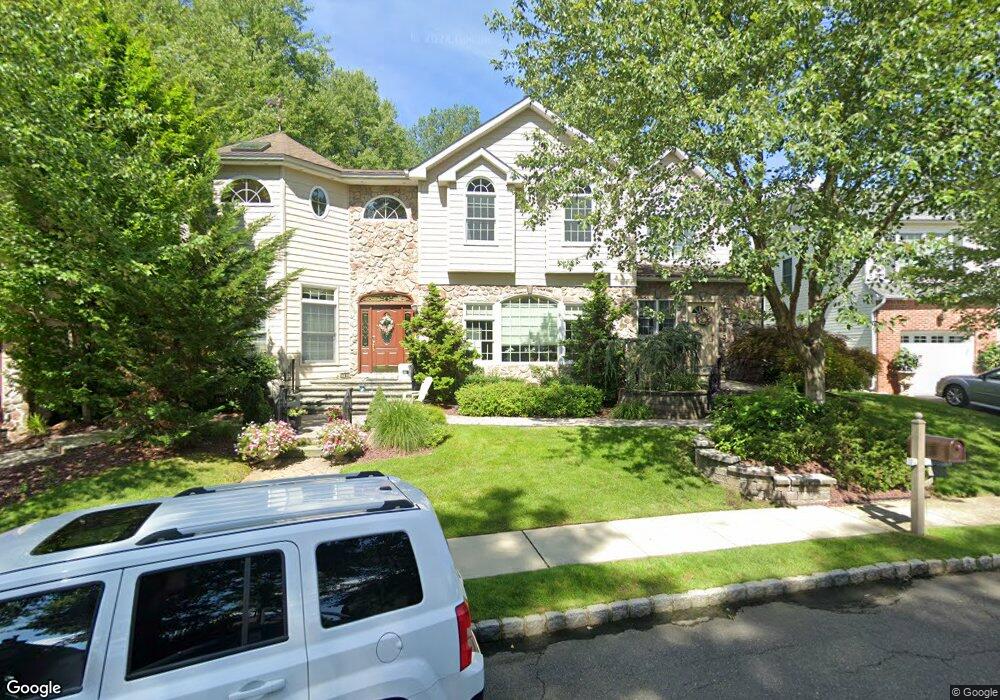
787 Manchester Way Paramus, NJ 07652
Estimated Value: $1,320,000 - $1,968,000
--
Bed
--
Bath
3,974
Sq Ft
$396/Sq Ft
Est. Value
About This Home
This home is located at 787 Manchester Way, Paramus, NJ 07652 and is currently estimated at $1,571,969, approximately $395 per square foot. 787 Manchester Way is a home located in Bergen County with nearby schools including Paramus High School and Bergen Catholic High School.
Ownership History
Date
Name
Owned For
Owner Type
Purchase Details
Closed on
Nov 1, 2006
Sold by
Oneill Finbar
Bought by
Oneill Finbar and Oneill Paula
Current Estimated Value
Purchase Details
Closed on
Mar 6, 2003
Sold by
Estate Of Wanda M Mason
Bought by
O'Neill Finbar and O'Neill Paula
Home Financials for this Owner
Home Financials are based on the most recent Mortgage that was taken out on this home.
Original Mortgage
$420,000
Interest Rate
5.94%
Purchase Details
Closed on
Oct 9, 1996
Sold by
Soldier Hill Developers Inc
Bought by
Mason Ralph and Mason Wanda
Create a Home Valuation Report for This Property
The Home Valuation Report is an in-depth analysis detailing your home's value as well as a comparison with similar homes in the area
Home Values in the Area
Average Home Value in this Area
Purchase History
| Date | Buyer | Sale Price | Title Company |
|---|---|---|---|
| Oneill Finbar | -- | -- | |
| O'Neill Finbar | $525,000 | -- | |
| Mason Ralph | $274,500 | -- |
Source: Public Records
Mortgage History
| Date | Status | Borrower | Loan Amount |
|---|---|---|---|
| Previous Owner | O'Neill Finbar | $420,000 |
Source: Public Records
Tax History Compared to Growth
Tax History
| Year | Tax Paid | Tax Assessment Tax Assessment Total Assessment is a certain percentage of the fair market value that is determined by local assessors to be the total taxable value of land and additions on the property. | Land | Improvement |
|---|---|---|---|---|
| 2025 | $16,562 | $1,162,500 | $424,500 | $738,000 |
| 2024 | $16,098 | $1,093,900 | $391,600 | $702,300 |
| 2023 | $15,284 | $1,049,400 | $372,400 | $677,000 |
| 2022 | $15,284 | $984,800 | $347,700 | $637,100 |
| 2021 | $14,980 | $905,700 | $319,700 | $586,000 |
| 2020 | $14,234 | $892,400 | $314,700 | $577,700 |
| 2019 | $12,734 | $686,100 | $290,200 | $395,900 |
| 2018 | $12,576 | $686,100 | $290,200 | $395,900 |
| 2017 | $12,357 | $686,100 | $290,200 | $395,900 |
| 2016 | $12,020 | $686,100 | $290,200 | $395,900 |
| 2015 | $11,897 | $686,100 | $290,200 | $395,900 |
| 2014 | $11,794 | $686,100 | $290,200 | $395,900 |
Source: Public Records
Map
Nearby Homes
- 828 Pascack Rd
- 141 Pond Dr Unit 14A
- 672 Rutgers Place
- 780 Hilton Place
- 801 Godwin Rd
- 33 Oliver Rd
- 1153 Linwood Ave
- 314 Ross Rd
- 319 Franklin Place
- 1977 E Glen Ave
- 12 Robyn Ct
- 624 West Dr
- 120 Carl Place
- 827 Alden Rd
- 11 Patrick Ave
- 131 4th Ave
- 412 Coolidge Ave
- 279 West Place
- 947 E Glen Ave
- 384 Mountain Ave
- 791 Manchester Way
- 799 Livingston Ct
- 774 Pascack Rd
- 795 Livingston Ct
- 803 Livingston Ct
- 778 Manchester Way
- 774 Manchester Way
- 779 Manchester Way
- 770 Pascack Rd
- 807 Livingston Ct
- 779 Livingston Ct
- 775 Manchester Way
- 770 Manchester Way
- 806 Livingston Ct
- 810 Livingston Ct
- 802 Livingston Ct
- 775 Livingston Ct
- 814 Livingston Ct
- 766 Pascack Rd
- 811 Livingston Ct