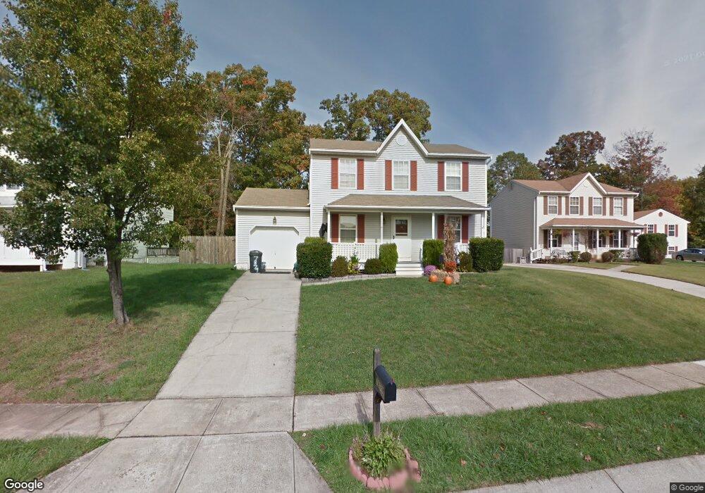
7879 Twin Ridge Dr Glen Burnie, MD 21061
Estimated Value: $400,719 - $488,000
--
Bed
2
Baths
1,785
Sq Ft
$247/Sq Ft
Est. Value
About This Home
This home is located at 7879 Twin Ridge Dr, Glen Burnie, MD 21061 and is currently estimated at $440,430, approximately $246 per square foot. 7879 Twin Ridge Dr is a home located in Anne Arundel County with nearby schools including Woodside Elementary School, Corkran Middle School, and Glen Burnie High School.
Ownership History
Date
Name
Owned For
Owner Type
Purchase Details
Closed on
Jun 29, 1992
Sold by
Davidson Development, Inc
Bought by
Spadaro Frank A and Spadaro Mary J
Current Estimated Value
Home Financials for this Owner
Home Financials are based on the most recent Mortgage that was taken out on this home.
Original Mortgage
$135,800
Interest Rate
8.43%
Purchase Details
Closed on
Jun 4, 1992
Sold by
Cattail Associates Inc
Bought by
Davidson Development, Inc
Home Financials for this Owner
Home Financials are based on the most recent Mortgage that was taken out on this home.
Original Mortgage
$135,800
Interest Rate
8.43%
Purchase Details
Closed on
Nov 25, 1991
Sold by
Wengert Melvin J
Bought by
Cattail Associates Inc
Home Financials for this Owner
Home Financials are based on the most recent Mortgage that was taken out on this home.
Original Mortgage
$250,000
Interest Rate
8.63%
Create a Home Valuation Report for This Property
The Home Valuation Report is an in-depth analysis detailing your home's value as well as a comparison with similar homes in the area
Home Values in the Area
Average Home Value in this Area
Purchase History
| Date | Buyer | Sale Price | Title Company |
|---|---|---|---|
| Spadaro Frank A | $150,900 | -- | |
| Davidson Development, Inc | $41,800 | -- | |
| Cattail Associates Inc | $255,900 | -- |
Source: Public Records
Mortgage History
| Date | Status | Borrower | Loan Amount |
|---|---|---|---|
| Closed | Spadaro Frank A | $135,800 | |
| Closed | Davidson Development, Inc | $318,000 | |
| Previous Owner | Cattail Associates Inc | $250,000 |
Source: Public Records
Tax History Compared to Growth
Tax History
| Year | Tax Paid | Tax Assessment Tax Assessment Total Assessment is a certain percentage of the fair market value that is determined by local assessors to be the total taxable value of land and additions on the property. | Land | Improvement |
|---|---|---|---|---|
| 2025 | $3,669 | $361,700 | $150,000 | $211,700 |
| 2024 | $3,669 | $336,833 | $0 | $0 |
| 2023 | $3,550 | $311,967 | $0 | $0 |
| 2022 | $3,297 | $287,100 | $120,000 | $167,100 |
| 2021 | $6,482 | $281,833 | $0 | $0 |
| 2020 | $3,146 | $276,567 | $0 | $0 |
| 2019 | $3,094 | $271,300 | $110,000 | $161,300 |
| 2018 | $2,653 | $261,600 | $0 | $0 |
| 2017 | $2,906 | $251,900 | $0 | $0 |
| 2016 | -- | $242,200 | $0 | $0 |
| 2015 | -- | $242,200 | $0 | $0 |
| 2014 | -- | $242,200 | $0 | $0 |
Source: Public Records
Map
Nearby Homes
- 180 Jessica Ln
- 8906 Jeff Mar Dr
- 8903 Jeff Mar Dr
- 338 White Oak Way
- 1731 Saunders Way
- 7808 Five Oaks Ct
- 221 Foxmanor Ln
- 220 Foxtree Dr
- 251 Oakview Village Dr
- 1702 Manning Rd
- 100 Sandsbury Ave
- 405 Morningside Dr
- 1612 Lorimer Rd
- 7818 Oakwood Rd
- 7911 Ritchie Hwy
- 7992 Foxchase Ln
- 306 Woodleaf Ct
- 206 Sandsbury Ave
- 7959 Pipers Path
- 90 Foxchase Ct
- 7875 Twin Ridge Dr
- 7883 Twin Ridge Dr
- 1906 Ridgewick Rd
- 1908 Ridgewick Rd
- 7873 Twin Ridge Dr
- 7885 Twin Ridge Dr
- 7878 Twin Ridge Dr
- 7880 Twin Ridge Dr
- 7876 Twin Ridge Dr
- 1904 Ridgewick Rd
- 7874 Twin Ridge Dr
- 1910 Ridgewick Rd
- 7871 Twin Ridge Dr
- 7882 Twin Ridge Dr
- 7884 Twin Ridge Dr
- 7888 Twin Ridge Dr
- 7869 Twin Ridge Dr
- 7886 Twin Ridge Dr
- 7887 Twin Ridge Dr
- 1902 Ridgewick Rd