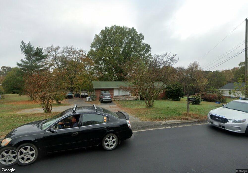
789 Kannapolis Pkwy Concord, NC 28027
Estimated Value: $254,272 - $577,000
3
Beds
1
Bath
1,080
Sq Ft
$438/Sq Ft
Est. Value
About This Home
This home is located at 789 Kannapolis Pkwy, Concord, NC 28027 and is currently estimated at $473,068, approximately $438 per square foot. 789 Kannapolis Pkwy is a home located in Cabarrus County with nearby schools including Charles E. Boger Elementary School, Northwest Cabarrus Middle School, and Northwest Cabarrus High.
Ownership History
Date
Name
Owned For
Owner Type
Purchase Details
Closed on
Sep 10, 2024
Sold by
Tucker Glen Azore and Tucker Elizabeth L
Bought by
789 Kannapolis Pkwy Llc
Current Estimated Value
Purchase Details
Closed on
Apr 22, 2022
Sold by
Robinson John Calvin
Bought by
Tucker Glen A and Tucker Eric G
Home Financials for this Owner
Home Financials are based on the most recent Mortgage that was taken out on this home.
Original Mortgage
$800,000
Interest Rate
4.16%
Mortgage Type
New Conventional
Purchase Details
Closed on
Jun 1, 1979
Create a Home Valuation Report for This Property
The Home Valuation Report is an in-depth analysis detailing your home's value as well as a comparison with similar homes in the area
Home Values in the Area
Average Home Value in this Area
Purchase History
| Date | Buyer | Sale Price | Title Company |
|---|---|---|---|
| 789 Kannapolis Pkwy Llc | -- | None Listed On Document | |
| 789 Kannapolis Pkwy Llc | -- | None Listed On Document | |
| Tucker Glen A | -- | -- | |
| Tucker Glen A | -- | None Listed On Document | |
| Tucker Glen A | $510,000 | Critz Robert M | |
| -- | $32,000 | -- |
Source: Public Records
Mortgage History
| Date | Status | Borrower | Loan Amount |
|---|---|---|---|
| Previous Owner | Tucker Glen A | $800,000 |
Source: Public Records
Tax History Compared to Growth
Tax History
| Year | Tax Paid | Tax Assessment Tax Assessment Total Assessment is a certain percentage of the fair market value that is determined by local assessors to be the total taxable value of land and additions on the property. | Land | Improvement |
|---|---|---|---|---|
| 2025 | $2,579 | $227,150 | $88,690 | $138,460 |
| 2024 | $2,579 | $227,150 | $88,690 | $138,460 |
| 2023 | $1,915 | $139,760 | $63,350 | $76,410 |
| 2022 | $1,906 | $139,120 | $63,500 | $75,620 |
| 2021 | $1,906 | $139,120 | $63,500 | $75,620 |
| 2020 | $1,906 | $139,120 | $63,500 | $75,620 |
| 2019 | $1,676 | $122,340 | $57,150 | $65,190 |
| 2018 | $1,652 | $122,340 | $57,150 | $65,190 |
| 2017 | $1,627 | $122,340 | $57,150 | $65,190 |
| 2016 | -- | $148,580 | $104,380 | $44,200 |
| 2015 | $1,872 | $148,580 | $104,380 | $44,200 |
| 2014 | $1,872 | $148,580 | $104,380 | $44,200 |
Source: Public Records
Map
Nearby Homes
- 648 Kannapolis Pkwy
- 439 Beacon St NW
- 5505 Yorke St NW
- 5554 Village Dr NW
- 75 Mccurdy St NW Unit 75
- 6106 Old Macedonia Ct
- 4946 Grand Canyon Rd NW
- 5461 Ives St NW
- 6115 Village Dr NW
- 6762 Davidson Hwy
- 6755 Davidson Hwy
- 6119 Village Dr NW
- 5618 Burck Dr NW
- 5185 Grand Canyon Rd NW
- 2100 Black Forest Cove
- 4909 Charmwood Ct NW
- 7335 Davidson Hwy
- 6525 Derby Ln NW
- 1132 Rustic Ln NW
- 4329 Hunton Dale Rd NW
- 815 Kannapolis Pkwy
- 763 Kannapolis Pkwy
- 745 Kannapolis Pkwy
- 843 Kannapolis Pkwy
- 715 Kannapolis Pkwy
- 760 Kannapolis Pkwy
- 5971 Navajo Trail
- 6000 Navajo Trail
- 6420 Fingerlake Dr
- 6500 Finger Lake Dr
- 740 Kannapolis Pkwy
- 6500 Fingerlake Dr
- 5941 Navajo Trail
- 5941 Navajo Trail Unit 23
- 885 Kannapolis Pkwy
- 820 Kannapolis Pkwy
- 6405 Finger Lake Dr
- 6425 Fingerlake Dr
- 6405 Fingerlake Dr
- 6655 Fingerlake Dr