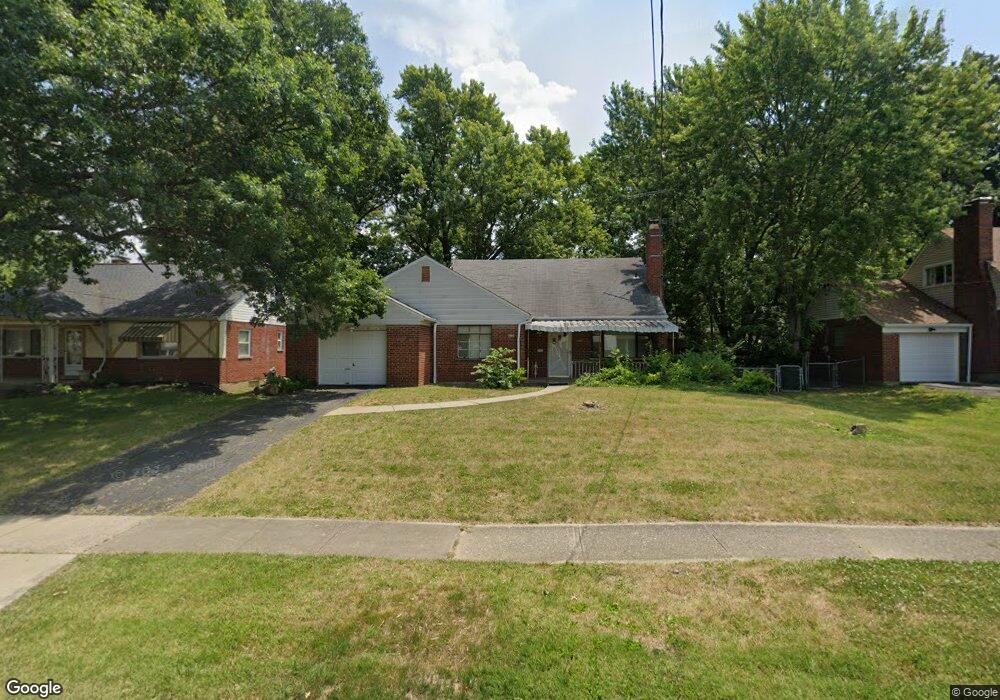
7890 Bobolink Dr Cincinnati, OH 45224
College Hill NeighborhoodEstimated Value: $200,962 - $233,000
3
Beds
1
Bath
1,145
Sq Ft
$187/Sq Ft
Est. Value
About This Home
This home is located at 7890 Bobolink Dr, Cincinnati, OH 45224 and is currently estimated at $213,741, approximately $186 per square foot. 7890 Bobolink Dr is a home located in Hamilton County with nearby schools including Pleasant Hill Elementary School, Western Hills High School, and Gilbert A. Dater High School.
Ownership History
Date
Name
Owned For
Owner Type
Purchase Details
Closed on
Sep 30, 2013
Sold by
Geppert Moran Mary Alice and Moran John Francis
Bought by
Geppert Andrew
Current Estimated Value
Purchase Details
Closed on
Oct 25, 2006
Sold by
Geppert Mary Alice and Geppert Moran Mary Alice
Bought by
Moran John Francis and Geppert Moran Mary Alice
Home Financials for this Owner
Home Financials are based on the most recent Mortgage that was taken out on this home.
Original Mortgage
$60,000
Interest Rate
6.36%
Mortgage Type
New Conventional
Create a Home Valuation Report for This Property
The Home Valuation Report is an in-depth analysis detailing your home's value as well as a comparison with similar homes in the area
Home Values in the Area
Average Home Value in this Area
Purchase History
| Date | Buyer | Sale Price | Title Company |
|---|---|---|---|
| Geppert Andrew | -- | Attorney | |
| Moran John Francis | -- | Transnation Title Ins Co |
Source: Public Records
Mortgage History
| Date | Status | Borrower | Loan Amount |
|---|---|---|---|
| Closed | Moran John Francis | $60,000 |
Source: Public Records
Tax History Compared to Growth
Tax History
| Year | Tax Paid | Tax Assessment Tax Assessment Total Assessment is a certain percentage of the fair market value that is determined by local assessors to be the total taxable value of land and additions on the property. | Land | Improvement |
|---|---|---|---|---|
| 2024 | $2,801 | $43,967 | $12,964 | $31,003 |
| 2023 | $2,806 | $43,967 | $12,964 | $31,003 |
| 2022 | $2,181 | $30,643 | $10,556 | $20,087 |
| 2021 | $2,137 | $30,643 | $10,556 | $20,087 |
| 2020 | $2,144 | $30,643 | $10,556 | $20,087 |
| 2019 | $2,065 | $26,880 | $9,261 | $17,619 |
| 2018 | $2,067 | $26,880 | $9,261 | $17,619 |
| 2017 | $1,990 | $26,880 | $9,261 | $17,619 |
| 2016 | $1,386 | $18,200 | $9,884 | $8,316 |
| 2015 | $1,240 | $18,200 | $9,884 | $8,316 |
| 2014 | $1,246 | $18,200 | $9,884 | $8,316 |
| 2013 | $1,932 | $27,854 | $10,189 | $17,665 |
Source: Public Records
Map
Nearby Homes
- 7923 Bobolink Dr
- 1280 Brushwood Ave
- 7929 Cherrywood Ct
- 6596 S Oak Knoll Dr
- 6586 S Oak Knoll Dr
- 6538 S Oak Knoll Dr
- 6765 Richard Ave
- 1148 Hollywood Ave
- 1140 Hollywood Ave
- 6642 Plantation Way
- 6785 Marvin Ave
- 6832 Tarawa Dr
- 1544 W Galbraith Rd
- 1063 Roxie Ln
- 1533 Corcoran Place
- 1346 Wittekind Terrace
- 1406 Wittekind Terrace
- 1025 Eastgate Dr
- 1562 Oak Knoll Dr
- 8579 Daly Rd
- 7886 Bobolink Dr
- 7896 Bobolink Dr
- 7863 Knollwood Ln
- 7839 Knollwood Ln
- 7887 Knollwood Ln
- 7880 Bobolink Dr
- 7904 Bobolink Dr
- 7897 Bobolink Dr
- 7889 Bobolink Dr
- 7874 Bobolink Dr
- 7791 Knollwood Ln
- 7885 Bobolink Dr
- 7901 Knollwood Ln
- 7879 Bobolink Dr
- 7936 Bobolink Dr
- 7868 Bobolink Dr
- 7767 Knollwood Ln
- 7901 Bobolink Dr
- 7911 Knollwood Ln
- 7873 Bobolink Dr