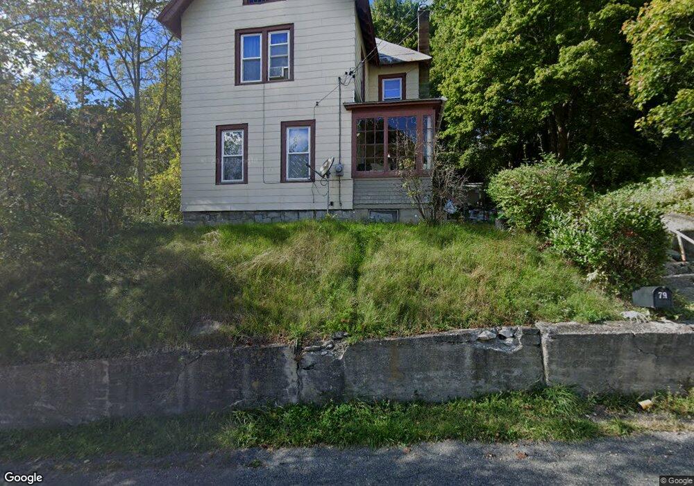
79 Cliff St North Adams, MA 01247
Estimated Value: $195,000 - $240,000
3
Beds
1
Bath
1,518
Sq Ft
$139/Sq Ft
Est. Value
About This Home
This home is located at 79 Cliff St, North Adams, MA 01247 and is currently estimated at $210,805, approximately $138 per square foot. 79 Cliff St is a home located in Berkshire County with nearby schools including Colegrove Park Elementary School and Drury High School.
Ownership History
Date
Name
Owned For
Owner Type
Purchase Details
Closed on
Oct 16, 2002
Sold by
Morris John T
Bought by
Morgan Daniel W and Morgan Jennifer L
Current Estimated Value
Home Financials for this Owner
Home Financials are based on the most recent Mortgage that was taken out on this home.
Original Mortgage
$65,500
Outstanding Balance
$27,500
Interest Rate
6.18%
Mortgage Type
Purchase Money Mortgage
Estimated Equity
$183,305
Purchase Details
Closed on
Oct 31, 1991
Sold by
Gagne Michael R and Gagne Kathryn L
Bought by
Morris John T and Morris Lori A
Home Financials for this Owner
Home Financials are based on the most recent Mortgage that was taken out on this home.
Original Mortgage
$55,629
Interest Rate
8.9%
Mortgage Type
Purchase Money Mortgage
Create a Home Valuation Report for This Property
The Home Valuation Report is an in-depth analysis detailing your home's value as well as a comparison with similar homes in the area
Home Values in the Area
Average Home Value in this Area
Purchase History
| Date | Buyer | Sale Price | Title Company |
|---|---|---|---|
| Morgan Daniel W | $69,000 | -- | |
| Morris John T | $55,250 | -- | |
| Morgan Daniel W | $69,000 | -- | |
| Morris John T | $55,250 | -- |
Source: Public Records
Mortgage History
| Date | Status | Borrower | Loan Amount |
|---|---|---|---|
| Open | Morris John T | $65,500 | |
| Closed | Morris John T | $65,500 | |
| Previous Owner | Morris John T | $58,000 | |
| Previous Owner | Morris John T | $55,629 |
Source: Public Records
Tax History Compared to Growth
Tax History
| Year | Tax Paid | Tax Assessment Tax Assessment Total Assessment is a certain percentage of the fair market value that is determined by local assessors to be the total taxable value of land and additions on the property. | Land | Improvement |
|---|---|---|---|---|
| 2025 | $2,501 | $149,700 | $23,600 | $126,100 |
| 2024 | $2,348 | $137,000 | $21,600 | $115,400 |
| 2023 | $2,244 | $127,000 | $21,600 | $105,400 |
| 2022 | $2,029 | $109,500 | $21,600 | $87,900 |
| 2021 | $1,885 | $101,300 | $20,000 | $81,300 |
| 2020 | $3,851 | $101,500 | $21,200 | $80,300 |
| 2019 | $3,462 | $97,900 | $21,200 | $76,700 |
| 2018 | $2,369 | $97,500 | $22,300 | $75,200 |
| 2017 | $1,707 | $96,600 | $22,100 | $74,500 |
| 2016 | $1,656 | $95,200 | $22,100 | $73,100 |
| 2015 | $1,591 | $95,300 | $22,800 | $72,500 |
Source: Public Records
Map
Nearby Homes
- 306 Union St
- 50 Gallup St
- 23-27 Gallup St
- 35 Jackson St
- 33 Hudson St
- 38 Wesleyan St
- 20 Wesleyan St
- 159 Eagle St
- 24 Franklin St
- 129-133 Franklin St
- 33-35 Hall St
- 22 Marietta St
- 194 E Main St
- 67 Cherry St
- 54 Marietta St
- 66-68 Bracewell Ave
- 19 N Church St Unit 11
- 19 N Church St Unit 14
- 19 N Church St Unit 12
- 19 N Church St Unit 7
- 85 Cliff St
- 73 Cliff St
- 91 Cliff St
- 86 Cliff St
- 86 Cliff St Unit Cliff Street Apt 1
- 86 Cliff St Unit 2
- 99 Cliff St Unit 101
- 78 Cliff St Unit 80
- 57 Montgomery St
- 70 Cliff St Unit 72
- 55 Beacon St
- 100 Cliff St
- 53 Montgomery St
- 121 Cliff St
- 63 Montgomery St
- 66 Cliff St
- 107 Cliff St Unit 109
- 47 Beacon St
- 60 Cliff St
- 60 Cliff St Unit A