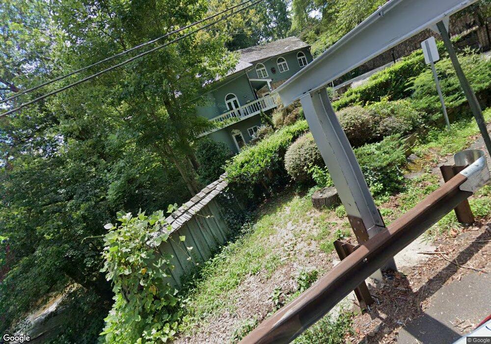
79 Concord Rd SW Smyrna, GA 30082
Estimated Value: $583,000 - $696,000
4
Beds
6
Baths
3,140
Sq Ft
$209/Sq Ft
Est. Value
About This Home
This home is located at 79 Concord Rd SW, Smyrna, GA 30082 and is currently estimated at $656,982, approximately $209 per square foot. 79 Concord Rd SW is a home located in Cobb County with nearby schools including Russell Elementary School, Floyd Middle School, and Covered Bridge Academy.
Ownership History
Date
Name
Owned For
Owner Type
Purchase Details
Closed on
Apr 14, 2004
Sold by
Crookston Thomas R
Bought by
Leidigh Laura F
Current Estimated Value
Home Financials for this Owner
Home Financials are based on the most recent Mortgage that was taken out on this home.
Original Mortgage
$268,000
Outstanding Balance
$124,110
Interest Rate
5.54%
Mortgage Type
New Conventional
Estimated Equity
$532,872
Purchase Details
Closed on
Jun 30, 1993
Sold by
Resolution Trust Corp
Bought by
Crookston Thomas R and Laughinghouse Patricia E
Home Financials for this Owner
Home Financials are based on the most recent Mortgage that was taken out on this home.
Original Mortgage
$163,800
Interest Rate
4.75%
Create a Home Valuation Report for This Property
The Home Valuation Report is an in-depth analysis detailing your home's value as well as a comparison with similar homes in the area
Home Values in the Area
Average Home Value in this Area
Purchase History
| Date | Buyer | Sale Price | Title Company |
|---|---|---|---|
| Leidigh Laura F | $335,000 | -- | |
| Crookston Thomas R | -- | -- |
Source: Public Records
Mortgage History
| Date | Status | Borrower | Loan Amount |
|---|---|---|---|
| Open | Leidigh Laura F | $268,000 | |
| Previous Owner | Crookston Thomas R | $163,800 |
Source: Public Records
Tax History Compared to Growth
Tax History
| Year | Tax Paid | Tax Assessment Tax Assessment Total Assessment is a certain percentage of the fair market value that is determined by local assessors to be the total taxable value of land and additions on the property. | Land | Improvement |
|---|---|---|---|---|
| 2025 | $2,019 | $199,520 | $52,920 | $146,600 |
| 2024 | $2,023 | $199,520 | $52,920 | $146,600 |
| 2023 | $1,817 | $199,520 | $52,920 | $146,600 |
| 2022 | $1,874 | $171,020 | $45,360 | $125,660 |
| 2021 | $1,673 | $153,544 | $32,760 | $120,784 |
| 2020 | $1,673 | $153,544 | $32,760 | $120,784 |
| 2019 | $1,966 | $180,588 | $46,800 | $133,788 |
| 2018 | $1,636 | $150,256 | $25,200 | $125,056 |
| 2017 | $1,412 | $150,256 | $25,200 | $125,056 |
| 2016 | $1,316 | $140,404 | $21,600 | $118,804 |
| 2015 | $1,391 | $138,456 | $21,600 | $116,856 |
| 2014 | $1,423 | $138,456 | $0 | $0 |
Source: Public Records
Map
Nearby Homes
- 188 Covered Bridge Trail SW
- 4800 Timberland Dr SW
- 4094 Norton Place SE
- 2508 Haddenham Ln SW
- 51 Queen Anne Dr SE
- 35 Dunaire Ct SW
- 4025 Benell Ct SE
- 4066 Covered Bridge Rd SW
- 221 Shady Ln SW
- 1375 Mosswood Ln SE
- 5020 Hickory Mill Dr SE
- 450 Dorset Way SW
- 321 Covered Bridge Place SW
- 620 Gregory Manor Dr SW
- 4246 Antler Trail SE
- 347 Covered Bridge Place SW
- 63 Geraldine Dr SE
- 4135 Fawn Ln SE
- 175 Covered Bridge Dr SW
- 10 Concord Rd SW
- 20 Concord Rd SW
- 4330 Covered Bridge Rd SW
- 100 Covered Bridge Dr SW
- 177 Covered Bridge Dr SW
- 161 Covered Bridge Dr SW
- 179 Covered Bridge Dr SW
- 0 Covered Bridge Trail Unit 8069645
- 0 Covered Bridge Trail Unit 8049856
- 0 Covered Bridge Trail Unit 8044068
- 0 Covered Bridge Trail Unit 7629741
- 0 Covered Bridge Trail Unit 7471915
- 0 Covered Bridge Trail Unit 8503192
- 0 Covered Bridge Trail Unit 7024593
- 0 Covered Bridge Trail Unit 8953504
- 0 Covered Bridge Trail Unit 8977332
- 0 Covered Bridge Trail Unit 3120652
- 0 Covered Bridge Trail Unit 3247926
- 0 Covered Bridge Dr Unit 4126786