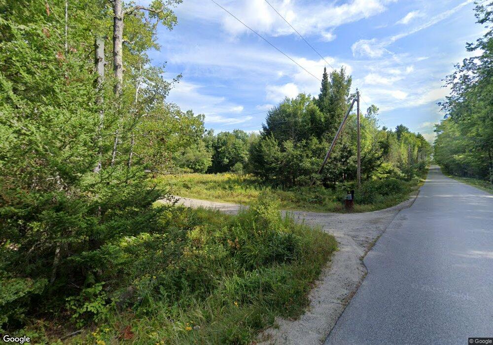
79 Foss Rd Limerick, ME 04048
Estimated Value: $487,000 - $546,515
Studio
--
Bath
1,372
Sq Ft
$372/Sq Ft
Est. Value
About This Home
This home is located at 79 Foss Rd, Limerick, ME 04048 and is currently estimated at $510,838, approximately $372 per square foot. 79 Foss Rd is a home with nearby schools including Massabesic High School.
Ownership History
Date
Name
Owned For
Owner Type
Purchase Details
Closed on
Sep 19, 2024
Sold by
Frank Timothy J
Bought by
Frank Timothy J and Heseltine Melissa
Current Estimated Value
Home Financials for this Owner
Home Financials are based on the most recent Mortgage that was taken out on this home.
Original Mortgage
$50,000
Outstanding Balance
$49,341
Interest Rate
6.47%
Mortgage Type
Purchase Money Mortgage
Estimated Equity
$461,497
Purchase Details
Closed on
May 22, 2017
Sold by
Frank John D and Frank Christine L
Bought by
Frank Timothy J
Home Financials for this Owner
Home Financials are based on the most recent Mortgage that was taken out on this home.
Original Mortgage
$204,750
Interest Rate
4.1%
Mortgage Type
Commercial
Create a Home Valuation Report for This Property
The Home Valuation Report is an in-depth analysis detailing your home's value as well as a comparison with similar homes in the area
Home Values in the Area
Average Home Value in this Area
Purchase History
| Date | Buyer | Sale Price | Title Company |
|---|---|---|---|
| Frank Timothy J | -- | None Available | |
| Frank Timothy J | -- | None Available | |
| Frank Timothy J | -- | -- | |
| Frank Timothy J | -- | -- | |
| Frank Timothy J | -- | -- |
Source: Public Records
Mortgage History
| Date | Status | Borrower | Loan Amount |
|---|---|---|---|
| Open | Frank Timothy J | $50,000 | |
| Closed | Frank Timothy J | $50,000 | |
| Previous Owner | Frank Timothy J | $204,750 |
Source: Public Records
Tax History
| Year | Tax Paid | Tax Assessment Tax Assessment Total Assessment is a certain percentage of the fair market value that is determined by local assessors to be the total taxable value of land and additions on the property. | Land | Improvement |
|---|---|---|---|---|
| 2025 | $4,796 | $504,893 | $164,010 | $340,883 |
| 2024 | $4,796 | $504,893 | $164,010 | $340,883 |
| 2023 | $5,525 | $363,495 | $101,175 | $262,320 |
| 2022 | $5,162 | $363,495 | $101,175 | $262,320 |
| 2021 | $4,827 | $290,796 | $80,940 | $209,856 |
| 2020 | $4,769 | $290,796 | $80,940 | $209,856 |
| 2019 | $4,580 | $290,796 | $80,940 | $209,856 |
| 2018 | $4,696 | $290,796 | $80,940 | $209,856 |
| 2017 | $4,580 | $290,796 | $80,940 | $209,856 |
| 2016 | $4,376 | $290,796 | $80,940 | $209,856 |
| 2015 | $4,246 | $290,796 | $80,940 | $209,856 |
| 2014 | $4,115 | $290,796 | $80,940 | $209,856 |
Source: Public Records
Map
Nearby Homes
- TBD Sokokis Trail & Beaver Brook Rd
- 50 Island Rd
- 0 Island Rd Unit 1643509
- 240 Leisure Ln
- 4 Deer Crossing Rd
- 33 Arrowhead Ln
- 68 Lone Pine Rd
- 545 Foss Rd
- 3 Division Dr
- 92 Silver Ln
- LOT# 8 Business Park Rd
- Lot# 11 Business Park Rd
- 13 Quaker Ln
- 48 King Hill Rd
- 59 Crescent Dr
- 17 High Point Cir
- 515 Range East Rd
- 6 Moose Dr
- 0 Quarry Rd
- 60 Sequoia Ln
Your Personal Tour Guide
Ask me questions while you tour the home.
