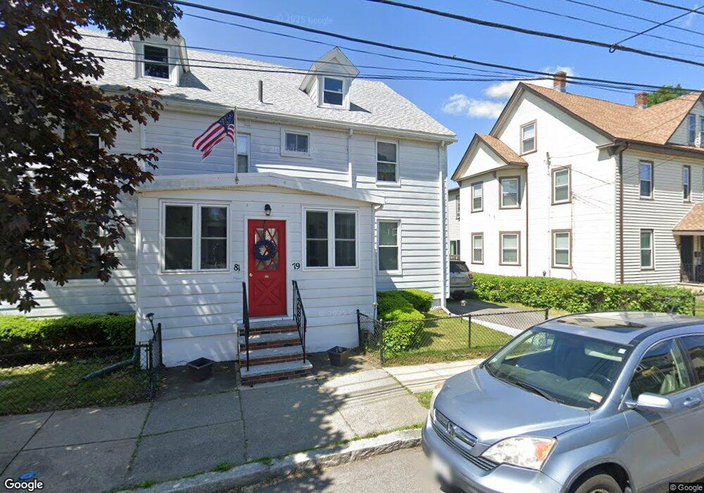
79 Fremont St Unit 81 Winthrop, MA 02152
Downtown Winthrop NeighborhoodEstimated Value: $875,000 - $1,017,347
8
Beds
3
Baths
3,648
Sq Ft
$263/Sq Ft
Est. Value
About This Home
This home is located at 79 Fremont St Unit 81, Winthrop, MA 02152 and is currently estimated at $959,837, approximately $263 per square foot. 79 Fremont St Unit 81 is a home located in Suffolk County with nearby schools including William P. Gorman/Fort Banks Elementary School, Arthur T. Cummings Elementary School, and Winthrop Middle School.
Ownership History
Date
Name
Owned For
Owner Type
Purchase Details
Closed on
Aug 28, 2003
Sold by
Meiggs John E and Meiggs Virginia C
Bought by
Maumann Stephen D and Maumann Kristina L
Current Estimated Value
Home Financials for this Owner
Home Financials are based on the most recent Mortgage that was taken out on this home.
Original Mortgage
$346,880
Interest Rate
5.69%
Mortgage Type
Purchase Money Mortgage
Create a Home Valuation Report for This Property
The Home Valuation Report is an in-depth analysis detailing your home's value as well as a comparison with similar homes in the area
Home Values in the Area
Average Home Value in this Area
Purchase History
| Date | Buyer | Sale Price | Title Company |
|---|---|---|---|
| Maumann Stephen D | $433,600 | -- | |
| Maumann Stephen D | $433,600 | -- |
Source: Public Records
Mortgage History
| Date | Status | Borrower | Loan Amount |
|---|---|---|---|
| Previous Owner | Maumann Stephen D | $15,000 | |
| Previous Owner | Maumann Stephen D | $346,880 |
Source: Public Records
Tax History Compared to Growth
Tax History
| Year | Tax Paid | Tax Assessment Tax Assessment Total Assessment is a certain percentage of the fair market value that is determined by local assessors to be the total taxable value of land and additions on the property. | Land | Improvement |
|---|---|---|---|---|
| 2025 | $8,842 | $856,800 | $363,300 | $493,500 |
| 2024 | $7,825 | $751,000 | $349,200 | $401,800 |
| 2023 | $8,595 | $803,300 | $319,600 | $483,700 |
| 2022 | $8,471 | $720,300 | $285,200 | $435,100 |
| 2021 | $8,299 | $654,500 | $254,600 | $399,900 |
| 2020 | $8,089 | $641,000 | $254,600 | $386,400 |
| 2019 | $7,973 | $604,900 | $234,700 | $370,200 |
| 2018 | $7,788 | $550,000 | $201,400 | $348,600 |
| 2017 | $7,124 | $494,400 | $178,300 | $316,100 |
| 2016 | $6,784 | $441,400 | $155,000 | $286,400 |
| 2015 | $6,033 | $420,700 | $150,500 | $270,200 |
| 2014 | $5,843 | $375,000 | $140,000 | $235,000 |
Source: Public Records
Map
Nearby Homes
- 174 Winthrop St Unit 2
- 34 Fremont St
- 3 Buckthorn Terrace Unit 2
- 10 Somerset Ave Unit 405
- 10 Somerset Ave Unit 403
- 10 Somerset Ave Unit 404
- 10 Somerset Ave Unit 408
- 10 Somerset Ave Unit 201
- 10 Somerset Ave Unit 211
- 10 Somerset Ave Unit 206
- 142 Pleasant St Unit 12
- 142 Pleasant St Unit 2
- 35 Somerset Ave Unit 6
- 28 Thornton Park
- 87 Hermon St
- 92 Plummer Ave
- 220 Woodside Ave Unit 1
- 170 Cottage Park Rd
- 47 Bellevue Ave
- 191 Cottage Park Rd
- 81 Fremont St
- 69 Fremont St Unit 71
- 69 Fremont St Unit na
- 85 Fremont St
- 89 Fremont St
- 76 Fremont St
- 76 Fremont St Unit 3
- 76 Fremont St Unit 1
- 76 Fremont St Unit 2
- 72 Fremont St
- 82 Fremont St
- 16 Putnam Place
- 18 Putnam Place
- 2 Putnam Place
- 24 Putnam Place
- 22 Putnam Place
- 91 Fremont St
- 68 Fremont St
- 68 Fremont St Unit 1
- 12 Putnam Place