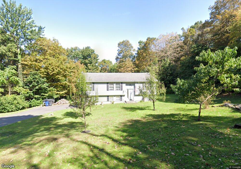
79 Gilbert Rd Stafford Springs, CT 06076
Stafford NeighborhoodEstimated Value: $394,512 - $440,000
3
Beds
2
Baths
1,338
Sq Ft
$311/Sq Ft
Est. Value
About This Home
This home is located at 79 Gilbert Rd, Stafford Springs, CT 06076 and is currently estimated at $416,128, approximately $311 per square foot. 79 Gilbert Rd is a home located in Tolland County with nearby schools including Stafford Elementary School, Stafford Middle School, and Stafford High School.
Ownership History
Date
Name
Owned For
Owner Type
Purchase Details
Closed on
Jul 1, 2003
Sold by
Block Prop Llc
Bought by
Wearne Charles and Wearne Rebecca
Current Estimated Value
Purchase Details
Closed on
Jan 27, 2003
Sold by
Notman Robert
Bought by
Block Prop Lic
Create a Home Valuation Report for This Property
The Home Valuation Report is an in-depth analysis detailing your home's value as well as a comparison with similar homes in the area
Home Values in the Area
Average Home Value in this Area
Purchase History
| Date | Buyer | Sale Price | Title Company |
|---|---|---|---|
| Wearne Charles | $186,000 | -- | |
| Block Prop Lic | $40,000 | -- |
Source: Public Records
Mortgage History
| Date | Status | Borrower | Loan Amount |
|---|---|---|---|
| Open | Block Prop Lic | $241,350 | |
| Closed | Block Prop Lic | $251,700 | |
| Closed | Block Prop Lic | $247,600 |
Source: Public Records
Tax History Compared to Growth
Tax History
| Year | Tax Paid | Tax Assessment Tax Assessment Total Assessment is a certain percentage of the fair market value that is determined by local assessors to be the total taxable value of land and additions on the property. | Land | Improvement |
|---|---|---|---|---|
| 2025 | $8,960 | $151,550 | $37,590 | $113,960 |
| 2024 | $5,848 | $151,550 | $37,590 | $113,960 |
| 2023 | $5,571 | $151,550 | $37,590 | $113,960 |
| 2022 | $5,422 | $151,550 | $37,590 | $113,960 |
| 2021 | $5,294 | $151,550 | $37,590 | $113,960 |
| 2020 | $4,900 | $140,280 | $39,690 | $100,590 |
| 2019 | $4,900 | $140,280 | $39,690 | $100,590 |
| 2018 | $4,806 | $140,280 | $39,690 | $100,590 |
| 2017 | $4,760 | $140,280 | $39,690 | $100,590 |
| 2016 | $4,701 | $140,280 | $39,690 | $100,590 |
| 2015 | $4,793 | $143,640 | $39,690 | $103,950 |
| 2014 | $4,744 | $143,640 | $39,690 | $103,950 |
Source: Public Records
Map
Nearby Homes
- 58 Rocky Dundee Rd
- 8 S Ridge Rd
- 12 & 16 Haas Rd
- Lot 2R &3 Chapin Rd
- 59 St Germain Rd
- Lot D South Rd
- 190 Root Rd
- 179 Chapin Rd
- 63 Rose Haven Rd
- 169 Stafford Rd
- 17 Long Hill Dr
- 200 Hampden Rd
- 175 Stafford Rd
- 49 Franklin Woods Dr
- 64 Potash Hill Ln
- 369 Turnpike Rd
- 41 Martin Farms Rd
- 64 Bradfield Dr
- 201 Diamond Ledge Rd
- 319 Main St
- 75 Gilbert Rd
- 86 Gilbert Rd
- 82 Gilbert Rd
- 31 Rocky Dundee Rd
- 28 Rocky Dundee Rd
- 00 Rocky Dundee Rd
- 77 Gilbert Rd
- 78 Gilbert Rd
- 73 Gilbert Rd
- 76 Gilbert Rd
- 27 Rocky Dundee Rd
- 71 Gilbert Rd
- 2 Upper Hampden Rd
- 63 Rocky Dundee Rd
- 65 Gilbert Rd
- 74 Gilbert Rd
- 16 Rocky Dundee Rd
- 69 Gilbert Rd
- 123 Rocky Dundee Rd
- 3 Upper Hampden Rd