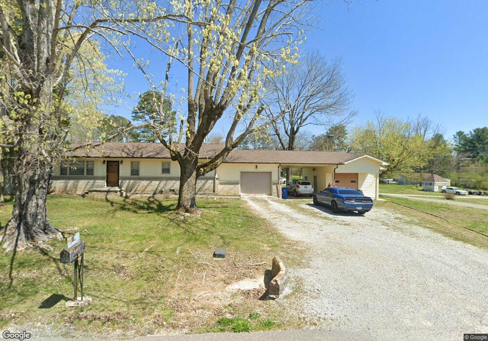
79 Swing Away Dr Manchester, TN 37355
Estimated Value: $181,188 - $262,000
--
Bed
1
Bath
1,333
Sq Ft
$170/Sq Ft
Est. Value
About This Home
This home is located at 79 Swing Away Dr, Manchester, TN 37355 and is currently estimated at $226,547, approximately $169 per square foot. 79 Swing Away Dr is a home located in Coffee County with nearby schools including Westwood Middle School and Temple Baptist Christian School.
Ownership History
Date
Name
Owned For
Owner Type
Purchase Details
Closed on
Jul 28, 2011
Sold by
Carroll Robert G
Bought by
York Keith D and York Janice M
Current Estimated Value
Home Financials for this Owner
Home Financials are based on the most recent Mortgage that was taken out on this home.
Original Mortgage
$55,000
Outstanding Balance
$38,010
Interest Rate
4.53%
Mortgage Type
New Conventional
Estimated Equity
$188,537
Purchase Details
Closed on
Nov 12, 1997
Sold by
Ewing Carroll Dixie
Bought by
Carroll Robert G
Create a Home Valuation Report for This Property
The Home Valuation Report is an in-depth analysis detailing your home's value as well as a comparison with similar homes in the area
Home Values in the Area
Average Home Value in this Area
Purchase History
| Date | Buyer | Sale Price | Title Company |
|---|---|---|---|
| York Keith D | $55,000 | -- | |
| Carroll Robert G | $60,560 | -- |
Source: Public Records
Mortgage History
| Date | Status | Borrower | Loan Amount |
|---|---|---|---|
| Open | York Keith D | $55,000 |
Source: Public Records
Tax History Compared to Growth
Tax History
| Year | Tax Paid | Tax Assessment Tax Assessment Total Assessment is a certain percentage of the fair market value that is determined by local assessors to be the total taxable value of land and additions on the property. | Land | Improvement |
|---|---|---|---|---|
| 2024 | $1,124 | $26,675 | $2,650 | $24,025 |
| 2023 | $1,124 | $26,675 | $0 | $0 |
| 2022 | $968 | $26,675 | $2,650 | $24,025 |
| 2021 | $778 | $17,000 | $1,800 | $15,200 |
| 2020 | $778 | $17,000 | $1,800 | $15,200 |
| 2019 | $778 | $17,000 | $1,800 | $15,200 |
| 2018 | $778 | $17,000 | $1,800 | $15,200 |
| 2017 | $814 | $15,525 | $2,825 | $12,700 |
| 2016 | $814 | $15,525 | $2,825 | $12,700 |
| 2015 | $814 | $15,525 | $2,825 | $12,700 |
| 2014 | $814 | $15,525 | $0 | $0 |
Source: Public Records
Map
Nearby Homes
- 775 Ragsdale Rd
- 627 Ragsdale Rd
- 215 Wellington Dr
- 1395 Ragsdale Rd
- 1292 McMinnville Hwy
- 793 Old Bushy Branch Rd
- 416 Powers Rd
- 304 W Lynn Dr
- 31 Stonehenge Ln S
- 54 Stonehenge Ln E
- 107 Grace Ct
- 76 Stonehenge Ln N
- 58 Stonehenge Ln
- 1989 Elevation JKL Plan at Stonehenge
- 1726 Elevation JKL Plan at Stonehenge
- 1824 Elevation JKL Plan at Stonehenge
- 1258 Stonehenge Plan at Stonehenge
- 2073 Elevation JKL Plan at Stonehenge
- 1624 Elevation JKL Plan at Stonehenge
- Henry Plan at Stonehenge
- 39 Teakwood Dr
- 51 Swing Away Dr
- 119 Swing Away Dr
- 59 Teakwood Dr
- 58 Teakwood Dr
- 848 Ragsdale Rd
- 870 Ragsdale Rd
- 0 Circle Ave
- 900 Ragsdale Rd
- 69 Kettrell St
- 80 Circle Ave
- 768 Ragsdale Rd
- 55 Kettrell St
- 167 Swing Away Dr
- 815 Ragsdale Rd
- 142 Circle Ave
- 916 Ragsdale Rd
- 881 Ragsdale Rd
- 17 Kettrell St
- 157 Swing Away Dr