
Seller's Agent in 2026
Robin O'donnell
Keller Williams Realty Evolution
(978) 979-1842
1 in this area
44 Total Sales
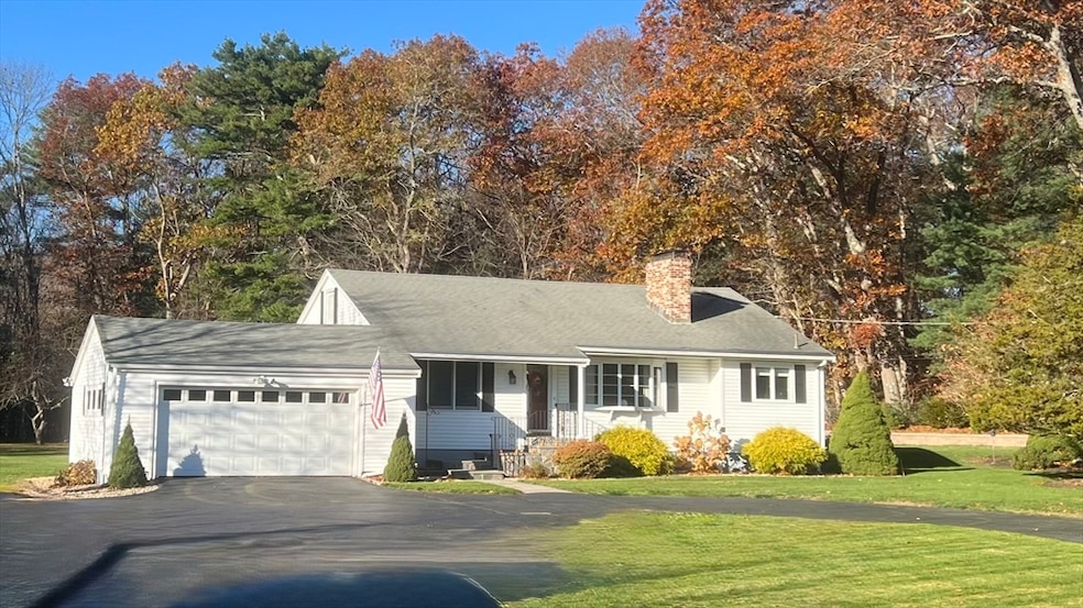
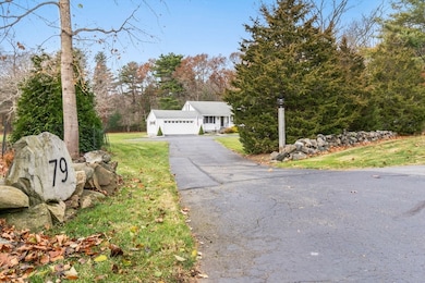
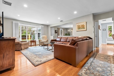
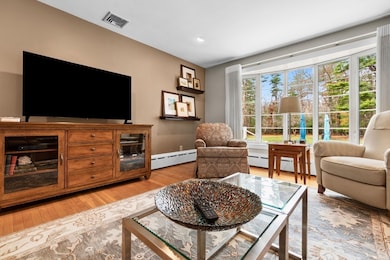
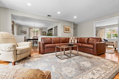
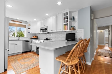
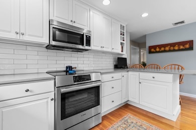
Showings by appointment only. Are you looking for easy one floor living? Look no more! This 2 bedroom home has been lovingly maintained with many updates on both the interior and exterior. The property has a new septic system designed for four bedrooms, ready for expansion in any direction. Enjoy the benefits of all seasons inside and out. The den boasts a wood burning insert for those cold days you want to cozy up for reading or relaxing or in fall and summer enjoy the benefits of the expansive quiet backyard with a fire pit and plenty of space gatherings. Many updates include the kitchen, bathrooms, and septic systems. If you like spending time in the outdoors you have conservation land surrounding you as well as the new West Wenham Park and Cedar Pond Wildlife Sanctuary. Whether you're downsizing or looking for that perfect property to expand family space you'll want to come and visit this home.
Last Agent to Sell the Property
Keller Williams Realty Evolution Listed on: 11/26/2025
| Date | Type | Sale Price | Title Company |
|---|---|---|---|
| Quit Claim Deed | $825,000 | -- | |
| Deed | $200,000 | -- | |
| Deed | $225,000 | -- |
| Date | Status | Loan Amount | Loan Type |
|---|---|---|---|
| Open | $425,000 | New Conventional | |
| Previous Owner | $175,000 | No Value Available | |
| Previous Owner | $199,000 | No Value Available |
| Date | Event | Price | List to Sale | Price per Sq Ft |
|---|---|---|---|---|
| 01/15/2026 01/15/26 | Sold | $825,000 | +13.2% | $586 / Sq Ft |
| 11/29/2025 11/29/25 | Pending | -- | -- | -- |
| 11/26/2025 11/26/25 | For Sale | $729,000 | -- | $518 / Sq Ft |
| Year | Tax Paid | Tax Assessment Tax Assessment Total Assessment is a certain percentage of the fair market value that is determined by local assessors to be the total taxable value of land and additions on the property. | Land | Improvement |
|---|---|---|---|---|
| 2025 | $10,923 | $702,900 | $425,100 | $277,800 |
| 2024 | $10,744 | $686,100 | $425,100 | $261,000 |
| 2023 | $12,400 | $714,700 | $436,300 | $278,400 |
| 2022 | $9,582 | $489,400 | $288,400 | $201,000 |
| 2021 | $9,124 | $463,600 | $262,600 | $201,000 |
| 2020 | $8,527 | $450,200 | $262,500 | $187,700 |
| 2019 | $8,113 | $450,200 | $262,500 | $187,700 |
| 2018 | $7,471 | $397,600 | $268,900 | $128,700 |
| 2017 | $7,288 | $397,600 | $268,900 | $128,700 |
| 2016 | $6,751 | $397,600 | $268,900 | $128,700 |
| 2015 | $6,461 | $397,600 | $268,900 | $128,700 |
Seller's Agent in 2026
Robin O'donnell
Keller Williams Realty Evolution
(978) 979-1842
1 in this area
44 Total Sales
Buyer's Agent in 2026
Terryanne St. Pierre
MerryFox Realty
(978) 580-9396
1 in this area
24 Total Sales
Source: MLS Property Information Network (MLS PIN)
MLS Number: 73457110
APN: WENH-000025-000000-000007
Disclaimer: Certain information contained herein is derived from information provided by parties other than Homes.com. All information provided is deemed reliable, but is not guaranteed to be accurate and should be independently verified.
![]() The property listing data and information, or the Images, set forth herein were provided to MLS Property Information Network, Inc. from third party sources, including sellers, lessors and public records, and were compiled by MLS Property Information Network, Inc. The property listing data and information, and the Images, are for the personal, non-commercial use of consumers having a good faith interest in purchasing or leasing listed properties of the type displayed to them and may not be used for any purpose other than to identify prospective properties which such consumers may have a good faith interest in purchasing or leasing. MLS Property Information Network, Inc. and its subscribers disclaim any and all representations and warranties as to the accuracy of the property listing data and information, or as to the accuracy of any of the Images, set forth herein.
The property listing data and information, or the Images, set forth herein were provided to MLS Property Information Network, Inc. from third party sources, including sellers, lessors and public records, and were compiled by MLS Property Information Network, Inc. The property listing data and information, and the Images, are for the personal, non-commercial use of consumers having a good faith interest in purchasing or leasing listed properties of the type displayed to them and may not be used for any purpose other than to identify prospective properties which such consumers may have a good faith interest in purchasing or leasing. MLS Property Information Network, Inc. and its subscribers disclaim any and all representations and warranties as to the accuracy of the property listing data and information, or as to the accuracy of any of the Images, set forth herein.
Ask me questions while you tour the home.