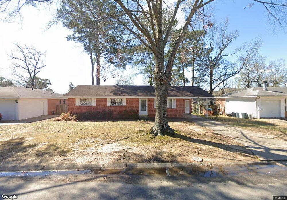
7901 Apache Rd Little Rock, AR 72205
Briarwood NeighborhoodEstimated Value: $148,000 - $188,000
3
Beds
2
Baths
1,125
Sq Ft
$147/Sq Ft
Est. Value
About This Home
This home is located at 7901 Apache Rd, Little Rock, AR 72205 and is currently estimated at $165,294, approximately $146 per square foot. 7901 Apache Rd is a home located in Pulaski County with nearby schools including Brady Elementary School, Henderson Middle School, and Central High School.
Ownership History
Date
Name
Owned For
Owner Type
Purchase Details
Closed on
Mar 30, 2018
Sold by
Embry Juanita
Bought by
Chheav Ratna
Current Estimated Value
Home Financials for this Owner
Home Financials are based on the most recent Mortgage that was taken out on this home.
Original Mortgage
$85,600
Outstanding Balance
$50,221
Interest Rate
4.38%
Mortgage Type
New Conventional
Estimated Equity
$115,073
Purchase Details
Closed on
Aug 8, 2013
Sold by
Roberts Lola G
Bought by
Embry Juanita
Create a Home Valuation Report for This Property
The Home Valuation Report is an in-depth analysis detailing your home's value as well as a comparison with similar homes in the area
Home Values in the Area
Average Home Value in this Area
Purchase History
| Date | Buyer | Sale Price | Title Company |
|---|---|---|---|
| Chheav Ratna | $107,000 | First National Title Company | |
| Embry Juanita | $65,000 | Pulaski County Title |
Source: Public Records
Mortgage History
| Date | Status | Borrower | Loan Amount |
|---|---|---|---|
| Open | Chheav Ratna | $85,600 |
Source: Public Records
Tax History Compared to Growth
Tax History
| Year | Tax Paid | Tax Assessment Tax Assessment Total Assessment is a certain percentage of the fair market value that is determined by local assessors to be the total taxable value of land and additions on the property. | Land | Improvement |
|---|---|---|---|---|
| 2024 | $1,539 | $25,678 | $7,600 | $18,078 |
| 2023 | $1,539 | $25,678 | $7,600 | $18,078 |
| 2022 | $1,411 | $25,678 | $7,600 | $18,078 |
| 2021 | $1,292 | $18,320 | $4,800 | $13,520 |
| 2020 | $1,282 | $18,320 | $4,800 | $13,520 |
| 2019 | $1,282 | $18,320 | $4,800 | $13,520 |
| 2018 | $1,282 | $18,320 | $4,800 | $13,520 |
| 2017 | $1,282 | $18,320 | $4,800 | $13,520 |
| 2016 | $1,257 | $17,960 | $5,000 | $12,960 |
| 2015 | $1,259 | $17,960 | $5,000 | $12,960 |
| 2014 | $1,259 | $0 | $0 | $0 |
Source: Public Records
Map
Nearby Homes
- 7800 Choctaw Rd
- 705 Legato Dr
- 618 S Mississippi St
- 7616 Briarwood Cir
- 409 Sunnymeade Dr
- 7410 Ouachita Dr
- 1 Sun Valley Rd
- 15 Tomahawk Rd
- 4 Tomahawk Rd
- 7111 W Markham St
- 215 Shamrock Dr
- 7011 W Markham St
- 22 Nob Hill Cove
- 3 Edgestone Dr
- 7020 Amherst Dr
- 3 Lorine Cir
- 7 Brookfield Cove
- 22 Nob View Cir
- 9 Brookfield Cove
- 6905 Carrilon Rd
- 7905 Apache Rd
- 7815 Apache Rd
- 7809 Apache Rd
- 312 Cherokee Cir
- 7913 Apache Rd
- 7805 Apache Rd
- 308 Cherokee Cir
- 315 S Rodney Parham Rd
- 311 Cherokee Cir
- 7800 Choctaw Rd Unit 2
- 312 Hiawatha Dr
- 7803 Apache Rd
- 709 S Rodney Parham Rd
- 304 Cherokee Cir
- 305 Cherokee Cir
- 308 Hiawatha Dr
- 7726 Choctaw Rd
- 305 S Rodney Parham Rd
- 7801 Apache Rd
- 300 Cherokee Cir