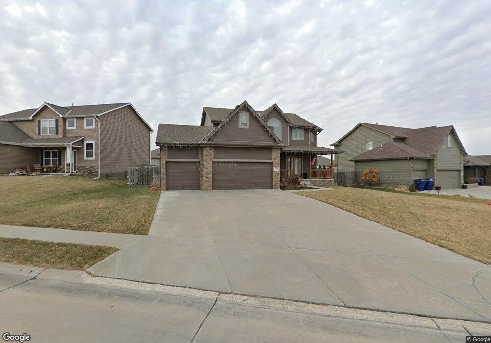
7902 S 162nd Ave Omaha, NE 68136
Millard Park NeighborhoodEstimated Value: $418,590 - $446,000
4
Beds
4
Baths
2,090
Sq Ft
$206/Sq Ft
Est. Value
About This Home
This home is located at 7902 S 162nd Ave, Omaha, NE 68136 and is currently estimated at $429,898, approximately $205 per square foot. 7902 S 162nd Ave is a home located in Sarpy County with nearby schools including Upchurch Elementary School, Millard South High School, and Harry Andersen Middle School.
Ownership History
Date
Name
Owned For
Owner Type
Purchase Details
Closed on
Mar 14, 2011
Sold by
Proline Custom Homes Inc
Bought by
Hizer Kimberly J
Current Estimated Value
Home Financials for this Owner
Home Financials are based on the most recent Mortgage that was taken out on this home.
Original Mortgage
$180,650
Interest Rate
4.53%
Purchase Details
Closed on
Nov 10, 2010
Sold by
Dodge Land Co
Bought by
Proline Custom Homes Inc
Create a Home Valuation Report for This Property
The Home Valuation Report is an in-depth analysis detailing your home's value as well as a comparison with similar homes in the area
Home Values in the Area
Average Home Value in this Area
Purchase History
| Date | Buyer | Sale Price | Title Company |
|---|---|---|---|
| Hizer Kimberly J | $213,000 | Nlta | |
| Proline Custom Homes Inc | $25,000 | Professional Title |
Source: Public Records
Mortgage History
| Date | Status | Borrower | Loan Amount |
|---|---|---|---|
| Previous Owner | Hizer Kimberly J | $180,650 |
Source: Public Records
Tax History
| Year | Tax Paid | Tax Assessment Tax Assessment Total Assessment is a certain percentage of the fair market value that is determined by local assessors to be the total taxable value of land and additions on the property. | Land | Improvement |
|---|---|---|---|---|
| 2025 | $5,662 | $394,558 | $57,000 | $337,558 |
| 2024 | $6,252 | $357,691 | $54,000 | $303,691 |
| 2023 | $6,252 | $328,500 | $48,000 | $280,500 |
| 2022 | $6,095 | $299,143 | $42,000 | $257,143 |
| 2021 | $6,092 | $284,515 | $42,000 | $242,515 |
| 2020 | $6,106 | $275,501 | $36,000 | $239,501 |
| 2019 | $6,297 | $268,994 | $36,000 | $232,994 |
| 2018 | $5,893 | $244,127 | $32,000 | $212,127 |
| 2017 | $5,085 | $208,359 | $27,000 | $181,359 |
| 2016 | $4,962 | $202,178 | $27,000 | $175,178 |
| 2015 | $4,908 | $198,965 | $27,000 | $171,965 |
| 2014 | $4,947 | $200,008 | $27,000 | $173,008 |
| 2012 | -- | $204,066 | $27,000 | $177,066 |
Source: Public Records
Map
Nearby Homes
- 16111 Birch Ave
- 16007 Greenleaf St
- 16419 Cary St
- 15724 Rosewood St
- 15818 Timberlane Dr
- 15802 Stony Cir
- 15721 Timberlane Dr
- 16863 Cary St
- 16113 Emiline St
- 7705 S 169th St
- 8352 S 169th St
- 8505 S 169th St
- 7206 S 157th St
- 15616 Edna Cir
- 15605 Edna Cir
- 17116 Joanne Dr
- 15708 Audrey St
- 7820 S 173rd St
- 8113 S 152nd Ave
- 15225 Robin Dr
- 7906 S 162nd Ave
- 16211 Briar St
- 16215 Briar St
- 16308 Rosewood St
- 7910 S 162nd Ave
- 7901 S 162nd Ave
- 7905 S 162nd Ave
- 16305 Briar St
- 16212 Briar St
- 7909 S 162nd Ave
- 16312 Rosewood St Unit SST
- 16216 Briar St
- 7913 S 162nd Ave
- 16309 Briar St
- 16208 Briar St
- 16316 Rosewood St
- 7914 S 162nd St
- 8017 S 162nd Ave
- 16301 Rosewood St
- 16302 Briar St
Your Personal Tour Guide
Ask me questions while you tour the home.