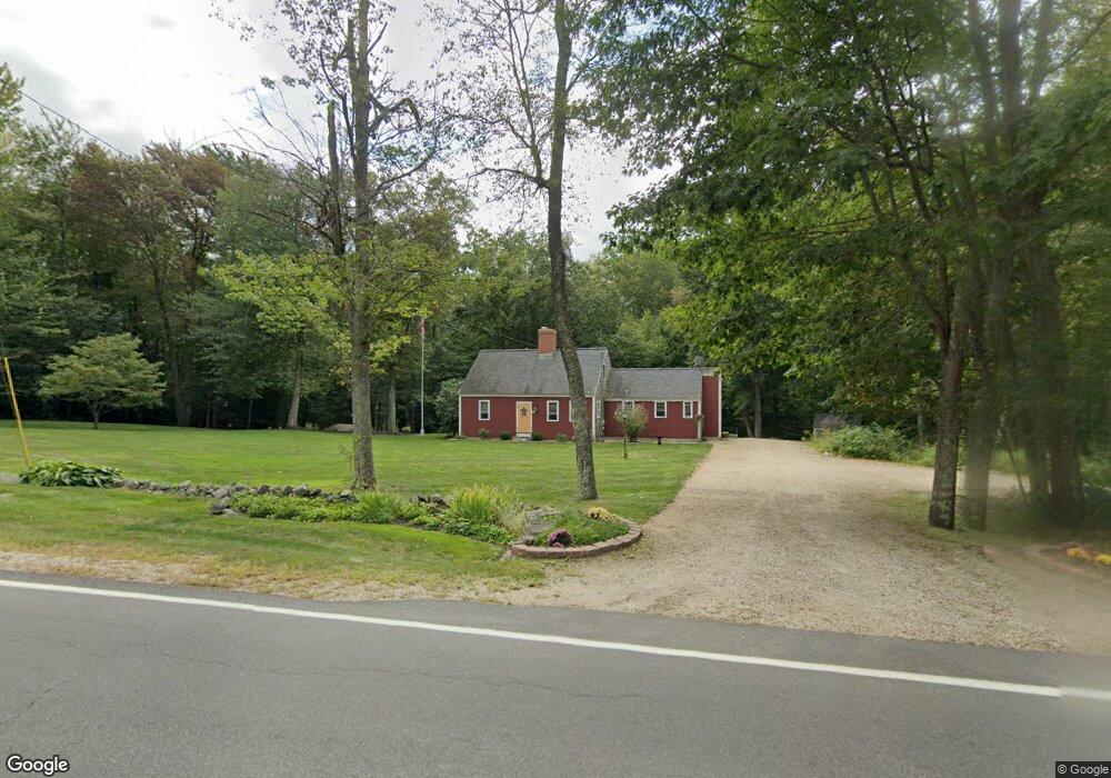
791 Goodwin Rd Eliot, ME 03903
East Eliot NeighborhoodEstimated Value: $628,000 - $760,000
3
Beds
3
Baths
1,859
Sq Ft
$366/Sq Ft
Est. Value
About This Home
This home is located at 791 Goodwin Rd, Eliot, ME 03903 and is currently estimated at $679,886, approximately $365 per square foot. 791 Goodwin Rd is a home located in York County with nearby schools including Marshwood High School and Seacoast Waldorf School.
Ownership History
Date
Name
Owned For
Owner Type
Purchase Details
Closed on
Dec 13, 2022
Sold by
Reindl Lauren E and Reindl Paul L
Bought by
Reindl Ft 2022
Current Estimated Value
Purchase Details
Closed on
Oct 6, 2010
Sold by
Baker Lauren E and Baker Michael W
Bought by
Shirk Lawrence E and Baker Lauren E
Home Financials for this Owner
Home Financials are based on the most recent Mortgage that was taken out on this home.
Original Mortgage
$309,306
Interest Rate
3.37%
Mortgage Type
FHA
Create a Home Valuation Report for This Property
The Home Valuation Report is an in-depth analysis detailing your home's value as well as a comparison with similar homes in the area
Home Values in the Area
Average Home Value in this Area
Purchase History
| Date | Buyer | Sale Price | Title Company |
|---|---|---|---|
| Reindl Ft 2022 | -- | None Available | |
| Shirk Lawrence E | -- | -- |
Source: Public Records
Mortgage History
| Date | Status | Borrower | Loan Amount |
|---|---|---|---|
| Previous Owner | Shirk Lawrence E | $309,306 |
Source: Public Records
Tax History
| Year | Tax Paid | Tax Assessment Tax Assessment Total Assessment is a certain percentage of the fair market value that is determined by local assessors to be the total taxable value of land and additions on the property. | Land | Improvement |
|---|---|---|---|---|
| 2024 | $5,931 | $500,500 | $154,000 | $346,500 |
| 2023 | $5,543 | $452,500 | $134,700 | $317,800 |
| 2022 | $5,301 | $438,100 | $134,700 | $303,400 |
| 2021 | $4,805 | $379,700 | $124,100 | $255,600 |
| 2020 | $6,292 | $356,700 | $118,700 | $238,000 |
| 2019 | $6,200 | $356,700 | $118,700 | $238,000 |
| 2018 | $5,243 | $356,700 | $118,700 | $238,000 |
| 2017 | $5,021 | $351,100 | $118,700 | $232,400 |
| 2016 | $6,080 | $351,100 | $118,700 | $232,400 |
| 2015 | $4,915 | $351,100 | $118,700 | $232,400 |
| 2014 | $4,845 | $351,100 | $118,700 | $232,400 |
| 2013 | $4,624 | $351,100 | $118,700 | $232,400 |
Source: Public Records
Map
Nearby Homes
- 25 Heritage Dr
- Lot 2 Cedar Tbd
- 10 Pasture Hill Dr
- 0 Goodwin Rd Unit 1646628
- 116 Heron Cove Rd
- 1708 State Rd
- 18 Governor Hill Rd
- 708 River Rd Unit 2
- 708 River Rd Unit 3
- 25 Fosters Dr
- Lot 4 Stonecrop Farm Ln
- Lot 1 Brixham (Stonecrop Farm Lot 1) Rd
- 69 Polly Ann Trailer Park
- 3 Bhoireann Ln
- 4 Bhoireann Ln
- 16 Polly Ann Park
- 1 Independence Dr
- 4 Freedom Dr
- 14 Independence Dr
- Slip B18 Little Bay
- 803 Goodwin Rd
- 786 Goodwin Rd
- 781 Goodwin Rd
- 804 Goodwin Rd
- 305 Goodwin Rd
- Lot B Goodwin Rd
- 817 Goodwin Rd
- 766 Goodwin Rd
- Lot A Goodwin Rd
- 759 Goodwin Rd
- 829 Goodwin Rd
- TBD Goodwin Rd
- 314 Goodwin Rd
- 52 Ambush Rock Rd
- 756 Goodwin Rd
- 835 Goodwin Rd
- 48 Ambush Rock Rd
- 7 Sullivans Crossing
- 11 Cardinal Dr
- 40 Ambush Rock Rd
Your Personal Tour Guide
Ask me questions while you tour the home.