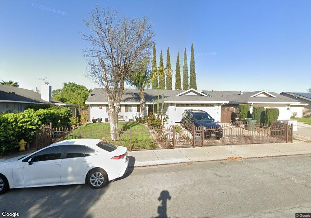
791 Marian Ct Merced, CA 95341
Estimated Value: $254,000 - $401,000
4
Beds
2
Baths
1,614
Sq Ft
$217/Sq Ft
Est. Value
About This Home
This home is located at 791 Marian Ct, Merced, CA 95341 and is currently estimated at $350,566, approximately $217 per square foot. 791 Marian Ct is a home located in Merced County with nearby schools including Leontine Gracey Elementary School, Tenaya Middle School, and El Capitan High School.
Ownership History
Date
Name
Owned For
Owner Type
Purchase Details
Closed on
Jul 16, 2022
Sold by
Ortiz-Chaparro Ricardo
Bought by
Ortiz Chaparro Family Revocable Living Trust
Current Estimated Value
Purchase Details
Closed on
Feb 8, 2005
Sold by
Ortiz Ricardo and Ortiz Dolores
Bought by
Ortiz Chaparro Ricardo
Home Financials for this Owner
Home Financials are based on the most recent Mortgage that was taken out on this home.
Original Mortgage
$195,000
Interest Rate
5.73%
Mortgage Type
New Conventional
Purchase Details
Closed on
Oct 1, 1997
Sold by
Mccabe James D and Mccabe Donna P
Bought by
Ortiz Ricardo and Ortiz Dolores
Home Financials for this Owner
Home Financials are based on the most recent Mortgage that was taken out on this home.
Original Mortgage
$98,620
Interest Rate
7.49%
Create a Home Valuation Report for This Property
The Home Valuation Report is an in-depth analysis detailing your home's value as well as a comparison with similar homes in the area
Purchase History
| Date | Buyer | Sale Price | Title Company |
|---|---|---|---|
| Ortiz Chaparro Family Revocable Living Trust | -- | -- | |
| Ortiz Chaparro Ricardo | -- | Chicago Title Company | |
| Ortiz Ricardo | $99,000 | Transcounty Title Company |
Source: Public Records
Mortgage History
| Date | Status | Borrower | Loan Amount |
|---|---|---|---|
| Previous Owner | Ortiz Chaparro Ricardo | $195,000 | |
| Previous Owner | Ortiz Ricardo | $98,620 | |
| Closed | Ortiz Ricardo | $5,948 |
Source: Public Records
Tax History Compared to Growth
Tax History
| Year | Tax Paid | Tax Assessment Tax Assessment Total Assessment is a certain percentage of the fair market value that is determined by local assessors to be the total taxable value of land and additions on the property. | Land | Improvement |
|---|---|---|---|---|
| 2025 | $1,635 | $158,054 | $39,906 | $118,148 |
| 2024 | $1,635 | $154,956 | $39,124 | $115,832 |
| 2023 | $1,611 | $151,918 | $38,357 | $113,561 |
| 2022 | $1,661 | $148,940 | $37,605 | $111,335 |
| 2021 | $1,665 | $146,020 | $36,868 | $109,152 |
| 2020 | $1,675 | $144,523 | $36,490 | $108,033 |
| 2019 | $1,651 | $141,690 | $35,775 | $105,915 |
| 2018 | $1,508 | $138,913 | $35,074 | $103,839 |
| 2017 | $1,540 | $136,190 | $34,387 | $101,803 |
| 2016 | $1,516 | $133,520 | $33,713 | $99,807 |
| 2015 | $1,493 | $131,515 | $33,207 | $98,308 |
| 2014 | $1,461 | $128,940 | $32,557 | $96,383 |
Source: Public Records
Map
Nearby Homes
- 2051 Wardrobe Ave
- 995 Emory Way
- 1821 W 8th St
- 1803 Lopes Ave
- 965 N Bryant
- 817 T St
- 1251 W 9th St
- 1220 Fig Ave
- 915 R St
- 1646 W North Bear Creek Dr
- 1648 W North Bear Creek Dr
- 1973 Shadowbrook Dr
- 1963 Shadowbrook Dr
- 130 Mcgregor St
- 835 W 10th St
- 2440 Crystal Springs Ave
- 2500 N State Highway 59 Unit 36
- 2500 N State Highway 59 Unit 18
- 2500 N State Highway 59
- 832 W 9th St