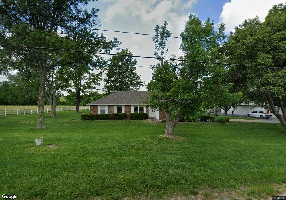
7910 Mize Rd Lenexa, KS 66227
Estimated Value: $422,000 - $557,000
3
Beds
2
Baths
1,770
Sq Ft
$263/Sq Ft
Est. Value
About This Home
This home is located at 7910 Mize Rd, Lenexa, KS 66227 and is currently estimated at $466,227, approximately $263 per square foot. 7910 Mize Rd is a home located in Johnson County with nearby schools including Mize Elementary School, Mill Creek Middle School, and De Soto High School.
Ownership History
Date
Name
Owned For
Owner Type
Purchase Details
Closed on
Jan 22, 2007
Sold by
Creten John Gary
Bought by
Greyhawk Development Llc
Current Estimated Value
Home Financials for this Owner
Home Financials are based on the most recent Mortgage that was taken out on this home.
Original Mortgage
$1,700,000
Interest Rate
6.11%
Mortgage Type
Construction
Create a Home Valuation Report for This Property
The Home Valuation Report is an in-depth analysis detailing your home's value as well as a comparison with similar homes in the area
Home Values in the Area
Average Home Value in this Area
Purchase History
| Date | Buyer | Sale Price | Title Company |
|---|---|---|---|
| Greyhawk Development Llc | -- | Kansas City Title |
Source: Public Records
Mortgage History
| Date | Status | Borrower | Loan Amount |
|---|---|---|---|
| Previous Owner | Greyhawk Development Llc | $1,700,000 |
Source: Public Records
Tax History Compared to Growth
Tax History
| Year | Tax Paid | Tax Assessment Tax Assessment Total Assessment is a certain percentage of the fair market value that is determined by local assessors to be the total taxable value of land and additions on the property. | Land | Improvement |
|---|---|---|---|---|
| 2024 | $5,733 | $47,487 | $14,352 | $33,135 |
| 2023 | $5,198 | $42,324 | $13,450 | $28,874 |
| 2022 | $5,185 | $41,489 | $11,193 | $30,296 |
| 2021 | $4,298 | $33,277 | $9,324 | $23,953 |
| 2020 | $4,143 | $31,864 | $9,278 | $22,586 |
| 2019 | $4,297 | $32,611 | $8,969 | $23,642 |
| 2018 | $4,080 | $30,530 | $8,969 | $21,561 |
| 2017 | $4,002 | $28,816 | $8,969 | $19,847 |
| 2016 | $4,002 | $28,478 | $8,969 | $19,509 |
| 2015 | $3,960 | $27,087 | $8,924 | $18,163 |
| 2013 | -- | $24,004 | $8,924 | $15,080 |
Source: Public Records
Map
Nearby Homes
- Lakewood Villa Plan at Mize Hill
- Newberry Plan at Mize Hill
- 7822 Houston St
- 25492 W 84th Terrace
- 25371 W 84th St
- 25481 W 84th Terrace
- 8520 Pickering St
- 8523 Pickering St
- 8444 Shady Bend Rd
- 7505 Mccormick Dr
- 26544 W 83rd Terrace
- 26555 W 83rd Terrace
- 26571 W 83rd Terrace
- 26584 W 83rd Terrace
- 8978 Shady Bend Rd
- 8901 Shady Bend Rd
- 8973 Shady Bend Rd
- 8972 Shady Bend Rd
- 8357 Greentree Dr
- 26561 W 84th Terrace
- 7905 Mize Rd
- 25450 W 79th St
- 25310 W 79th St
- 25417 W 79th St
- 7800 Mize Rd
- 7810 Mize Rd
- 9527 Shady Bend Rd Unit 3R
- 9530 Shady Bend Rd Unit 2R
- 9532 Shady Bend Rd Unit 2L
- 9538 Shady Bend Rd Unit 1R
- 9540 Shady Bend Rd Unit 1L
- 9530 Shady Bend Rd
- 9532 Shady Bend Rd
- 8110 Mize Blvd
- 7702 Mize Rd
- 9045 Shady Bend Rd
- 8985 Shady Bend Rd
- 9021 Shady Bend Rd
- 25661 W 77th St
- 25080 W 79th St