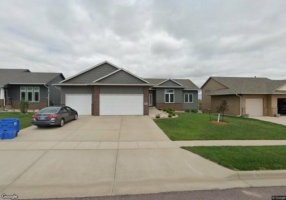
7912 W President St Sioux Falls, SD 57106
Northwest Sioux Falls NeighborhoodEstimated Value: $417,000 - $527,000
5
Beds
3
Baths
2,611
Sq Ft
$180/Sq Ft
Est. Value
About This Home
This home is located at 7912 W President St, Sioux Falls, SD 57106 and is currently estimated at $468,761, approximately $179 per square foot. 7912 W President St is a home located in Minnehaha County with nearby schools including Discovery Elementary School, Memorial Middle School, and Jefferson High School - 67.
Ownership History
Date
Name
Owned For
Owner Type
Purchase Details
Closed on
Mar 12, 2021
Sold by
Fedulov Nikolai and Fedulov Caitlyn R
Bought by
Wieler Raymond H and Wieler Linda
Current Estimated Value
Purchase Details
Closed on
Oct 24, 2014
Bought by
Fedulov Nikolai and Fedulov Caitlyn R
Home Financials for this Owner
Home Financials are based on the most recent Mortgage that was taken out on this home.
Original Mortgage
$258,305
Interest Rate
4.21%
Mortgage Type
New Conventional
Create a Home Valuation Report for This Property
The Home Valuation Report is an in-depth analysis detailing your home's value as well as a comparison with similar homes in the area
Home Values in the Area
Average Home Value in this Area
Purchase History
| Date | Buyer | Sale Price | Title Company |
|---|---|---|---|
| Wieler Raymond H | $380,000 | None Available | |
| Fedulov Nikolai | $271,900 | -- |
Source: Public Records
Mortgage History
| Date | Status | Borrower | Loan Amount |
|---|---|---|---|
| Previous Owner | Fedulov Nikolai | $258,305 |
Source: Public Records
Tax History Compared to Growth
Tax History
| Year | Tax Paid | Tax Assessment Tax Assessment Total Assessment is a certain percentage of the fair market value that is determined by local assessors to be the total taxable value of land and additions on the property. | Land | Improvement |
|---|---|---|---|---|
| 2024 | $4,984 | $368,100 | $41,800 | $326,300 |
| 2023 | $5,259 | $374,900 | $41,800 | $333,100 |
| 2022 | $4,996 | $335,700 | $41,800 | $293,900 |
| 2021 | $4,983 | $322,600 | $0 | $0 |
| 2020 | $4,983 | $322,100 | $0 | $0 |
| 2019 | $4,849 | $307,809 | $0 | $0 |
| 2018 | $3,893 | $280,521 | $0 | $0 |
| 2017 | $3,561 | $246,967 | $47,925 | $199,042 |
| 2016 | $3,561 | $225,522 | $36,865 | $188,657 |
| 2015 | $3,533 | $215,096 | $35,021 | $180,075 |
| 2014 | -- | $209,851 | $35,021 | $174,830 |
Source: Public Records
Map
Nearby Homes
- 1200 S Monticello Ave
- 7809 W Stoney Creek St
- 7805 W Noah Cir
- 1301 Hyannis Port Ln
- 1315 S President Ct
- 1501 S Wheatland Ave
- 1209 S Discovery Ave
- 604 S Mary Gene Ave
- 8709 W Rathburn St
- 1612 S Meadowland Ave
- 1604 S Kinderhook Ave
- 8101 W 24th St
- 8105 W 24th St
- 8113 W 24th St
- 8905 W 18th St
- 1405 S Maria Ave
- 1500 S Kathryn Ave
- 7524 W Boysenberry St
- 7512 W Stoney Creek St
- 1508 S Kathryn Ave
- 7908 W President St
- 8000 W President St
- 8004 W President St
- 7904 W President St
- 1100 S Kinderhook Ave
- 7905 W Stoney Creek St
- 7917 W Stoney Creek St
- 7909 W Stoney Creek St
- 7900 W President St
- 8008 W President St
- 1101 S Monticello Ave
- 8001 W Stoney Creek St
- 8001 W Stoney Creek St St
- 1101 S Kinderhook Ave
- 8005 W Stoney Creek St
- 7901 W Stoney Creek St
- 1104 S Kinderhook Ave
- 8009 W Stoney Creek St
- 1105 S Kinderhook Ave
- 1105 S Monticello Ave