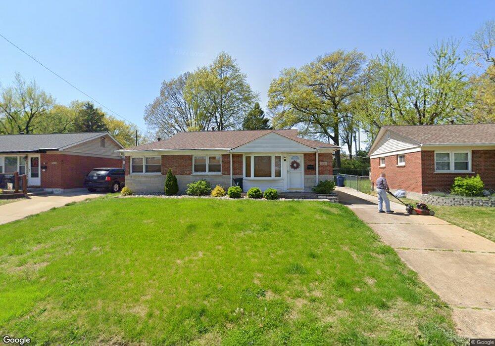
7915 Birkenhead Dr Saint Louis, MO 63123
Estimated Value: $240,000 - $259,201
3
Beds
2
Baths
1,000
Sq Ft
$249/Sq Ft
Est. Value
About This Home
This home is located at 7915 Birkenhead Dr, Saint Louis, MO 63123 and is currently estimated at $249,050, approximately $249 per square foot. 7915 Birkenhead Dr is a home located in St. Louis County with nearby schools including Mesnier Primary School, Gotsch Intermediate School, and Rogers Middle School.
Ownership History
Date
Name
Owned For
Owner Type
Purchase Details
Closed on
Sep 2, 2020
Sold by
Carol A Bauer Revocable Living Trust
Bought by
Kohlschreiber Alexandra L
Current Estimated Value
Home Financials for this Owner
Home Financials are based on the most recent Mortgage that was taken out on this home.
Original Mortgage
$139,500
Outstanding Balance
$123,797
Interest Rate
2.9%
Mortgage Type
New Conventional
Estimated Equity
$125,253
Create a Home Valuation Report for This Property
The Home Valuation Report is an in-depth analysis detailing your home's value as well as a comparison with similar homes in the area
Home Values in the Area
Average Home Value in this Area
Purchase History
| Date | Buyer | Sale Price | Title Company |
|---|---|---|---|
| Kohlschreiber Alexandra L | $155,000 | Security Title Ins Agcy |
Source: Public Records
Mortgage History
| Date | Status | Borrower | Loan Amount |
|---|---|---|---|
| Open | Kohlschreiber Alexandra L | $139,500 |
Source: Public Records
Tax History Compared to Growth
Tax History
| Year | Tax Paid | Tax Assessment Tax Assessment Total Assessment is a certain percentage of the fair market value that is determined by local assessors to be the total taxable value of land and additions on the property. | Land | Improvement |
|---|---|---|---|---|
| 2025 | $3,386 | $45,750 | $14,780 | $30,970 |
| 2024 | $3,386 | $41,340 | $9,860 | $31,480 |
| 2023 | $3,275 | $41,340 | $9,860 | $31,480 |
| 2022 | $3,082 | $35,440 | $10,850 | $24,590 |
| 2021 | $3,012 | $35,440 | $10,850 | $24,590 |
| 2020 | $2,717 | $29,810 | $9,670 | $20,140 |
| 2019 | $2,693 | $29,810 | $9,670 | $20,140 |
| 2018 | $2,595 | $25,380 | $6,760 | $18,620 |
| 2017 | $2,369 | $23,290 | $6,760 | $16,530 |
| 2016 | $2,205 | $22,990 | $5,810 | $17,180 |
| 2015 | $2,210 | $22,990 | $5,810 | $17,180 |
| 2014 | $2,238 | $23,180 | $5,720 | $17,460 |
Source: Public Records
Map
Nearby Homes
- 7936 Radnor Dr
- 739 Hurstgreen Rd
- 7101 Fernbrook Dr
- 6804 Snowy Owl Ln
- 6843 Preservation Pkwy
- 6819 Preservation Pkwy
- 6830 Preservation Pkwy
- 6730 Snowy Owl Ln
- 6728 Preservation Pkwy
- 6724 Preservation Pkwy
- 6714 Snowy Owl Ln
- 6712 Preservation Pkwy
- 7243 General Sherman Ln
- Magnolia Plan at The Preserve - Designer Collection
- Wyatt Plan at The Preserve - Designer Collection
- Calvin Plan at The Preserve - Designer Collection
- Ivy Plan at The Preserve - Designer Collection
- Avery Plan at The Preserve - Designer Collection
- Olive Plan at The Preserve - Designer Collection
- Charles Plan at The Preserve - Designer Collection
- 7911 Birkenhead Dr
- 7919 Birkenhead Dr
- 7923 Birkenhead Dr
- 7907 Birkenhead Dr
- 7934 Croydon Dr
- 7938 Croydon Dr
- 7927 Birkenhead Dr
- 7916 Birkenhead Dr
- 7901 Birkenhead Dr
- 7920 Birkenhead Dr
- 7912 Birkenhead Dr
- 7928 Croydon Dr
- 7929 Radnor Dr
- 7924 Birkenhead Dr
- 7908 Birkenhead Dr
- 7927 Radnor Dr
- 7931 Birkenhead Dr
- 7928 Birkenhead Dr
- 7904 Birkenhead Dr
- 7932 Birkenhead Dr