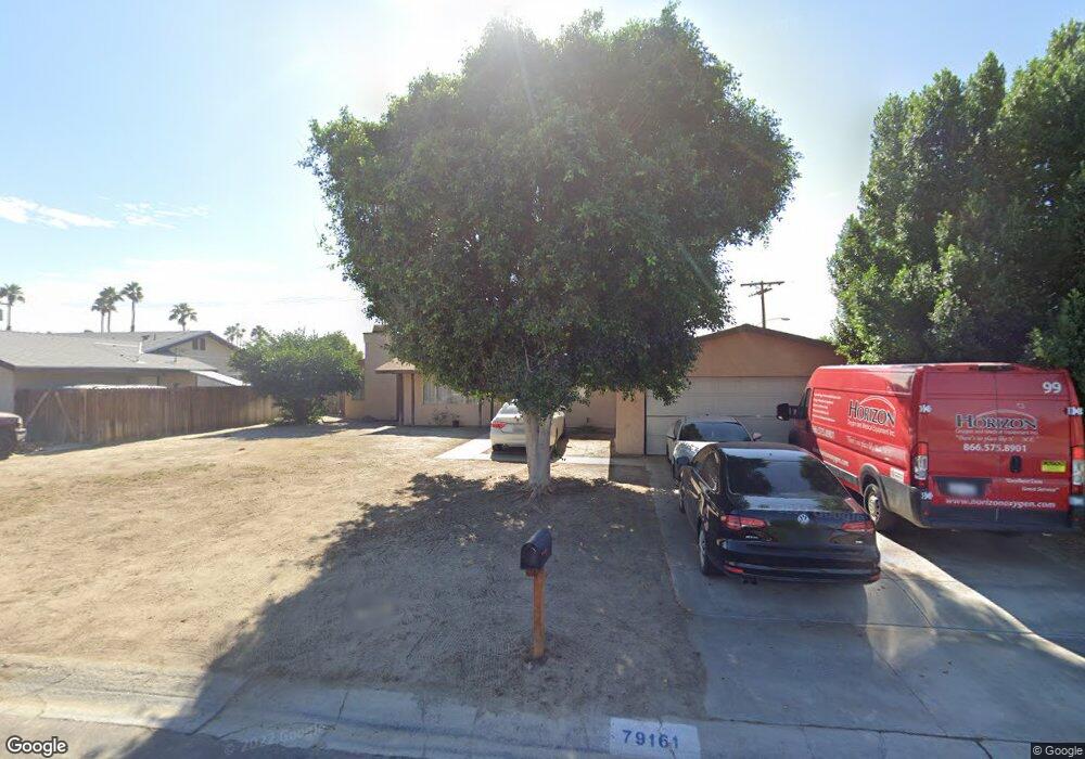
79161 Port Royal Ave Bermuda Dunes, CA 92203
Estimated Value: $466,000 - $603,000
3
Beds
2
Baths
1,646
Sq Ft
$331/Sq Ft
Est. Value
About This Home
This home is located at 79161 Port Royal Ave, Bermuda Dunes, CA 92203 and is currently estimated at $544,134, approximately $330 per square foot. 79161 Port Royal Ave is a home located in Riverside County with nearby schools including James Monroe Elementary School, Colonel Mitchell Paige Middle School, and Palm Desert High School.
Ownership History
Date
Name
Owned For
Owner Type
Purchase Details
Closed on
Sep 6, 2005
Sold by
Lanning Sevie L
Bought by
Dela Rosa Susana
Current Estimated Value
Home Financials for this Owner
Home Financials are based on the most recent Mortgage that was taken out on this home.
Original Mortgage
$95,000
Interest Rate
6.82%
Mortgage Type
Purchase Money Mortgage
Purchase Details
Closed on
Jul 2, 1999
Sold by
Lanning Brian and Lanning Maria
Bought by
Lanning Sevie L
Home Financials for this Owner
Home Financials are based on the most recent Mortgage that was taken out on this home.
Original Mortgage
$68,000
Interest Rate
7.47%
Purchase Details
Closed on
Sep 16, 1994
Sold by
Cosgrove Michele Robinson
Bought by
Cosgrove Michael J
Create a Home Valuation Report for This Property
The Home Valuation Report is an in-depth analysis detailing your home's value as well as a comparison with similar homes in the area
Home Values in the Area
Average Home Value in this Area
Purchase History
| Date | Buyer | Sale Price | Title Company |
|---|---|---|---|
| Dela Rosa Susana | $5,000 | Ticor Title | |
| Lanning Sevie L | $103,000 | Fidelity National Title Ins | |
| Cosgrove Michael J | -- | Old Republic Title Company |
Source: Public Records
Mortgage History
| Date | Status | Borrower | Loan Amount |
|---|---|---|---|
| Previous Owner | Dela Rosa Susana | $95,000 | |
| Previous Owner | Lanning Sevie L | $68,000 |
Source: Public Records
Tax History Compared to Growth
Tax History
| Year | Tax Paid | Tax Assessment Tax Assessment Total Assessment is a certain percentage of the fair market value that is determined by local assessors to be the total taxable value of land and additions on the property. | Land | Improvement |
|---|---|---|---|---|
| 2025 | $5,376 | $444,115 | $170,812 | $273,303 |
| 2023 | $5,376 | $426,872 | $164,180 | $262,692 |
| 2022 | $4,977 | $402,862 | $154,947 | $247,915 |
| 2021 | $4,055 | $327,530 | $125,973 | $201,557 |
| 2020 | $3,592 | $292,438 | $112,476 | $179,962 |
| 2019 | $3,489 | $283,920 | $109,200 | $174,720 |
| 2018 | $3,356 | $273,000 | $105,000 | $168,000 |
| 2017 | $3,278 | $267,000 | $103,000 | $164,000 |
| 2016 | $2,910 | $238,000 | $92,000 | $146,000 |
| 2015 | $2,914 | $234,000 | $90,000 | $144,000 |
| 2014 | $2,613 | $209,000 | $80,000 | $129,000 |
Source: Public Records
Map
Nearby Homes
- 41855 Volare Ct
- 41868 Volare Ct
- 41879 Volare Ct
- 41891 Volare Ct
- 41880 Volare Ct
- 41892 Volare Ct
- 79211 Bermuda Dunes Dr
- 42410 Adams St
- 79305 Bermuda Dunes Dr
- 79361 Port Royal Ave
- 78900 Runaway Bay Dr
- 79381 Avenue 42
- 78650 Avenue 42 Unit 1514
- 78650 Avenue 42 Unit 1609
- 78650 Avenue 42 Unit 101
- 41252 Gaslight Ave
- 42505 Adams St
- 79040 Cliff St
- 42533 Capri Dr
- 42320 Baracoa Dr Unit 20
- 79171 Port Royal Ave
- 79181 Port Royal Ave
- 79170 Port Royal Ave
- 79191 Port Royal Ave
- 41780 Hermitage Dr
- 79201 Port Royal Ave
- 0 Locovia Ct
- 00000 Locovia Ct
- 79194 Locovia Ct
- 79211 Port Royal Ave
- 42 Avenue 42
- 79210 Port Royal Ave
- 78845 Avenue 42
- 79198 Locovia Ct
- 79210 Avenue 42 Unit D4
- 79210 Avenue 42
- 79210 Avenue 42
- 79221 Port Royal Ave
- 79161 Avenue 42
- 79141 Avenue 42 Unit C