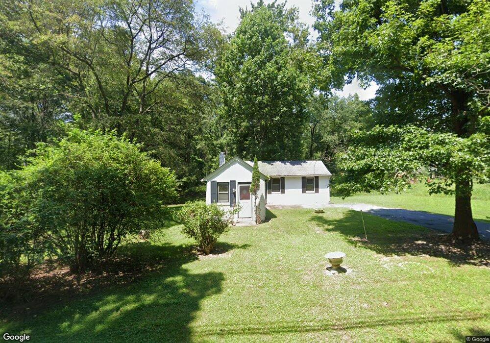
7918 Brock Bridge Rd Jessup, MD 20794
Estimated Value: $320,175 - $439,000
2
Beds
1
Bath
768
Sq Ft
$504/Sq Ft
Est. Value
About This Home
This home is located at 7918 Brock Bridge Rd, Jessup, MD 20794 and is currently estimated at $387,392, approximately $504 per square foot. 7918 Brock Bridge Rd is a home located in Anne Arundel County with nearby schools including Jessup Elementary School, Meade Middle School, and Meade High School.
Ownership History
Date
Name
Owned For
Owner Type
Purchase Details
Closed on
Nov 20, 2015
Sold by
Wells Fargo Bank Na
Bought by
Payne Memorial African Methodist Episcop and African Methodist Episcopal Church Inc
Current Estimated Value
Purchase Details
Closed on
Jun 4, 2015
Sold by
Clarke James E and Dyson Renee
Bought by
Wells Fargo Bank Na
Purchase Details
Closed on
May 26, 1998
Sold by
Robinson Theodore A
Bought by
Robinson Theodore A
Purchase Details
Closed on
Dec 19, 1995
Sold by
Brown Dora
Bought by
Robinson Theodore A and Robinson Violet G
Create a Home Valuation Report for This Property
The Home Valuation Report is an in-depth analysis detailing your home's value as well as a comparison with similar homes in the area
Home Values in the Area
Average Home Value in this Area
Purchase History
| Date | Buyer | Sale Price | Title Company |
|---|---|---|---|
| Payne Memorial African Methodist Episcop | $147,400 | Linear Title & Closing | |
| Wells Fargo Bank Na | $147,070 | Attorney | |
| Robinson Theodore A | -- | -- | |
| Robinson Theodore A | -- | -- |
Source: Public Records
Tax History Compared to Growth
Tax History
| Year | Tax Paid | Tax Assessment Tax Assessment Total Assessment is a certain percentage of the fair market value that is determined by local assessors to be the total taxable value of land and additions on the property. | Land | Improvement |
|---|---|---|---|---|
| 2025 | $502 | $277,200 | $215,100 | $62,100 |
| 2024 | $502 | $277,200 | $215,100 | $62,100 |
| 2023 | $474 | $277,200 | $215,100 | $62,100 |
| 2022 | $430 | $288,300 | $234,100 | $54,200 |
| 2021 | $430 | $282,267 | $0 | $0 |
| 2020 | $3,277 | $276,233 | $0 | $0 |
| 2019 | $3,216 | $270,200 | $215,100 | $55,100 |
| 2018 | $2,436 | $240,267 | $0 | $0 |
| 2017 | $2,526 | $210,333 | $0 | $0 |
| 2016 | -- | $180,400 | $0 | $0 |
| 2015 | -- | $172,067 | $0 | $0 |
| 2014 | -- | $163,733 | $0 | $0 |
Source: Public Records
Map
Nearby Homes
- 7911 Mine Run Rd
- 7836 Mine Run Rd
- 7820 Mine Run Rd
- 3723 Cedar Mountain Way
- 7938 Big Roundtop Rd
- 2357 Terrapin Crossing
- 2932 Hebron Ln
- 2914 Middleham Ct
- 7841 Chanceford Dr
- 2044 Orchard Ave
- 7808 Union Hill Dr
- 7812 Patterson Way
- 7652 Telamon Way
- 3106 Laurel Hill Rd
- 7951 Silver Oak Rd
- 7926 Silver Oak Rd
- 2727 Amber Crest Rd
- 2784 Fredericksburg Rd
- 7444 Burnside Way
- 2642 Shade Branch Rd
- 7910 Brock Bridge Rd
- 7928 Brock Bridge Rd
- 7902 Brock Bridge Rd
- 2001 Lazelle Dr
- 7901 Brock Bridge Rd
- 420 National Business Pkwy
- 7903 Brock Bridge Rd
- 7899 Brock Bridge Rd
- 410 National Business Pkwy
- 7888 Brock Bridge Rd
- 430 National Business Pkwy
- 7880 Brock Bridge Rd
- 7872 Brock Bridge Rd
- 7873 Brock Bridge Rd
- 7878 Brock Bridge Rd
- 7930 Brock Bridge Rd
- 7865 Brock Bridge Rd
- 540 National Business Pkwy
- 7855 Brock Bridge Rd
- 7837 Brock Bridge Rd