Estimated Value: $149,000 - $218,433
Studio
2
Baths
1,611
Sq Ft
$109/Sq Ft
Est. Value
About This Home
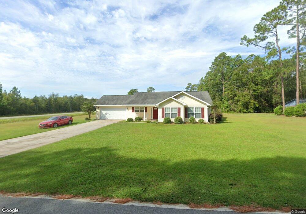
This home is located at 792 Hemlock St, Jesup, GA 31546 and is currently estimated at $175,858, approximately $109 per square foot. 792 Hemlock St is a home located in Wayne County with nearby schools including Jesup Elementary School, Arthur Williams Middle School, and Wayne County High School.
Ownership History
Date
Name
Owned For
Owner Type
Purchase Details
Closed on
Dec 5, 2007
Sold by
B E R Properties Llc
Bought by
Jones Daniel Sheron E
Current Estimated Value
Purchase Details
Closed on
Apr 11, 2007
Sold by
Blocker William Donald
Bought by
Jones Daniel Sheron Eloise
Purchase Details
Closed on
Aug 1, 2002
Purchase Details
Closed on
Oct 1, 1995
Purchase Details
Closed on
Dec 1, 1989
Purchase Details
Closed on
Dec 1, 1986
Purchase Details
Closed on
Aug 1, 1986
Purchase Details
Closed on
Apr 1, 1970
Purchase Details
Closed on
Aug 1, 1946
Create a Home Valuation Report for This Property
The Home Valuation Report is an in-depth analysis detailing your home's value as well as a comparison with similar homes in the area
Purchase History
| Date | Buyer | Sale Price | Title Company |
|---|---|---|---|
| Jones Daniel Sheron E | $121,500 | -- | |
| Jones Daniel Sheron Eloise | $7,500 | -- | |
| -- | -- | -- | |
| -- | $200 | -- | |
| -- | -- | -- | |
| -- | $27,600 | -- | |
| -- | $50,000 | -- | |
| -- | -- | -- | |
| -- | -- | -- |
Source: Public Records
Tax History
| Year | Tax Paid | Tax Assessment Tax Assessment Total Assessment is a certain percentage of the fair market value that is determined by local assessors to be the total taxable value of land and additions on the property. | Land | Improvement |
|---|---|---|---|---|
| 2025 | $2,254 | $77,159 | $4,461 | $72,698 |
| 2024 | $2,153 | $74,718 | $4,461 | $70,257 |
| 2023 | $1,800 | $50,888 | $4,046 | $46,842 |
| 2022 | $1,445 | $50,888 | $4,046 | $46,842 |
| 2021 | $1,547 | $50,888 | $4,046 | $46,842 |
| 2020 | $1,601 | $50,888 | $4,046 | $46,842 |
| 2019 | $1,648 | $50,888 | $4,046 | $46,842 |
| 2018 | $1,648 | $50,888 | $4,046 | $46,842 |
| 2017 | $1,419 | $50,888 | $4,046 | $46,842 |
| 2016 | $1,373 | $50,888 | $4,046 | $46,842 |
| 2014 | $1,377 | $50,888 | $4,046 | $46,842 |
| 2013 | -- | $50,888 | $4,046 | $46,842 |
Source: Public Records
Map
Nearby Homes
- 675 Fir St
- 548 N Cypress St
- 0 E Oak St
- Apt E Oak St
- 385 N Hickory St
- 15 Bethlehem Rd
- 447 NE Broad St
- 498 NE Broad St
- 436-441 Brunswick St
- 0 Bermuda Dr
- 187 E Pine St
- 197 NW Broad St
- 1074 E Cherry St
- 602 Bethlehem Rd
- 661 E Plum St
- 169 Pine Ridge Rd
- 0 N 4th St Unit 1660016
- 0 N 4th St Unit 166837
- 0 N 4th St Unit 10697567
- 110 E Pine St
- 0 Tract 2 - Hemlock St Unit 10155760
- 0 Tract 1 - Hemlock St
- 0 Tract 2 - Hemlock St
- 704 Hemlock St
- 703 Hemlock St
- 111 Avery St
- 695 Hemlock St
- 656 Greenbrae St
- 0 Tract 4 - Greenbrae Dr
- 190 Fern St
- 205 Hemlock St
- 0 Tract 3 - Hemlock St Unit 10156078
- 0 Tract 3 - Hemlock St
- 0 Tract 5 - Greenbrae Dr
- 255 Hemlock St
- 0 Greenbrae St
- 210 Fern St
- 195 Fern St
- 250 Fern St
- 192 Sumac Dr
Your Personal Tour Guide
Ask me questions while you tour the home.