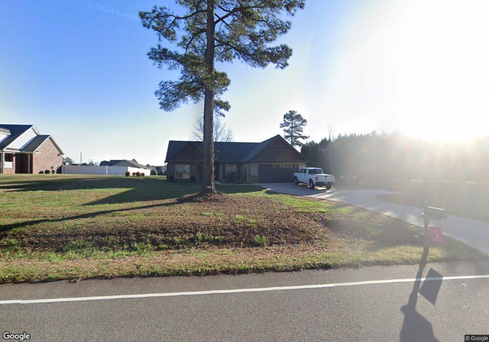
792 Whitestone Rd Spartanburg, SC 29302
Estimated Value: $262,745 - $323,000
2
Beds
2
Baths
1,480
Sq Ft
$204/Sq Ft
Est. Value
About This Home
This home is located at 792 Whitestone Rd, Spartanburg, SC 29302 and is currently estimated at $301,686, approximately $203 per square foot. 792 Whitestone Rd is a home with nearby schools including Broome High School.
Ownership History
Date
Name
Owned For
Owner Type
Purchase Details
Closed on
Oct 18, 2019
Sold by
The Douglas Group Llc
Bought by
Gregory Kyra M and Gregory William Todd
Current Estimated Value
Home Financials for this Owner
Home Financials are based on the most recent Mortgage that was taken out on this home.
Original Mortgage
$153,032
Outstanding Balance
$134,607
Interest Rate
3.7%
Mortgage Type
FHA
Estimated Equity
$167,079
Purchase Details
Closed on
Jul 23, 2018
Sold by
T & G Properties Inc
Bought by
The Douglas Group Llc
Create a Home Valuation Report for This Property
The Home Valuation Report is an in-depth analysis detailing your home's value as well as a comparison with similar homes in the area
Home Values in the Area
Average Home Value in this Area
Purchase History
| Date | Buyer | Sale Price | Title Company |
|---|---|---|---|
| Gregory Kyra M | $188,000 | None Available | |
| The Douglas Group Llc | $13,900 | None Available |
Source: Public Records
Mortgage History
| Date | Status | Borrower | Loan Amount |
|---|---|---|---|
| Open | Gregory Kyra M | $153,032 |
Source: Public Records
Tax History Compared to Growth
Tax History
| Year | Tax Paid | Tax Assessment Tax Assessment Total Assessment is a certain percentage of the fair market value that is determined by local assessors to be the total taxable value of land and additions on the property. | Land | Improvement |
|---|---|---|---|---|
| 2025 | $1,400 | $8,136 | $856 | $7,280 |
| 2024 | $1,400 | $8,136 | $856 | $7,280 |
| 2023 | $1,400 | $8,136 | $856 | $7,280 |
| 2022 | $1,330 | $7,516 | $544 | $6,972 |
| 2021 | $1,330 | $7,516 | $544 | $6,972 |
| 2020 | $1,308 | $7,516 | $544 | $6,972 |
| 2019 | $381 | $960 | $960 | $0 |
| 2018 | $404 | $960 | $960 | $0 |
| 2017 | $407 | $960 | $960 | $0 |
| 2016 | $407 | $960 | $960 | $0 |
| 2015 | $405 | $960 | $960 | $0 |
| 2014 | $405 | $960 | $960 | $0 |
Source: Public Records
Map
Nearby Homes
- 00 Highway 176 Bypass
- 0 Pinewood Rd
- 2051 Whitestone Rd
- 461 Cowford Bridge Rd
- 244 Kailin Shea Ave
- 171 Fernbrook Cir
- 901 Cowford Bridge Rd
- 4921 S Pine St
- 540 W Main St
- 4730 S Pine St
- 1008 Patch Dr
- ESSEX Plan at Riverdale Hills
- BERKSHIRE Plan at Riverdale Hills
- DUPONT Plan at Riverdale Hills
- CABOT Plan at Riverdale Hills
- BEAUMONT Plan at Riverdale Hills
- 0 Whitestone Glendale Rd
- 530 Patch Dr
- 231 Patch Dr
- 3420 E Croft Cir
- 755 Whitestone Rd
- 761 Whitestone Rd
- 770 Whitestone Rd
- 720 Whitestone Rd
- 111 White Springs Dr
- 681 Whitestone Rd
- 106 White Springs Dr
- 115 White Springs Dr
- 791 Whitestone Rd
- 119 White Springs Dr
- 771 Whitestone Rd
- 680 Whitestone Rd
- 710 Whitestone Rd
- 114 White Springs Dr
- 127 White Springs Dr
- 220 Riva Ridge
- 154 White Springs Dr
- 810 Whitestone Rd
- 122 White Springs Dr
- 660 Whitestone Rd