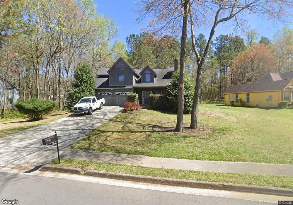
7920 Tower Dr Unit 1 Douglasville, GA 30134
Estimated Value: $249,171 - $304,000
3
Beds
2
Baths
1,453
Sq Ft
$189/Sq Ft
Est. Value
About This Home
This home is located at 7920 Tower Dr Unit 1, Douglasville, GA 30134 and is currently estimated at $274,293, approximately $188 per square foot. 7920 Tower Dr Unit 1 is a home located in Douglas County with nearby schools including North Douglas Elementary School, Stewart Middle School, and Douglas County High School.
Ownership History
Date
Name
Owned For
Owner Type
Purchase Details
Closed on
Jun 12, 2024
Sold by
Burts Ronald C
Bought by
Burts Ronald C and Burts Michele
Current Estimated Value
Home Financials for this Owner
Home Financials are based on the most recent Mortgage that was taken out on this home.
Original Mortgage
$25,000
Outstanding Balance
$24,681
Interest Rate
7.02%
Mortgage Type
Credit Line Revolving
Estimated Equity
$249,612
Purchase Details
Closed on
Jun 2, 1995
Sold by
Poston Assoc Devel
Bought by
Burts Ronald
Create a Home Valuation Report for This Property
The Home Valuation Report is an in-depth analysis detailing your home's value as well as a comparison with similar homes in the area
Home Values in the Area
Average Home Value in this Area
Purchase History
| Date | Buyer | Sale Price | Title Company |
|---|---|---|---|
| Burts Ronald C | -- | Priority Title | |
| Burts Ronald | $80,000 | -- |
Source: Public Records
Mortgage History
| Date | Status | Borrower | Loan Amount |
|---|---|---|---|
| Open | Burts Ronald C | $25,000 | |
| Closed | Burts Ronald | $0 |
Source: Public Records
Tax History Compared to Growth
Tax History
| Year | Tax Paid | Tax Assessment Tax Assessment Total Assessment is a certain percentage of the fair market value that is determined by local assessors to be the total taxable value of land and additions on the property. | Land | Improvement |
|---|---|---|---|---|
| 2024 | $2,834 | $80,520 | $21,720 | $58,800 |
| 2023 | $2,834 | $80,520 | $21,720 | $58,800 |
| 2022 | $2,399 | $68,600 | $14,000 | $54,600 |
| 2021 | $1,978 | $53,240 | $14,000 | $39,240 |
| 2020 | $1,906 | $49,360 | $10,480 | $38,880 |
| 2019 | $1,787 | $48,320 | $10,480 | $37,840 |
| 2018 | $1,922 | $52,480 | $11,760 | $40,720 |
| 2017 | $1,458 | $39,080 | $9,640 | $29,440 |
| 2016 | $1,428 | $37,720 | $9,640 | $28,080 |
| 2015 | $922 | $24,640 | $6,440 | $18,200 |
| 2014 | $689 | $19,520 | $5,400 | $14,120 |
| 2013 | -- | $18,880 | $5,280 | $13,600 |
Source: Public Records
Map
Nearby Homes
- 7900 Alpha Way Unit 1
- 0 Davis Dr Unit 10626722
- 0 Davis Dr Unit 10626705
- 6803 John Clark Dr
- 8051 Dallas Hwy
- 8068 Greene Ct
- 6859 John Clark Dr
- 6861 John Clark Dr
- 6588 Snowbird Ln Unit 1
- 6592 Malone Rd
- 8090 Colquitt St
- 7631 Dallas Hwy
- 7631 Dallas Hwy Unit D035
- 7835 Teton Trail Unit 1
- 6486 Snowbird Ln
- 7104 Skippingstone Way
- 7099 Skippingstone Way
- 1160 Pleasant Oak Ln
- 7125 Creeksong Dr
- 7712 Autry Cir
- 7910 Tower Dr Unit 1
- 7930 Tower Dr
- 0 Tower Dr Unit 3142124
- 0 Tower Dr Unit 8855064
- 0 Tower Dr Unit 8238056
- 0 Tower Dr
- 7944 Tower Dr Unit 1
- 7915 Alpha Way
- 6743 John Clark Dr
- 7915 Tower Dr
- 6737 John Clark Dr Unit 1
- 7931 Tower Dr Unit 1
- 6771 John Clark Dr Unit 1
- 7939 Dallas Hwy
- 7939 Hwy 92 - Dallas Hwy
- 6731 John Clark Dr
- 7939 Highway 92 Dallas Hwy
- 7943 Tower Dr Unit 1
- 7925 Dallas Hwy
- 7914 Alpha Way Unit 1