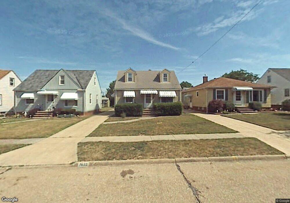
7922 Newport Ave Cleveland, OH 44129
Estimated Value: $168,000 - $182,000
3
Beds
1
Bath
1,092
Sq Ft
$159/Sq Ft
Est. Value
About This Home
This home is located at 7922 Newport Ave, Cleveland, OH 44129 and is currently estimated at $174,119, approximately $159 per square foot. 7922 Newport Ave is a home located in Cuyahoga County with nearby schools including Ridge-Brook Elementary School, Greenbriar Middle School, and Parma High School.
Ownership History
Date
Name
Owned For
Owner Type
Purchase Details
Closed on
Jan 9, 2011
Sold by
Jacques Diane A and Schaubel Eric Damien
Bought by
Jacques Diane A and Schaubel Eric Damien
Current Estimated Value
Purchase Details
Closed on
Oct 20, 2010
Sold by
Jacques Diane A
Bought by
Schaubel Eric Damien and Jacques Diane A
Purchase Details
Closed on
Aug 13, 2001
Sold by
Szolics Antonia E
Bought by
Szolics Antonia and Jacques Diane A
Purchase Details
Closed on
Jul 30, 1975
Sold by
Martin Joseph A and Martin Jeanette
Bought by
Szolics Antonia and Szolics Agoston
Purchase Details
Closed on
Jan 1, 1975
Bought by
Martin Joseph A and Martin Jeanette
Create a Home Valuation Report for This Property
The Home Valuation Report is an in-depth analysis detailing your home's value as well as a comparison with similar homes in the area
Home Values in the Area
Average Home Value in this Area
Purchase History
| Date | Buyer | Sale Price | Title Company |
|---|---|---|---|
| Jacques Diane A | -- | Public | |
| Schaubel Eric Damien | -- | None Available | |
| Szolics Antonia | -- | -- | |
| Szolics Antonia | $37,500 | -- | |
| Martin Joseph A | -- | -- |
Source: Public Records
Tax History Compared to Growth
Tax History
| Year | Tax Paid | Tax Assessment Tax Assessment Total Assessment is a certain percentage of the fair market value that is determined by local assessors to be the total taxable value of land and additions on the property. | Land | Improvement |
|---|---|---|---|---|
| 2024 | $2,733 | $43,575 | $9,940 | $33,635 |
| 2023 | $2,582 | $35,630 | $8,190 | $27,440 |
| 2022 | $2,557 | $35,630 | $8,190 | $27,440 |
| 2021 | $2,628 | $35,630 | $8,190 | $27,440 |
| 2020 | $2,306 | $27,410 | $6,300 | $21,110 |
| 2019 | $2,202 | $78,300 | $18,000 | $60,300 |
| 2018 | $2,090 | $27,410 | $6,300 | $21,110 |
| 2017 | $2,123 | $24,470 | $4,410 | $20,060 |
| 2016 | $2,111 | $24,470 | $4,410 | $20,060 |
| 2015 | $2,077 | $24,470 | $4,410 | $20,060 |
| 2014 | $2,077 | $26,040 | $4,690 | $21,350 |
Source: Public Records
Map
Nearby Homes
- 7707 Liberty Ave
- 8206 Newport Ave
- 8018 Pinegrove Ave
- 8119 Pinegrove Ave
- 9118 Fernhill Ave
- 6606 Theota Ave
- 6211 Luelda Ave
- 7609 Wooster Pkwy
- 6508 Delora Ave
- 9417 Fernhill Ave
- 6014 Laverne Ave
- 6306 Flowerdale Ave
- 5717 Chestnut Dr
- 5906 Velma Ave
- 6011 Theota Ave
- 5810 Laverne Ave
- 7910 Dresden Ave
- 6209 Archmere Ave
- 6903 Forest Ave
- 6025 Northcliff Ave
- 8002 Newport Ave
- 7918 Newport Ave
- 8006 Newport Ave
- 7914 Newport Ave
- 8010 Newport Ave
- 7923 Liberty Ave
- 7910 Newport Ave
- 8003 Liberty Ave
- 7919 Liberty Ave
- 8007 Liberty Ave
- 8014 Newport Ave
- 7906 Newport Ave
- 8011 Liberty Ave
- 7911 Liberty Ave
- 7923 Newport Ave
- 8003 Newport Ave
- 7919 Newport Ave
- 8007 Newport Ave
- 8018 Newport Ave
- 8015 Liberty Ave